Overview
The article addresses the pressing challenges in urban planning, particularly the intricate processes of land acquisition and urban development efficiency. It underscores the transformative impact of advanced technologies—such as AI, GIS mapping, and data analytics—on urban planning. These innovations enhance accuracy, mitigate environmental impacts, and promote community engagement. Consequently, they ensure that land acquisition processes are not only effective but also sustainable.
By leveraging these high-tech solutions, urban planners can navigate the complexities of legal and regulatory challenges, streamlining operations and fostering a more collaborative approach. The integration of technology into urban planning is not merely a trend; it represents a necessary evolution in how we approach land acquisition and urban development.
In conclusion, embracing these advanced technologies is crucial for stakeholders aiming to improve urban planning outcomes. It is imperative to consider how these tools can facilitate effective and sustainable land acquisition strategies, ultimately leading to more resilient urban environments.
Introduction
High-tech urban planning solutions are transforming the landscape of city development, offering not only enhanced efficiency but also sustainable growth amid escalating urban challenges. As cities confront rapid population increases and pressing environmental concerns, innovative technologies such as AI, GIS mapping, and smart infrastructure have emerged as essential tools for effective land acquisition and urban management. This raises a crucial question: how can urban planners harness these advancements to create resilient, livable spaces while navigating the complexities of modern urbanization?
Harbinger Land: Advanced Title Research Solutions for Confident Land Rights Acquisition
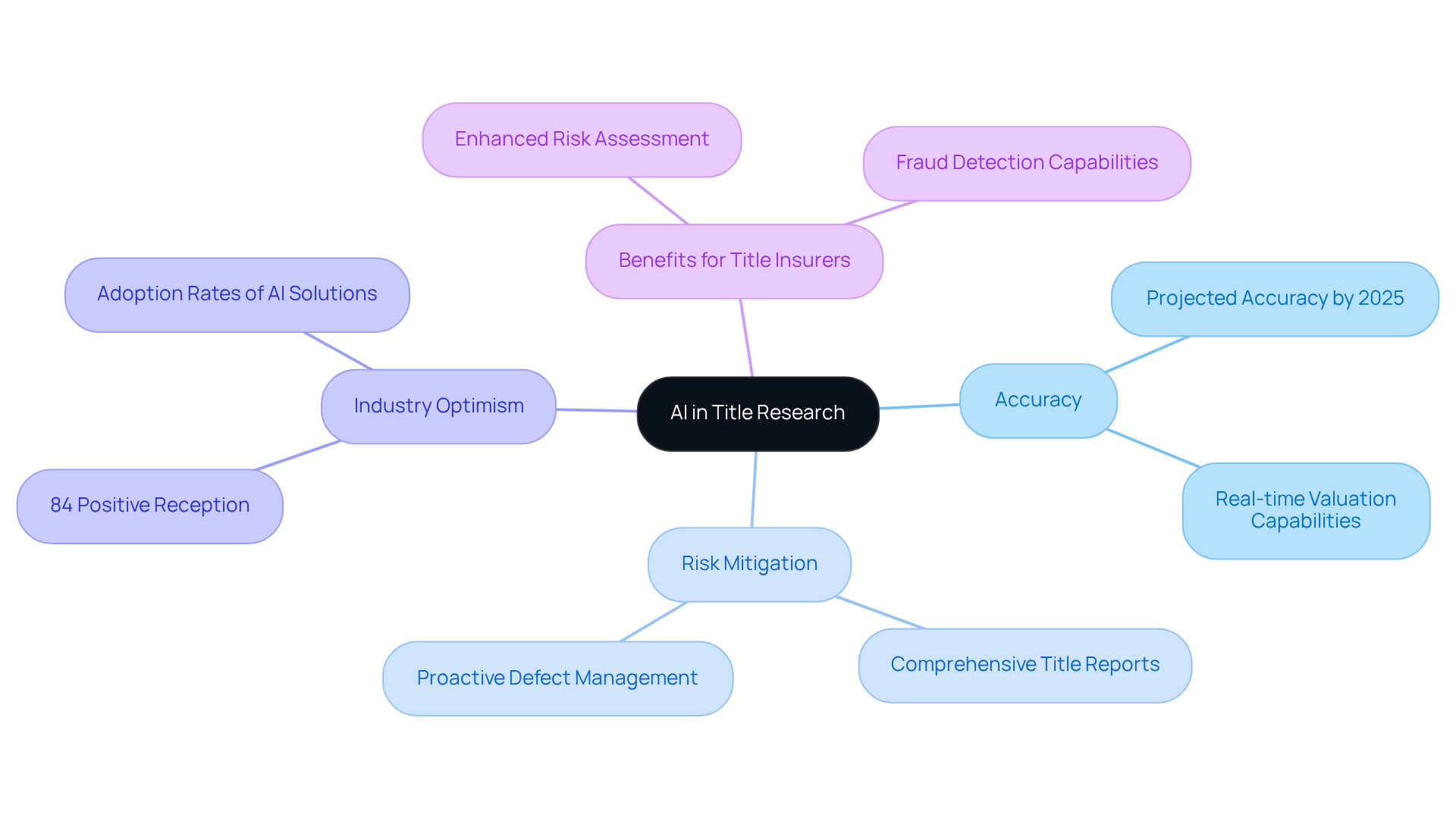
Harbinger Land leverages state-of-the-art AI-powered title research software, revolutionizing the verification of land ownership and rights. This advanced technology accelerates the research process and enhances accuracy, with projections indicating that AI-driven solutions will achieve accuracy rates of up to 90% by 2025. Clients can thus move forward with confidence in their land acquisitions. By delivering comprehensive title reports, Harbinger Land effectively mitigates risks associated with potential disputes over land ownership, proving to be an invaluable asset for energy and infrastructure projects.
Successful land acquisition projects, such as the recent partnership with a significant solar developer, demonstrate that employing advanced title research technology streamlines operations and enhances trust among stakeholders. This ensures that land rights are secured with precision and reliability. Furthermore, 84% of title professionals express optimism about the benefits of AI, highlighting the industry's positive reception of these innovations.
AI also aids title insurers in proactively addressing potential title defects, enhancing risk assessment and fraud detection capabilities. As the integration of AI in title research continues to evolve, it becomes evident that these advancements are crucial for maintaining the integrity and efficiency of land acquisition processes.
AI-Driven Urban Planning: Enhancing Decision-Making and Efficiency
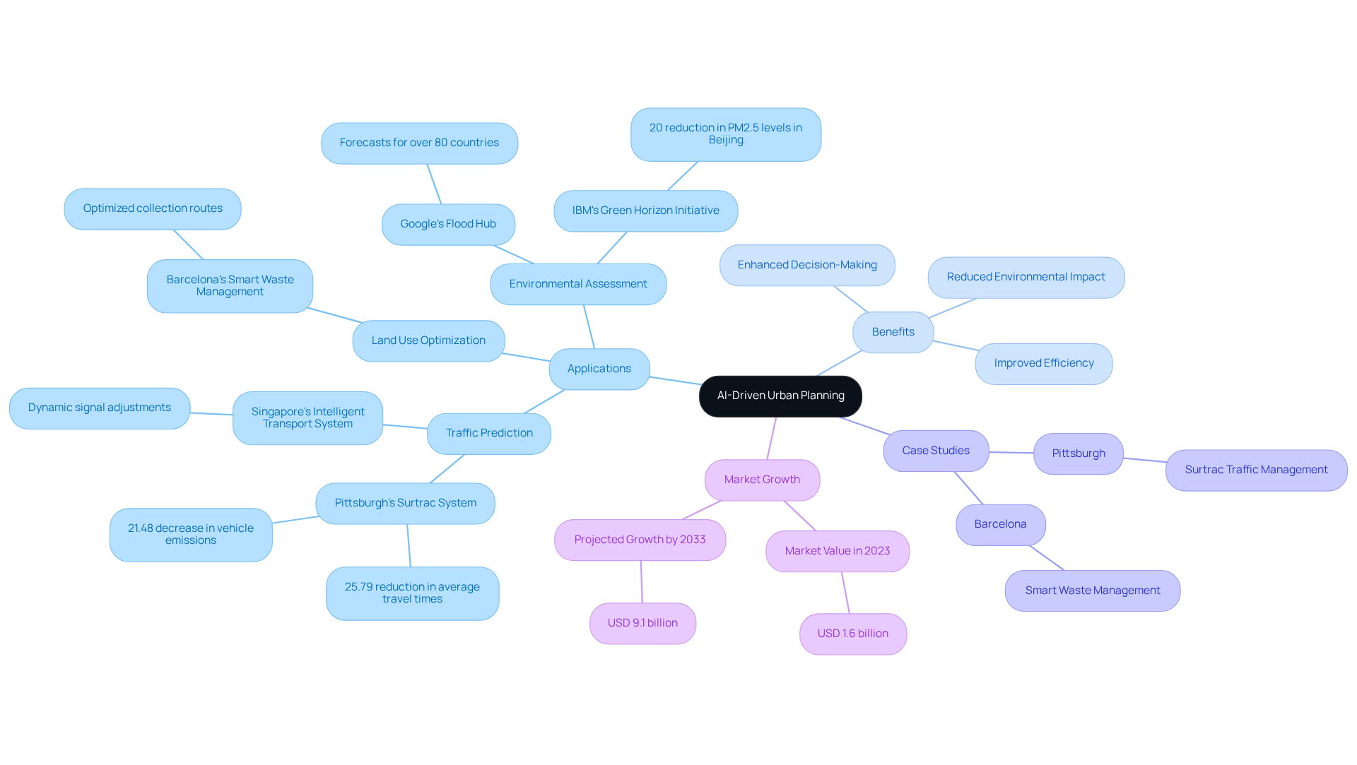
High-tech urban planning solutions powered by AI tools are transforming city development by enabling planners to swiftly analyze extensive datasets. High-tech urban planning solutions utilize advanced technologies to predict traffic patterns, assess environmental impacts, and optimize land use, leading to more informed decision-making.
For example, predictive analytics allows city planners to identify potential growth areas, ensuring that infrastructure development aligns with community needs and sustainability objectives. In Pittsburgh, the Surtrac system has achieved a 25.79% reduction in average travel times and a 21.48% decrease in vehicle emissions by adjusting traffic light timings based on real-time data. Similarly, Barcelona's smart waste management system employs IoT sensors to optimize collection routes, significantly lowering operational costs and environmental impact.
Given that metropolitan regions account for approximately 70% of global greenhouse gas emissions, the role of AI in addressing environmental challenges within city development is critical. With city populations projected to rise by 2.5 billion by 2050, the implementation of high-tech urban planning solutions is essential for fostering efficient, sustainable communities.
The AI in City Development Market, valued at USD 1.6 billion in 2023 and anticipated to reach USD 9.1 billion by 2033, underscores the growing importance and investment in high-tech urban planning solutions. Local authorities are increasingly exploring technology and data to tackle real-world challenges such as traffic safety and law enforcement, further illustrating the vital role of AI in city planning.
Smart City Solutions: Leveraging Technology for Sustainable Urban Development
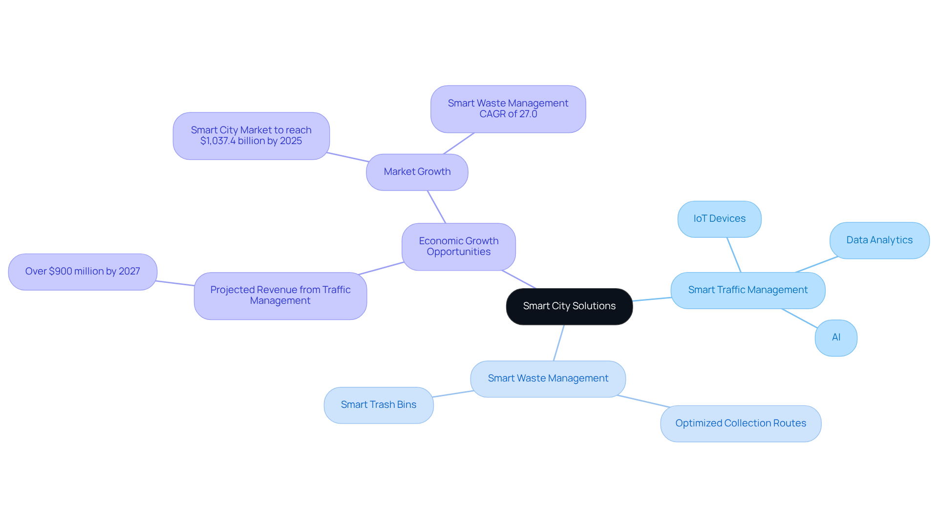
High-tech urban planning solutions are increasingly harnessing IoT devices, data analytics, and AI to foster interconnected urban environments. Take, for example, smart traffic management systems that dynamically adjust signal timings based on real-time traffic conditions. These systems effectively reduce congestion and lower emissions, demonstrating significant effectiveness. Projections indicate that intelligent traffic management could generate over $900 million in revenue by 2027. Furthermore, the intelligent urban market is anticipated to expand considerably, reaching USD 1,037.4 billion by 2025, underscoring the economic opportunities presented by these initiatives.
Additionally, smart waste management solutions optimize collection routes, leading to substantial cost savings and enhanced service delivery. The waste management segment is expected to grow at a CAGR of 27.0% due to the implementation of smart trash bin installations. By leveraging these advanced technologies, urban areas not only improve the quality of life for residents but also promote sustainable practices aligned with broader environmental objectives.
As city populations continue to rise—especially in Africa and Asia, where they are projected to double between 2000 and 2030—high-tech urban planning solutions, including the integration of IoT, become essential for developing efficient, livable spaces. As highlighted by ESI ThoughtLab, 'Smart cities enhance economic activity and livability for citizens and businesses,' emphasizing the critical role of high-tech urban planning solutions in contemporary urban development.
GIS Mapping: Transforming Urban Planning with Spatial Data Analysis
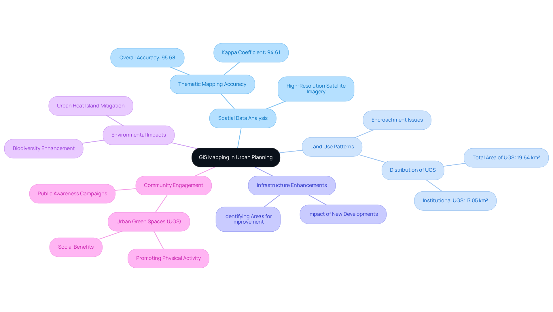
Geographic Information Systems (GIS) mapping empowers city planners to visualize and analyze spatial data with precision. This technology serves as a crucial tool for assessing land use patterns, environmental impacts, and demographic trends, thus enabling planners to make informed decisions. Consider the ability of GIS to identify areas in need of infrastructure enhancements and evaluate the potential impacts of new developments on existing communities.
Moreover, the integration of Urban Green Spaces (UGS) into city development policies is vital for fostering sustainable and equitable metropolitan environments. Successful city development projects have demonstrated that leveraging GIS for spatial data analysis not only improves project outcomes but also enhances community engagement and resource distribution. For instance, a thematic map of Islamabad's green spaces achieved an impressive accuracy rate of 95.68%, underscoring the effectiveness of GIS in identifying and managing these essential areas.
As city developers increasingly recognize the importance of spatial data, the adoption of GIS technology becomes paramount for effective land use evaluation and strategic planning. City planners have observed, 'The importance of spatial data analysis in land use cannot be overstated; it is essential for making informed choices that benefit both the environment and the community.' Addressing the challenges associated with managing UGS, such as maintenance and accessibility, is crucial for maximizing their benefits.
Thus, the integration of high-tech urban planning solutions into metropolitan development not only addresses these challenges but also ensures that communities can adapt to evolving needs, ultimately enhancing the quality of life.
Vertical Farming: Integrating Agriculture into Urban Landscapes
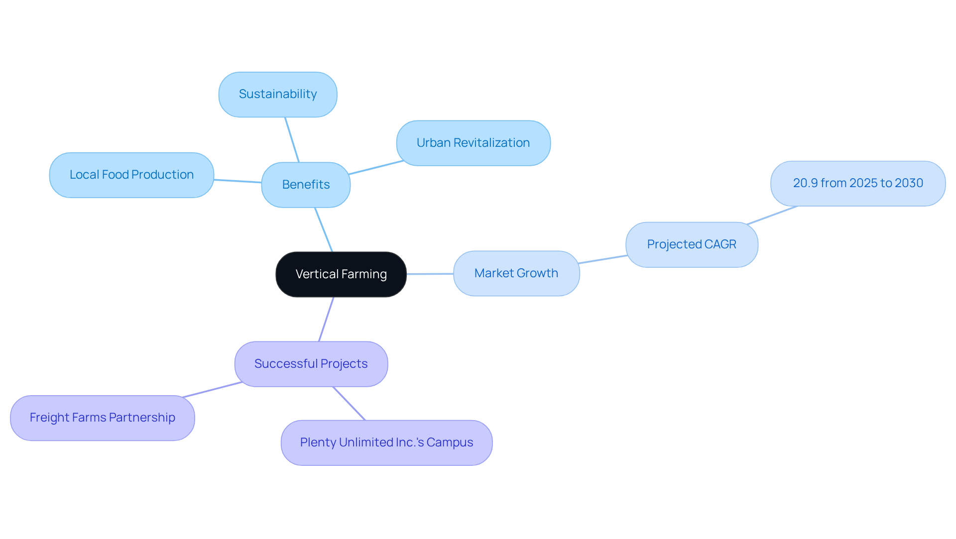
Vertical farming represents a transformative approach to agriculture, where crops are cultivated in vertically stacked layers within controlled environments. This innovative method allows urban areas to cultivate food locally, significantly decreasing reliance on external supply chains and minimizing transportation emissions. By incorporating high-tech urban planning solutions that integrate vertical farms, municipalities can enhance food security and encourage sustainable practices. Employing underutilized areas such as rooftops and vacant structures not only enhances land efficiency but also aids in city revitalization.
The vertical farming market is projected to grow at a robust CAGR of 20.9% from 2025 to 2030, reflecting the increasing demand for sustainable agricultural solutions. Successful city agriculture projects, such as Plenty Unlimited Inc.'s upcoming vertical farming campus in California, exemplify the potential of this approach to meet the rising food demands of metropolitan populations while addressing environmental concerns. Experts stress that high-tech urban planning solutions, including local food production through vertical farming, can strengthen community resilience and lessen the carbon footprint linked to food transportation, making it an essential element of future city planning strategies.
Transit-Oriented Development: High-Tech Solutions for Urban Mobility
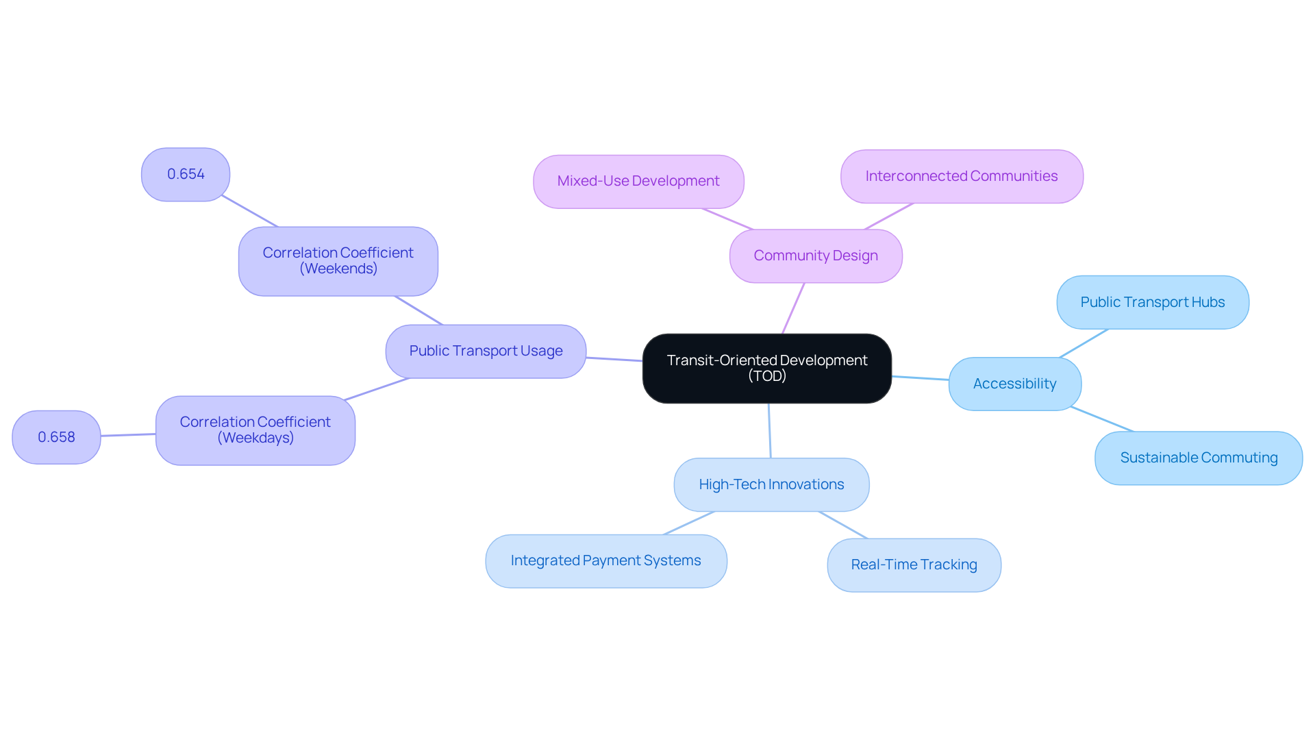
Transit-oriented development (TOD) is crucial in shaping mixed-use communities that prioritize accessibility to public transportation. By strategically designing neighborhoods around transit hubs, cities can significantly alleviate traffic congestion and promote sustainable commuting options. High-tech innovations, such as real-time transit tracking applications and integrated payment systems, enhance the user experience, making public transportation more attractive and efficient.
A compelling study reveals that ridership per capita strongly correlates with resident density, evidenced by a correlation coefficient of 0.658 for weekdays and 0.654 for weekends. This underscores the effectiveness of TOD in promoting public transport usage. This holistic approach, which includes high-tech urban planning solutions, not only enhances mobility but also fosters lively, interconnected communities, ultimately aiding in a more sustainable city environment.
As planner Dan Qiang aptly notes, "Transit-oriented development (TOD) has been widely adopted as a primary planning strategy to better integrate transit and land use.
Resilient Cities: Strategies for Adapting to Climate Change
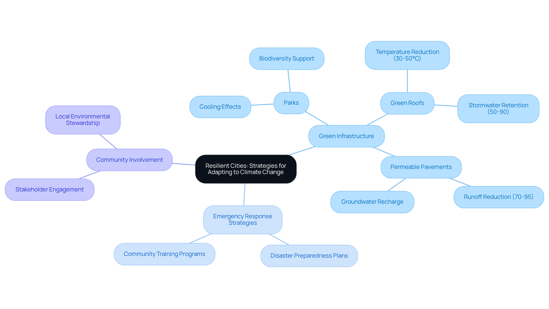
Building resilient cities is imperative, requiring the implementation of strategies that significantly enhance adaptability to climate change. Investing in green infrastructure—such as parks, green roofs, and permeable pavements—plays a crucial role in mitigating flooding and reducing urban heat effects. For instance, permeable pavements can reduce runoff by 70-95% compared to traditional surfaces, an essential factor for controlling flooding in urban areas. Additionally, green roofs can lower rooftop temperatures by 30-50°C, leading to substantial energy savings and contributing to urban heat mitigation.
Moreover, urban areas must develop extensive emergency response strategies and promote community involvement initiatives to prepare for potential disasters. Engaging local stakeholders enhances the effectiveness of these strategies and ensures that the needs of diverse populations are met, fostering social cohesion and local environmental stewardship. By emphasizing resilience in city development, municipalities can protect their residents and infrastructure from the escalating threats posed by climate change, ultimately improving public health and living standards.
Public Engagement Tools: Fostering Community Involvement in Urban Planning
Interactive mapping platforms and online surveys serve as vital public engagement tools, empowering residents to actively participate in the development process. These technologies foster seamless communication between planners and the community, facilitating valuable feedback on proposed projects and initiatives.
For example, platforms like ArcGIS CityEngine enable residents to visualize urban changes, rendering complex planning data more relatable and accessible. This tool effectively illustrates shifts in zoning, housing, and neighborhood character over time, thereby enhancing public understanding of local development issues.
By cultivating a culture of collaboration, municipalities can ensure that development projects align with community values and priorities. Such alignment not only boosts project acceptance but also leads to more successful outcomes.
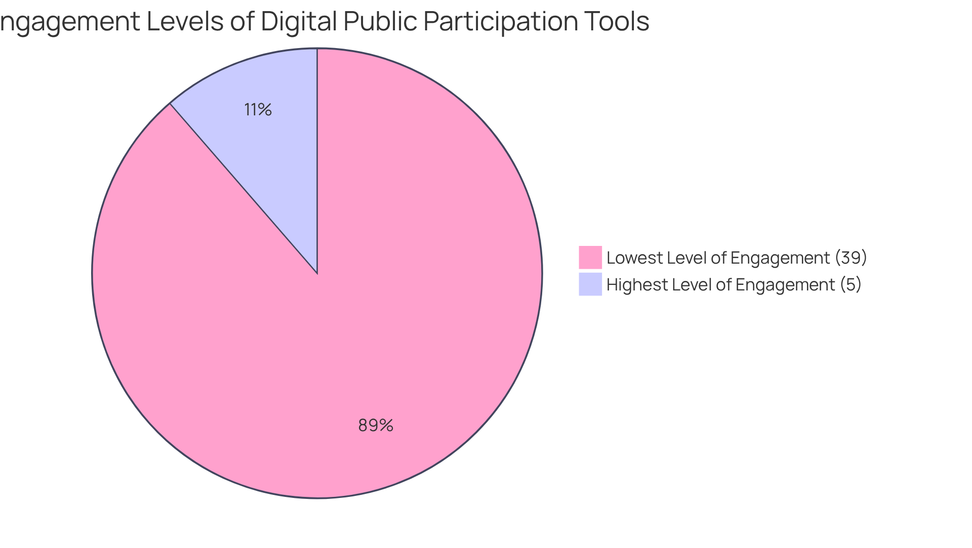
Recent studies reveal that:
- Only 5% of digital engagement tools are classified at the highest level of engagement.
- 39% fall within the lowest level, underscoring the necessity for improved accessibility and usability.
Moreover, challenges such as the digital divide and the cognitive demands of map editing tools can impede effective participation. As urban areas increasingly adopt these technologies, the movement toward inclusive and participatory development continues to grow, emphasizing the importance of resident engagement in shaping their environments.
Data Analytics: Informing Urban Planning Decisions with Insights
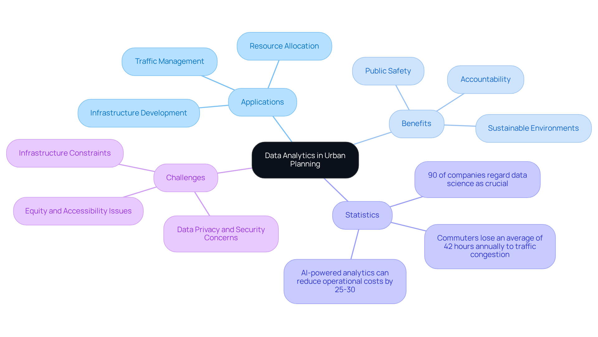
Data analytics is indispensable in urban development, providing planners with high-tech urban planning solutions that empower them to make decisions grounded in empirical evidence. By scrutinizing data related to traffic patterns, population demographics, and environmental impacts, planners can discern trends and project future requirements.
For instance, predictive analytics enables cities to foresee infrastructure demands and allocate resources more effectively. This data-centric approach not only enhances outcomes but also fosters accountability and transparency in the decision-making process. A recent survey reveals that 90% of companies regard data science as crucial for their business success, underscoring its importance in city planning.
Moreover, with commuters losing an average of 42 hours annually to traffic congestion, the integration of data analytics can significantly improve traffic management and urban mobility. As Sarah Lee notes, understanding city demographics is vital for policymakers and planners to make informed decisions regarding infrastructure development and resource allocation.
Ultimately, this data-driven methodology leads to improved public safety, optimized transportation systems, and the implementation of high-tech urban planning solutions to create more sustainable urban environments.
Sustainable Infrastructure: Innovative Solutions for Urban Development
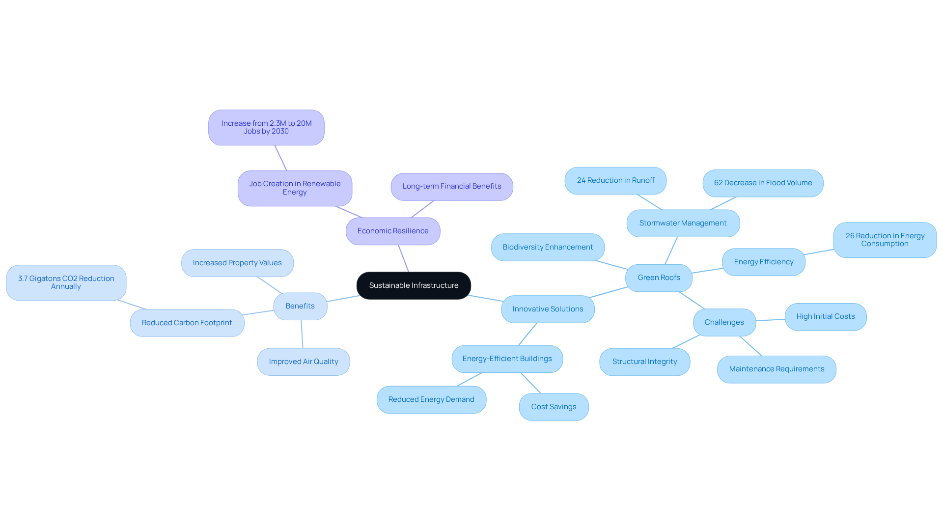
Sustainable infrastructure is a transformative approach to urban development that incorporates high-tech urban planning solutions to significantly reduce environmental impact and enhance resilience. Among these solutions, green roofs and energy-efficient buildings emerge as crucial components.
- Green roofs not only foster biodiversity but also mitigate the heat island effect, enhancing air quality by filtering pollutants and absorbing rainfall. This can lead to a reduction in stormwater runoff by up to 24% and a decrease in flood volume by as much as 62%.
- Additionally, energy-efficient buildings can reduce energy consumption by up to 26% during both summer and winter, resulting in considerable long-term cost savings.
Cities that implement high-tech urban planning solutions can expect a marked reduction in their carbon footprint. Forecasts indicate that improved city planning could lower CO2 emissions by 3.7 gigatons annually over the next 15 years. Successful initiatives worldwide have illustrated the feasibility of incorporating high-tech urban planning solutions, demonstrating their capacity to create healthier, more livable environments for residents.
- For instance, the implementation of green roofs has been linked to increased property values and reduced maintenance costs, making them a wise investment for urban planners.
Nevertheless, it is crucial to recognize the challenges associated with green roofs, such as high initial costs and ongoing maintenance demands. Experts underscore the necessity of conducting comprehensive feasibility studies and selecting the appropriate type of green roof to ensure successful outcomes.
Moreover, high-tech urban planning solutions not only fulfill essential service requirements but also enhance economic resilience in the face of climate change. As urban areas evolve, the integration of renewable energy sources into city infrastructure will further advance energy independence and sustainability, paving the way for a greener future.
Conclusion
High-tech urban planning solutions signify a pivotal shift in how cities navigate land acquisition and development. By integrating advanced technologies such as AI, GIS, and IoT, urban planners enhance decision-making processes, ensuring that developments cater to the needs of growing populations while prioritizing sustainability. This article underscores the transformative impact of these innovations, highlighting their role in creating more efficient, resilient, and livable urban environments.
Key insights reveal the advantages of:
- AI-driven title research for confident land rights acquisition
- The utilization of predictive analytics for informed decision-making
- The critical role of public engagement tools in fostering community involvement
Furthermore, the integration of smart city technologies and sustainable infrastructure solutions illustrates how urban areas can adapt to climate change while improving overall quality of life.
As cities continue to evolve, the adoption of these high-tech urban planning solutions becomes essential for tackling the pressing challenges of urbanization, climate change, and community engagement. The future of urban development relies on the effective leverage of technology, ensuring that cities not only thrive economically but also uphold their commitment to environmental stewardship and social equity.
Frequently Asked Questions
What is Harbinger Land and what services does it offer?
Harbinger Land provides advanced title research solutions using AI-powered software to verify land ownership and rights, enhancing the accuracy and speed of the research process.
How does Harbinger Land's technology improve land acquisition?
The technology accelerates the research process and is projected to achieve accuracy rates of up to 90% by 2025, allowing clients to move forward confidently in their land acquisitions.
What are the benefits of using AI in title research?
AI-driven solutions mitigate risks associated with potential disputes over land ownership, enhance risk assessment, and improve fraud detection capabilities for title insurers.
Can you provide an example of a successful project using Harbinger Land's technology?
A recent partnership with a significant solar developer demonstrated that advanced title research technology streamlines operations and enhances trust among stakeholders, securing land rights with precision.
What is the impact of AI on urban planning?
AI tools enable city planners to analyze extensive datasets quickly, predict traffic patterns, assess environmental impacts, and optimize land use, leading to more informed and efficient decision-making.
How have AI solutions improved traffic management in cities?
For instance, Pittsburgh's Surtrac system has reduced average travel times by 25.79% and vehicle emissions by 21.48% through real-time adjustments of traffic light timings.
What economic opportunities are presented by smart urban planning solutions?
The intelligent urban market is expected to grow significantly, reaching USD 1,037.4 billion by 2025, indicating substantial economic opportunities from high-tech urban planning initiatives.
How do smart city solutions promote sustainability?
Smart traffic management and waste management systems help reduce congestion, lower emissions, and optimize collection routes, contributing to cost savings and enhanced service delivery while aligning with environmental objectives.
Why is the integration of AI in city development crucial?
With city populations projected to rise significantly, especially in developing regions, AI-driven urban planning solutions are essential for creating efficient and sustainable communities.
What is the projected growth of the AI in City Development Market?
The market was valued at USD 1.6 billion in 2023 and is anticipated to reach USD 9.1 billion by 2033, highlighting the increasing investment in high-tech urban planning solutions.
List of Sources
- Harbinger Land: Advanced Title Research Solutions for Confident Land Rights Acquisition
- 90% of Title Professionals Already Using AI, Qualia Survey Shows (https://alta.org/news-and-publications/news/20240716-90-of-Title-Professionals-Already-Using-AI-Qualia-Survey-Shows)
- The Power of AI-Based Decision Support in The Title Industry - Axis Technical Group (https://axistechnical.com/the-power-of-ai-based-decision-support-in-the-title-industry)
- AI in Real Estate: 30+ Statistics 2025 (https://artsmart.ai/blog/ai-in-real-estate-statistics)
- AI for Title Search, Property Verification & Valuation in Real Estate Transactions (https://linkedin.com/pulse/ai-title-search-property-verification-valuation-real-aponte-parsi-zaf0e)
- 5 Ways AI for Title Search is Transforming Real Estate Research (https://samedaytitleupdates.com/resource-articles-same-day-title-updates/ai-for-title-search)
- AI-Driven Urban Planning: Enhancing Decision-Making and Efficiency
- The Role of AI in Predictive Modelling for Sustainable Urban Development: Challenges and Opportunities (https://mdpi.com/2071-1050/17/11/5148)
- (https://smartcitiesdive.com/ex/sustainablecitiescollective/twenty-best-quotes-about-sustainable-cities/176241)
- AI in Urban Planning Market (https://market.us/report/ai-in-urban-planning-market)
- AI in Sustainable Urban Planning Market Size & Industry Growth 2030 (https://futuredatastats.com/artificial-intelligence-in-sustainable-urban-planning-market?srsltid=AfmBOoodu3Q7PedCaJT6q0HQFMTGO58zZMHcpB8Z7VzdUQG2m2u7BxpP)
- 100 Game-Changing AI Statistics for 2025: Trends Shaping Our Future (https://spritle.com/blog/100-game-changing-ai-statistics-for-2025-trends-shaping-our-future)
- Smart City Solutions: Leveraging Technology for Sustainable Urban Development
- Smart City Statistics and Facts (2025) (https://scoop.market.us/smart-city-statistics)
- Smarter Cities 2025 - ThoughtLab (https://thoughtlabgroup.com/smarter-cities-2025)
- Smart Cities Market Size And Share | Industry Report, 2030 (https://grandviewresearch.com/industry-analysis/smart-cities-market)
- The OECD Programme on Smart Cities and Inclusive Growth (https://oecd.org/en/about/programmes/the-oecd-programme-on-smart-cities-and-inclusive-growth0.html)
- Smart Cities Market Report 2025 | StartUs Insights (https://startus-insights.com/innovators-guide/smart-cities-market-report)
- GIS Mapping: Transforming Urban Planning with Spatial Data Analysis
- Rohrbach Library Home: GIS Resources: Ebooks (https://library.kutztown.edu/c.php?g=229109&p=1518794)
- Equitable urban green space planning for sustainable cities: a GIS-based analysis of spatial disparities and functional strategies - Scientific Reports (https://nature.com/articles/s41598-025-07578-2)
- Official Statistics & GIS | Collect, Analyze & Manage Your Data (https://esri.com/en-us/industries/official-statistics/overview)
- Vertical Farming: Integrating Agriculture into Urban Landscapes
- Vertical Farming Market size to exceed $152.72 billion by 2037 | 26.5% CAGR Forecast (https://researchnester.com/reports/vertical-farming-market/4795)
- Global Vertical Farming Market Competitive Environment 2025-2032 (https://statsndata.org/report/vertical-farming-market-9669)
- Vertical Farming Market Size & Share | Industry Report, 2030 (https://grandviewresearch.com/industry-analysis/vertical-farming-market)
- US Vertical Farming Market 2025 Trends and Forecasts 2033: Analyzing Growth Opportunities (https://datainsightsmarket.com/reports/us-vertical-farming-market-468)
- Vertical Farming Market Report | Global Forecast From 2025 To 2033 (https://dataintelo.com/report/global-vertical-farming-market)
- Transit-Oriented Development: High-Tech Solutions for Urban Mobility
- Economic Impact of Land Use Planning (Transit-Oriented Development): A Comparative Analysis (https://digitalcommons.wcupa.edu/all_doctoral/223)
- Quantitative Evaluation of TOD Performance Based on Multi-Source Data: A Case Study of Shanghai - PMC (https://pmc.ncbi.nlm.nih.gov/articles/PMC8900918)
- Mobility impacts of a new metro system with transit-oriented development features (https://sciencedirect.com/science/article/pii/S1361920922001857)
- Can transit-oriented development change travel behavior in cities? (https://blogs.worldbank.org/en/sustainablecities/can-transit-oriented-development-change-travel-behavior-cities)
- Ridership Report - American Public Transportation Association (https://apta.com/research-technical-resources/transit-statistics/ridership-report)
- Resilient Cities: Strategies for Adapting to Climate Change
- Building green infrastructure to enhance urban resilience to climate change and pandemics - PMC (https://pmc.ncbi.nlm.nih.gov/articles/PMC7930103)
- Green infrastructure site prioritization to improve urban flood resilience in Monterrey and Brussels using a decision support model - Scientific Reports (https://nature.com/articles/s41598-025-94851-z)
- Green Infrastructure for Urban Resilience (https://numberanalytics.com/blog/green-infrastructure-urban-resilience)
- The effect of green infrastructure on resilience performance in combined sewer systems under climate change (https://sciencedirect.com/science/article/pii/S0301479724002159)
- What Statistics Indicate the Impact of Green Infrastructure on Climate Resilience? → Question (https://sustainability-directory.com/question/what-statistics-indicate-the-impact-of-green-infrastructure-on-climate-resilience)
- Public Engagement Tools: Fostering Community Involvement in Urban Planning
- Usability and usefulness of internet mapping platforms in participatory spatial planning (https://sciencedirect.com/science/article/abs/pii/S0143622818305460)
- Digital tools for stakeholder participation in urban development projects (https://sciencedirect.com/science/article/pii/S2666721522000138)
- (PDF) Strategic overview of digital public participation tools for urban planning (https://researchgate.net/publication/352784038_Strategic_overview_of_digital_public_participation_tools_for_urban_planning)
- MRSC - Expanding Public Participation in Planning Using Digital Tools (https://mrsc.org/stay-informed/mrsc-insight/may-2025/digital-planning-tools)
- Data Analytics: Informing Urban Planning Decisions with Insights
- Data Science Statistics and Facts (2025) (https://scoop.market.us/data-science-statistics)
- The Role of Big Data in Modern Urban Planning (https://intelligentliving.co/big-data-modern-urban-planning)
- Urban Demography in the Age of Smart Cities (https://numberanalytics.com/blog/urban-demography-smart-cities-analysis)
- Data Analytics Trends in 2025: What You Need to Know (https://medium.com/@kanerika/data-analytics-trends-in-2025-what-you-need-to-know-e070d7debe9e)
- Role of Big Data in Smart Cities and IoT Implementations (https://trigyn.com/insights/role-big-data-smart-cities-and-iot-implementations)
- Sustainable Infrastructure: Innovative Solutions for Urban Development
- Global Sustainable Infrastructure Market Size, Forecast 2033 (https://custommarketinsights.com/report/sustainable-infrastructure-market)
- Green Roofs for Urban Sustainability (https://numberanalytics.com/blog/green-roofs-urban-sustainability-guide)
- Infraestruturas sustentáveis: fundamentais na luta contra as mudanças climáticas (https://iberdrola.com/sustainability/sustainable-infrastructure)
- Sustainable Infrastructure Investment (https://unep.org/explore-topics/green-economy/what-we-do/sustainable-infrastructure-investment)
- Green Roofs: A Solution for Urban Flood Resilience? (https://biofriendlyplanet.com/green-roofs-a-solution-for-urban-flood-resilience)


