Overview
This article delineates a comprehensive four-step process for effectively measuring the land carbon footprint. It begins with defining the carbon footprint, followed by selecting suitable measurement tools and methods. The next steps involve the collection and analysis of relevant data, culminating in the implementation of monitoring and continuous improvement strategies. Each step underscores the critical importance of:
- Understanding land use practices
- Leveraging technology for data collection
- Actively engaging stakeholders
These elements collectively enhance sustainability efforts and facilitate an accurate assessment of greenhouse gas emissions.
Introduction
As the world confronts the pressing challenge of climate change, grasping and managing land carbon footprints has emerged as a critical necessity. This article explores the intricate elements that constitute a land carbon footprint, examining how different land types and practices contribute to greenhouse gas emissions.
By focusing on measurement tools and methodologies, it guides readers through the essential process of collecting and analyzing pertinent data to evaluate their land's environmental impact. Moreover, it underscores the significance of ongoing monitoring and improvement strategies, empowering stakeholders with the knowledge to implement sustainable practices effectively.
As the ramifications of land use decisions grow more evident, this comprehensive approach paves the way for responsible land management and a healthier planet.
Define Your Land Carbon Footprint
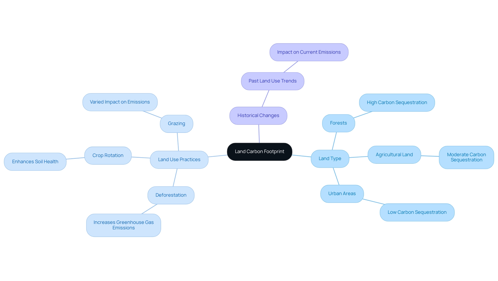
Understanding your ecological impact begins with a comprehensive grasp of its components. The terrestrial greenhouse gas impact encompasses the total greenhouse gas emissions generated directly or indirectly from usage activities, including emissions from soil disruption, terrain transformation, and agricultural practices. To accurately evaluate this footprint, consider the following factors:
- Land Type: Different land types, such as forests, agricultural land, and urban areas, demonstrate varying capacities for carbon sequestration. For instance, land carbon footprint measurement shows that forests typically retain more greenhouse gases than farmland, underscoring the importance of their management in reducing overall pollutant emissions.
Evaluate how specific land use practices, including deforestation, crop rotation, and grazing, influence greenhouse gas emissions in the context of land carbon footprint measurement. For example, deforestation can lead to significant increases in greenhouse gas release, while sustainable farming practices enhance carbon storage. In Canada, the year 2023 witnessed a rise in CO emissions from fires, estimated at 0.5–0.8 GtC/yr, underscoring the significance of land carbon footprint measurement in assessing the impact of land use practices on greenhouse gas outputs.
Analyzing historical changes in land use provides insight into past emissions and sequestration trends, which is crucial for land carbon footprint measurement and enables a more informed approach to current management strategies.
As we approach 2025, the land carbon footprint measurement of land utilization activities on greenhouse gas emissions remains critical. Recent statistics indicate that changes in land use contribute significantly to atmospheric CO2 levels, emphasizing the need for land carbon footprint measurement, which is projected to average 422.45 ppm. As Mark Brown, Prime Minister of the Cook Islands, remarked, "It is up to the G20 countries responsible for 80% of global emissions that we are beholden to for our survival." By establishing a precise definition and scope for your ecological emissions, you can effectively evaluate and manage its impact through land carbon footprint measurement, which supports broader environmental performance goals. Furthermore, findings from the case study 'Model Performance in Carbon Cycle Simulations' demonstrate how Dynamic Global Vegetation Models (DGVMs) can be utilized to assess various aspects of the ecological cycle, emphasizing the necessity of accurate measurement in usage activities.

Select Measurement Tools and Methods
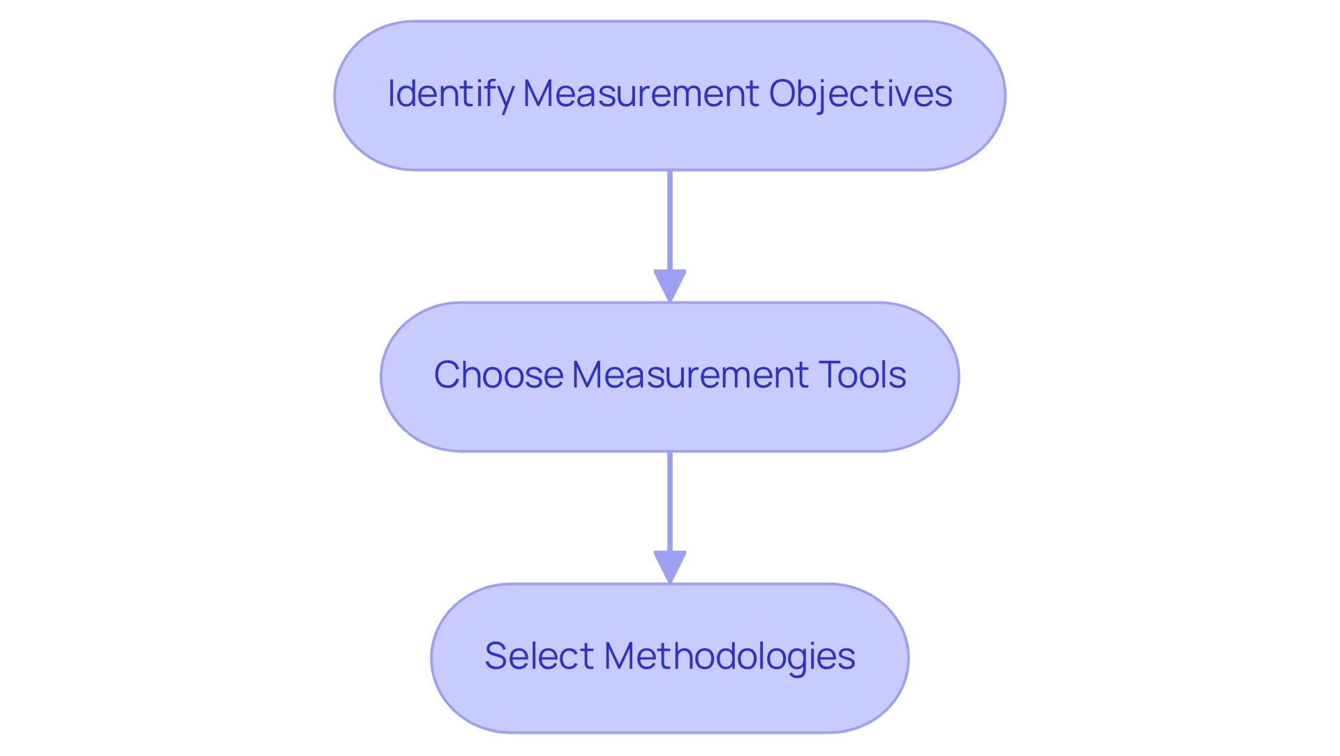
Selecting the right tools and methods for land carbon footprint measurement is crucial for effective environmental management. By following these essential steps, you can ensure that your assessments are precise and impactful.
Identify Measurement Objectives: Begin by determining your goals. Are you aiming to comply with regulations, enhance sustainability practices, or improve reporting accuracy through land carbon footprint measurement?
Choose Measurement Tools: Consider employing various tools, such as:
- Carbon Footprint Calculators: These online calculators provide estimates based on your input data regarding land use and practices, which can complement land carbon footprint measurement.
- Remote Sensing Technologies: Utilize satellite imagery and drones to observe changes in usage and greenhouse gas capture over time, aiding in land carbon footprint measurement.
- Soil Organic Matter Measurement Kits: These kits allow for direct assessment of soil organic content, providing valuable insights for land carbon footprint measurement.
Select Methodologies: Common methodologies to consider include:
- Life Cycle Assessment (LCA): This approach evaluates the environmental impacts associated with all stages of a product's life, including land carbon footprint measurement.
- IPCC Guidelines: Adhere to the Intergovernmental Panel on Climate Change guidelines for estimating emissions related to land use, which is integral to land carbon footprint measurement.
By thoughtfully selecting the appropriate tools and techniques for land carbon footprint measurement, you can guarantee accurate and meaningful assessments of your area's environmental impact, paving the way for informed decision-making and enhanced sustainability.

Collect and Analyze Relevant Data
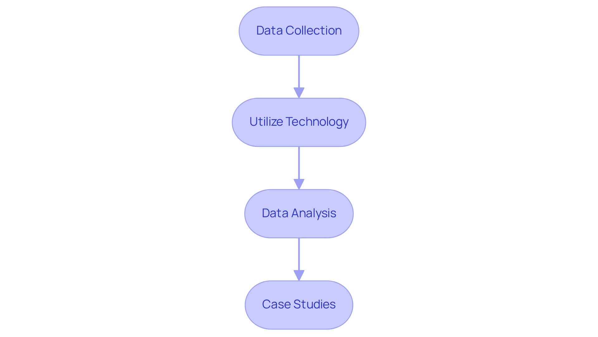
To effectively collect and analyze data for your land carbon footprint, it is essential to follow these steps:
-
Data Collection: Begin by gathering comprehensive data on:
- Land Use Practices: Document all activities on the land, including crop types, livestock management, and forestry practices.
- Soil Characteristics: Collect data on soil type, moisture levels, and existing organic matter content, as these factors significantly influence the storage of greenhouse gases.
- Climate Data: Understand local climate conditions, which significantly impact sequestration rates.
-
Utilize Technology: Leverage GIS mapping and advanced data processing tools to visualize and analyze your data. As Orestes Monterrey, President, notes, "GreenTech’s ability to specify the needed upgrades in a precise fashion helped us gain a better idea of exactly what we were paying for." This technology can unveil trends and connections between usage practices and greenhouse gases, enhancing your understanding of environmental effects.
-
Data Analysis: Analyze the collected data to:
- Calculate total emissions and sequestration rates, providing a clear picture of your land's carbon footprint. For instance, Kingsdown's exterior lighting enhancement led to a 69% decrease in yearly lighting energy consumption, illustrating the potential impact of efficient data gathering and assessment on greenhouse gases.
- Recognize patterns over time and evaluate the effects of various resource management practices on greenhouse gas emissions.
- Compare your findings against industry benchmarks to assess performance and identify areas for improvement.
-
Case Studies: Consider practical examples such as Troxler Electronic Laboratories, which upgraded to energy-efficient LED lighting based on data analysis. This upgrade resulted in a 68% reduction in annual lighting energy usage and significant energy incentives, showcasing the tangible benefits of informed decision-making.
By systematically gathering and examining data, you can gain valuable insights into your property's greenhouse gas impact, facilitating informed decision-making for sustainable management. The final outcome not only enhances operational efficiency but also contributes to environmental responsibility.

Implement Monitoring and Continuous Improvement Strategies
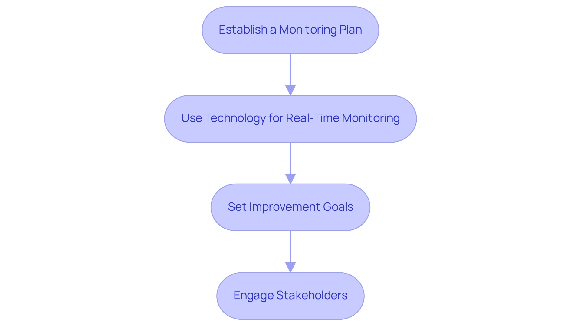
To implement effective monitoring and continuous improvement strategies for measuring your land carbon footprint, it is essential to consider the following:
- Establish a Monitoring Plan: Develop a strategy that outlines the frequency of your assessments and evaluations of environmental impact. This could be quarterly, bi-annually, or annually, depending on your specific goals.
- Use Technology for Real-Time Monitoring: Leverage tools that facilitate real-time data collection and monitoring. This includes:
- Remote Sensing: Utilize satellite data to track changes in land use and carbon sequestration.
- IoT Sensors: Deploy sensors to continuously monitor soil health and moisture levels.
- Set Improvement Goals: Based on your data analysis, establish specific, measurable objectives aimed at reducing your environmental footprint. This may involve:
- Adopting more sustainable land management practices.
- Enhancing greenhouse gas capture through reforestation or soil improvement methods.
- Engage Stakeholders: Collaborate with stakeholders, including local communities and environmental groups, to share best practices and enhance management efforts.
By establishing a robust monitoring and improvement framework, you can ensure that your land carbon footprint measurement leads to meaningful actions and contributes to overall sustainability.

Conclusion
Understanding and managing land carbon footprints is not just important; it is essential in the fight against climate change. This issue encompasses emissions from various land use activities, such as soil disturbance and agricultural practices. It is critical to consider land type and use practices, along with historical data, to accurately assess and manage emissions.
Selecting appropriate measurement tools and methodologies is crucial for obtaining accurate data. By employing carbon footprint calculators, remote sensing technologies, and established guidelines from the IPCC, stakeholders can gain valuable insights into their land's carbon impact. Systematic data collection and analysis are vital for identifying trends, calculating emissions, and comparing performance against industry standards.
Implementing continuous monitoring and improvement strategies ensures that land carbon footprint assessments lead to actionable outcomes. Establishing a monitoring plan, utilizing real-time data technologies, and engaging with stakeholders can drive sustainable land management practices.
Ultimately, a comprehensive approach to measuring and managing land carbon footprints contributes to reducing greenhouse gas emissions and fosters a healthier planet. As individuals and organizations embrace these strategies, they play a vital role in promoting environmental responsibility and sustainability for future generations.
Frequently Asked Questions
What is the terrestrial greenhouse gas impact?
The terrestrial greenhouse gas impact refers to the total greenhouse gas emissions generated directly or indirectly from usage activities, including emissions from soil disruption, terrain transformation, and agricultural practices.
How does land type affect carbon sequestration?
Different land types, such as forests, agricultural land, and urban areas, have varying capacities for carbon sequestration. For example, forests typically retain more greenhouse gases than farmland, highlighting the importance of their management in reducing overall emissions.
What role do land use practices play in greenhouse gas emissions?
Specific land use practices, including deforestation, crop rotation, and grazing, significantly influence greenhouse gas emissions. Deforestation can lead to substantial increases in greenhouse gas release, while sustainable farming practices can enhance carbon storage.
What recent data underscores the importance of land carbon footprint measurement?
In Canada, the year 2023 saw a rise in CO emissions from fires, estimated at 0.5–0.8 GtC/yr, emphasizing the need for land carbon footprint measurement to assess the impact of land use practices on greenhouse gas outputs.
Why is historical land use analysis important?
Analyzing historical changes in land use provides insight into past emissions and sequestration trends, which is crucial for land carbon footprint measurement and helps inform current management strategies.
What is the projected atmospheric CO2 level as we approach 2025?
The projected atmospheric CO2 level is expected to average 422.45 ppm, highlighting the significant contribution of changes in land use to these levels.
How can Dynamic Global Vegetation Models (DGVMs) be useful?
DGVMs can be utilized to assess various aspects of the ecological cycle, demonstrating the necessity of accurate measurement in usage activities for effective ecological impact management.
List of Sources
- Define Your Land Carbon Footprint
- Global Carbon Budget 2024 (https://essd.copernicus.org/articles/17/965/2025)
- Carbon Dioxide Emissions and Carbon Footprint - MAHB (https://mahb.stanford.edu/blog/carbon-footprint)
- COP27: The top quotes from climate and world leaders at the UN summit (https://weforum.org/stories/2022/11/cop27-quotes-climate-leaders)
- Collect and Analyze Relevant Data
- Case Study | GreenTech Solutions Group, LLC. (https://greentechsolutionsgroup.com/case_studies)


