Overview
This article presents four essential steps for implementing high-resolution drone mapping services:
- First, it is crucial to understand drone technology.
- Next, selecting appropriate equipment is vital.
- Following this, integrating mapping into land acquisition workflows is necessary.
- Finally, analyzing the resulting data is key for informed decision-making.
Each step is accompanied by detailed guidance on technology selection, project planning, and data utilization. The emphasis on high-resolution imagery highlights its role in enhancing accuracy and efficiency across various applications, such as land acquisition and environmental monitoring.
Introduction
High-resolution drone mapping is transforming the field of aerial surveying, delivering exceptional detail and precision through advanced unmanned aerial vehicles (UAVs). This innovative technology not only facilitates the development of intricate 2D and 3D models but also becomes an indispensable asset for professionals engaged in land acquisition and development.
Yet, as the intricacies of these processes escalate, organizations must consider:
- How can they effectively incorporate high-resolution drone mapping into their workflows to enhance efficiency and informed decision-making?
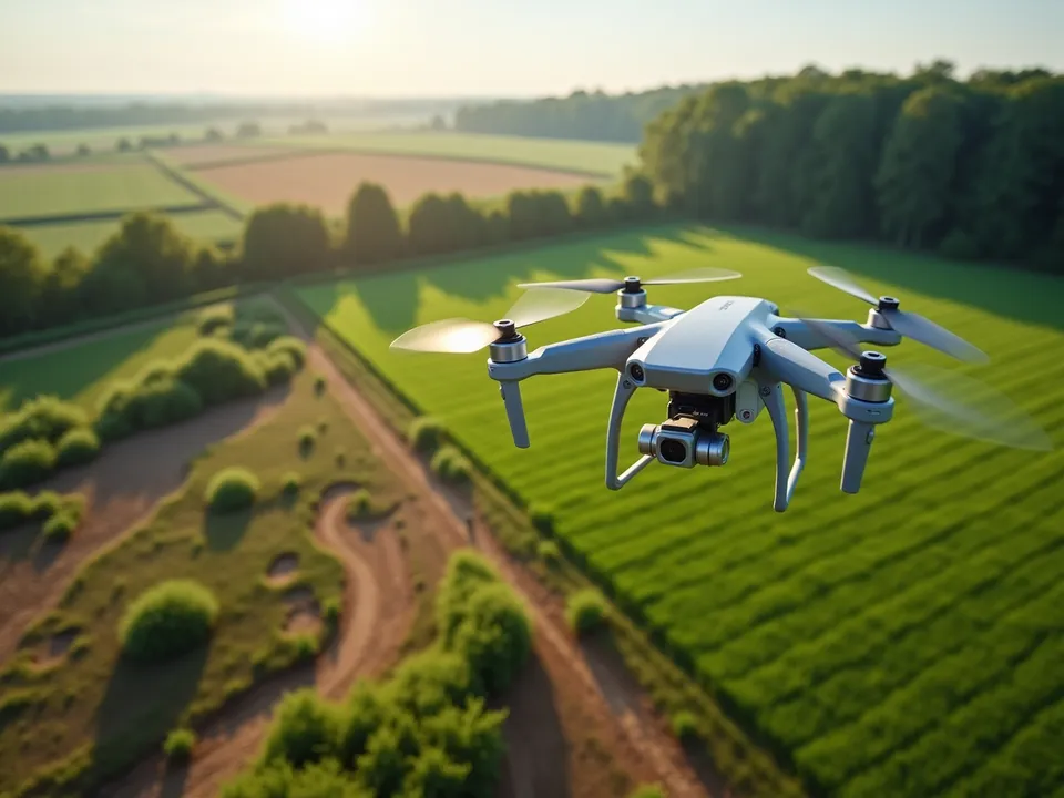
Understand High-Resolution Drone Mapping
High-resolution drone mapping represents a pivotal advancement in the field of aerial surveying, utilizing unmanned aerial vehicles (UAVs) equipped with sophisticated cameras and sensors to capture detailed aerial imagery. This technology not only facilitates the generation of accurate 2D representations but also enables the creation of intricate 3D models, which are indispensable for various applications, including land acquisition, construction, and environmental monitoring.
Understanding the principles of photogrammetry—the process of extracting measurements from photographs—is crucial for leveraging this technology effectively. High-resolution imagery yields a ground sample distance (GSD) that directly influences the level of detail in the produced maps. For example, a GSD of 2 cm signifies that each pixel in the image corresponds to a 2 cm square on the ground, thereby allowing for precise measurements and in-depth analysis.
As the complexities of land acquisition continue to evolve, including legal and regulatory challenges, the integration of high-resolution drone mapping services emerges as a compelling solution. This technology not only streamlines the mapping process but also enhances accuracy, ultimately supporting informed decision-making in land-related endeavors through high-resolution drone mapping services.
Incorporating high-resolution drone mapping services can significantly improve outcomes in various sectors, making these services an essential tool for professionals navigating the intricacies of land acquisition and development.

Select Appropriate Drone Technology and Equipment
When selecting aerial technology for high-resolution drone mapping services, it is imperative to consider critical factors such as:
- Camera quality
- Flight duration
- Payload capacity
The DJI Matrice 300 RTK stands out as a popular UAV for mapping, recognized for its robust features and high-resolution camera capabilities. Similarly, the WingtraOne Gen II excels in efficiently covering large areas.
Furthermore, ensure that the unmanned aerial vehicle is compatible with photogrammetry software, such as:
- Pix4D
- DroneDeploy
These can provide high-resolution drone mapping services by transforming captured images into usable maps. It is essential to assess the specific requirements of your project, including terrain and the desired level of detail, to select the most suitable aerial device and equipment.

Integrate Drone Mapping into Your Land Acquisition Workflow
Incorporating high-resolution drone mapping services into your land acquisition process is a strategic move that can enhance efficiency and accuracy.
- Begin by outlining the specific goals of your project.
- Collaborate with your team to identify the areas that need to be charted and the type of information required.
- Utilize flight planning software to create well-defined flight paths that ensure comprehensive coverage of the target area.
- After gathering the necessary data, employ processing software to generate detailed maps and models through high-resolution drone mapping services.
- Finally, share the results with stakeholders through collaborative platforms, ensuring that everyone involved has access to the latest information for informed decision-making.
This approach not only streamlines the acquisition process but also fosters transparency and collaboration among all parties.

Analyze and Utilize Drone Mapping Data for Decision Making
After processing the information from the high-resolution drone mapping services survey, it is essential to analyze the results to extract valuable insights. By utilizing GIS software, you can visualize this data, facilitating spatial analysis and the recognition of patterns. For instance, assessing land topography, identifying potential construction obstacles, or evaluating environmental impacts becomes possible.
Furthermore, the use of high-resolution drone mapping services in conjunction with other project materials, such as legal documents and stakeholder inputs, allows for the creation of a comprehensive overview that supports strategic decision-making.
It is imperative to regularly update your analysis as new data becomes available, ensuring that your decisions are grounded in the most current information.

Conclusion
High-resolution drone mapping services represent a transformative force in aerial surveying, delivering unmatched accuracy and detail in capturing land data. By harnessing advanced UAV technology and photogrammetry, professionals can develop precise 2D and 3D representations that are crucial for informed decision-making in land acquisition and development.
This article presents a comprehensive approach to implementing these services, beginning with an understanding of the technology and culminating in the selection of appropriate equipment. Essential steps include:
- Integrating drone mapping into existing workflows
- Utilizing flight planning and processing software
- Analyzing the resulting data to extract actionable insights
Each stage is meticulously designed to enhance efficiency, foster collaboration, and ensure that stakeholders have access to the most pertinent information for their projects.
Embracing high-resolution drone mapping transcends merely keeping pace with technological advancements; it is about leveraging these tools to enhance outcomes across diverse sectors. As the landscape of land acquisition evolves, the incorporation of drone mapping services becomes vital for professionals aiming to navigate complexities with precision and confidence. The future of mapping resides in these innovative solutions, compelling all stakeholders to consider their implementation for improved planning and execution in land-related endeavors.
Frequently Asked Questions
What is high-resolution drone mapping?
High-resolution drone mapping is an advanced technique in aerial surveying that uses unmanned aerial vehicles (UAVs) equipped with cameras and sensors to capture detailed aerial imagery, enabling the creation of accurate 2D representations and intricate 3D models.
What is photogrammetry and why is it important for drone mapping?
Photogrammetry is the process of extracting measurements from photographs. It is important for drone mapping as it allows for the effective utilization of high-resolution imagery to produce precise maps and models.
What does ground sample distance (GSD) mean in the context of drone mapping?
Ground sample distance (GSD) refers to the distance represented by each pixel in the image. For example, a GSD of 2 cm means each pixel corresponds to a 2 cm square on the ground, affecting the level of detail in the produced maps.
How does high-resolution drone mapping aid in land acquisition?
High-resolution drone mapping helps streamline the mapping process and enhances accuracy, which supports informed decision-making in land acquisition and development, especially amidst evolving legal and regulatory challenges.
What sectors can benefit from high-resolution drone mapping services?
High-resolution drone mapping services can significantly improve outcomes in various sectors, including land acquisition, construction, and environmental monitoring, making it an essential tool for professionals in these fields.