Overview
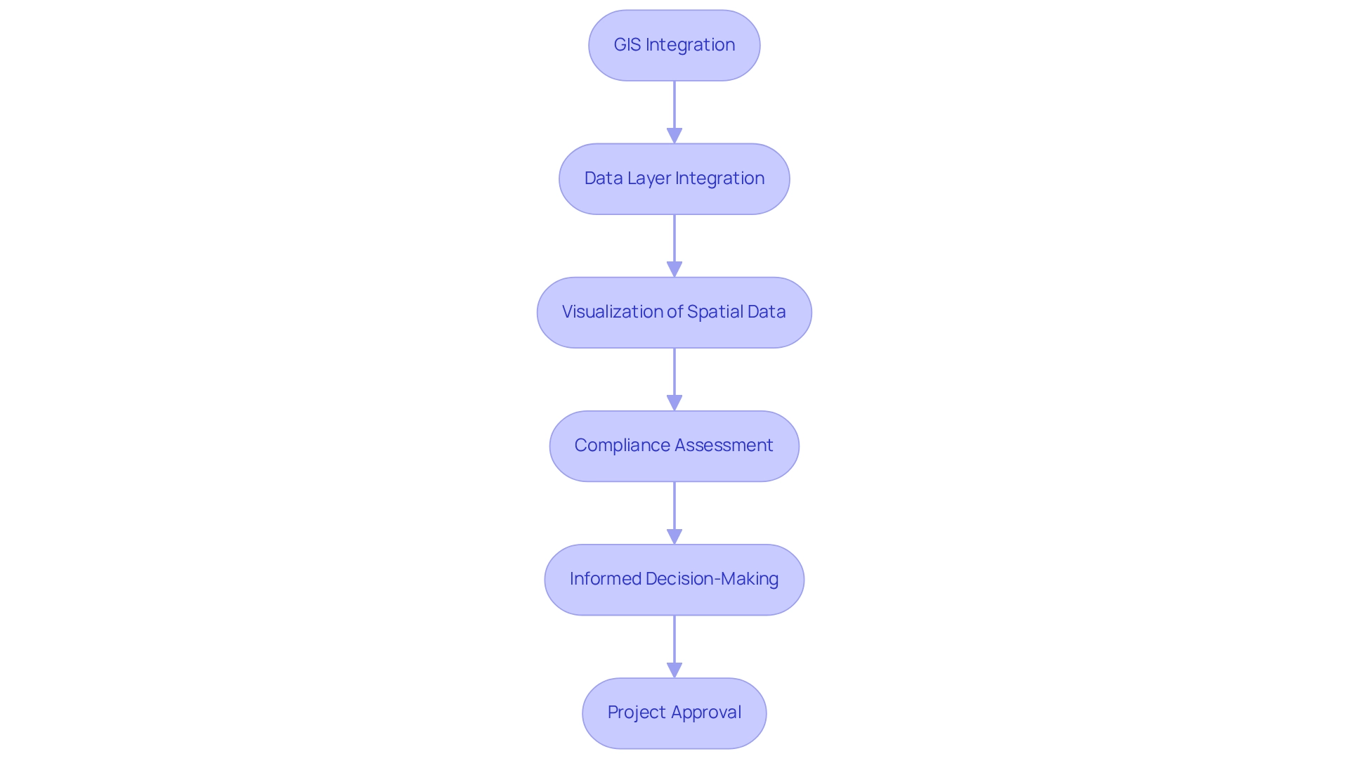
This article presents a structured approach to utilizing Integrated Geographic Information Systems (GIS) for ensuring zoning compliance, addressing a critical challenge faced by urban planners and developers. The process unfolds through four essential steps:
- Data collection and analysis
- Parcel evaluation
- Navigating legal requirements
By leveraging GIS tools, professionals can visualize spatial data and assess land use compatibility, which streamlines regulatory processes. This capability not only enhances decision-making but also significantly improves project outcomes in urban planning and development.
The complexities of land acquisition often involve navigating a myriad of legal and regulatory challenges. GIS serves as a powerful ally in this regard, enabling professionals to overcome these hurdles with precision. The ability to visualize and analyze data allows for informed decision-making, ultimately fostering a more efficient planning process.
In conclusion, integrating GIS into zoning compliance efforts is not merely advantageous; it is essential for effective urban planning. By adopting this innovative approach, professionals can ensure that projects meet all regulatory requirements while enhancing their overall effectiveness. Embrace the power of GIS to transform your zoning compliance strategies and achieve superior project outcomes.
Introduction
In the realm of urban planning and land development, Geographic Information Systems (GIS) stand as a transformative tool, fundamentally reshaping how professionals tackle zoning compliance. By enabling the visualization and analysis of spatial data, GIS empowers planners to navigate the intricate web of land use regulations with precision and confidence. As cities expand and evolve, recognizing the pivotal role of GIS is essential for ensuring development aligns with local zoning laws.
This article explores the multifaceted applications of GIS in zoning compliance, encompassing:
- Data collection and analysis
- Land parcel evaluation
- Navigation of legal requirements
Through insights drawn from real-world examples, this exploration underscores how GIS not only streamlines the planning process but also fosters sustainable development practices that benefit communities as a whole.
Understand GIS and Its Role in Zoning Compliance
Geographic Information Systems (GIS) serve as an indispensable tool for planners and developers, enabling them to visualize and analyze spatial data pertinent to land use and planning. Integrated GIS for zoning compliance empowers users to assess compliance with local planning laws effectively by integrating various data layers—such as topography, usage patterns, and regulatory frameworks. This capability is critical for professionals engaged in property development, as it illustrates how diverse spatial uses interact with existing regulations. For example, the State of Alaska has adeptly utilized GIS technology to aggregate and analyze tax data from 164 independent municipalities, thereby enhancing their understanding of sales tax management across the state.
The function of Integrated GIS for zoning compliance transcends mere visualization; it enables stakeholders to make informed decisions that align with land-use regulations, thereby facilitating smoother project approvals and reducing the likelihood of legal disputes. Recent advancements in GIS technology, including refined data processing algorithms and enhanced visualization tools, have further streamlined usage planning processes, simplifying the navigation of intricate regulatory landscapes for urban planners. As urban planner Ellen Dunham-Jones insightfully remarked, "Defining sprawl is a little bit like defining pornography. You know it when you see it." This underscores how GIS provides the clarity essential for effectively identifying and addressing such challenges.
With the increasing reliance on GIS in property development, current trends indicate a significant rise in its application, underscoring its importance in urban planning. By leveraging the capabilities of Integrated GIS for zoning compliance, professionals can ensure adherence to regulatory standards while optimizing usage strategies for sustainable development.

Collect and Analyze Zoning Data Using GIS Tools
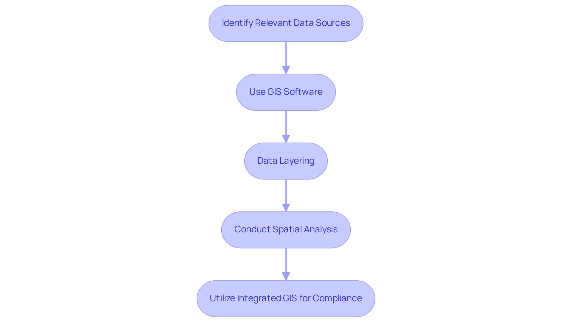
To effectively collect and analyze zoning data using GIS tools, it is essential to follow these steps:
- Identify Relevant Data Sources: Start by pinpointing local government databases, planning maps, and usage plans. Approximately 70% of municipalities now offer GIS data online, accessible through their planning departments, enhancing transparency and efficiency in data retrieval.
- Use GIS Software: Utilize robust GIS software such as ArcGIS or QGIS to import and visualize the collected data. These platforms facilitate the combination of district classifications with land use information, enabling a comprehensive examination of spatial relationships and regulatory implications.
- Data Layering: Integrate various datasets, including land use regulations, property boundaries, and environmental constraints. This layered approach provides a comprehensive perspective of the region, essential for identifying potential land-use disputes or regulatory challenges that may arise during project planning. As highlighted in the case study "Scale Considerations in Build-Out Analysis," the choice of scale significantly impacts the accuracy and effectiveness of the analysis, making this step vital.
- Conduct Spatial Analysis: Employ GIS analysis tools to evaluate how planning regulations pertain to specific parcels of property. Methods such as buffer analysis, proximity analysis, and overlay analysis are critical for assessing compliance with land-use regulations, ultimately supporting long-term community planning and sustainability objectives. As noted by Cloudpoint Geospatial, "GIS is a small, but important piece of this puzzle."
By utilizing Integrated GIS for zoning compliance, these practices not only simplify the area analysis process but also align with the latest trends in local government GIS data accessibility, ensuring that property acquisition efforts are both informed and compliant. Furthermore, the build-out analysis significantly contributes to long-term community planning and sustainability goals, reinforcing the importance of these steps.

Evaluate Land Parcels for Zoning Compliance with GIS Analysis
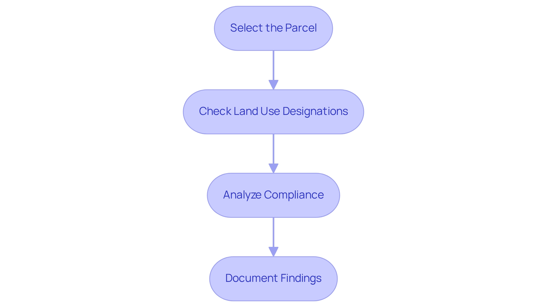
To effectively evaluate land parcels for zoning compliance using GIS analysis, it is essential to follow a structured approach:
- Select the Parcel: Begin by identifying the specific land parcel for evaluation. Utilize GIS tools to accurately locate the parcel on the map, ensuring precise analysis.
- Check Land Use Designations: Access the land use layer within your GIS software to ascertain the parcel's designation. Understanding these designations is crucial, as they dictate permitted uses and any applicable restrictions.
- Analyze Compliance: Conduct a thorough comparison of the parcel's current use against zoning regulations. Leverage GIS tools to assess critical factors such as setbacks, height restrictions, and compatibility with surrounding land uses. This analysis is vital; statistics indicate that non-compliance issues can significantly hinder project timelines and increase costs. For instance, recent data reveals that adherence rates differ greatly among regions, with some areas facing up to a 30% non-adherence rate.
- Document Findings: Compile a comprehensive report outlining your discoveries, emphasizing any regulatory issues uncovered during the analysis. This documentation is essential for facilitating discussions with stakeholders and regulatory bodies, ensuring that all parties are informed and aligned. As Neal Hefferren observes, "Each jurisdiction can vary, so seeking guidance from seasoned experts (planners, attorneys) is frequently recommended when pursuing or contesting a land use action."
The use of integrated GIS for zoning compliance not only simplifies the evaluation process but also improves the precision of regulatory assessments, ultimately aiding better decision-making in resource use planning. Furthermore, understanding the role of planning commissions, which act in an advisory capacity and often consider conditional use permits (CUPs), rezonings, and amendments to the comprehensive plan, is crucial for navigating the regulatory landscape effectively. The significance of land use planning cannot be overstated, as it plays a critical role in managing urban growth and development, ensuring that land use is compatible and beneficial to the community.

Navigate Legal and Regulatory Requirements for Zoning Compliance
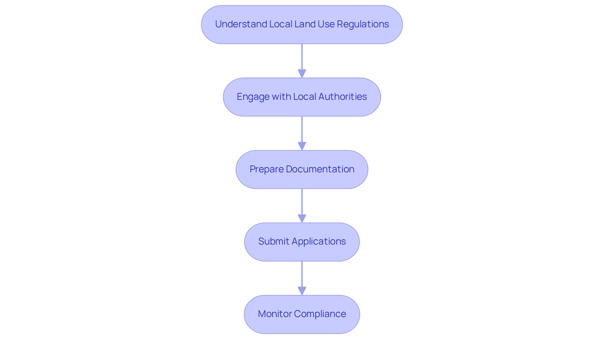
Navigating legal and regulatory requirements for land use compliance requires a strategic approach that can significantly influence project success. Understanding local land use regulations is paramount. Begin by thoroughly familiarizing yourself with the local land use codes and regulations pertinent to your project. This includes identifying permitted and conditional uses, as well as any special requirements that may apply. As Sara Bronin, an architect and legal expert, notes, many individuals are surprised to discover how little land in a community is designated for multifamily housing, underscoring the necessity of comprehending local land use.
Engaging with local authorities is another critical step. Establish proactive communication with local planning and regulatory bodies. Their insights can be invaluable for clarifying regulatory requirements and identifying necessary permits. Current trends indicate that effective collaboration with local authorities is essential for obtaining permits, particularly in complex projects such as mobile home parks, where community interests must be balanced. For example, a halfway house for parolees successfully mitigated community concerns by emphasizing their positive track record in other neighborhoods, illustrating the importance of addressing local interests.
Next, prepare your documentation meticulously. Compile all necessary materials, including detailed site plans, environmental assessments, and required applications. Ensuring that all documents are complete and accurate is vital to avoid delays in the approval process. Legal experts emphasize that thorough preparation can streamline interactions with authorities and enhance the likelihood of compliance. Consulting legal experts on land use appeals can provide a strategic advantage in overcoming challenges. Once your documentation is ready, submit your applications for land-use permits and any other required approvals. Be prepared to address questions or concerns raised by authorities during the review process. Engaging with local officials early can help mitigate potential issues.
Finally, monitor adherence to regulations consistently. After securing the required approvals, it is crucial to track compliance with land use regulations throughout the project duration. Routine check-ins with local officials, along with the use of integrated GIS for zoning compliance, can assist in ensuring conformity to regulations and enable prompt modifications to project plans when necessary. By adhering to these steps, you can effectively manage the intricacies of zoning regulations, ultimately enhancing project outcomes and community relations. Studies indicate that incorporating sustainable practices in real estate development can elevate property values by up to 20%, underscoring the significance of compliance in maximizing project potential.

Conclusion
The integration of Geographic Information Systems (GIS) in urban planning has transformed the assessment and management of zoning compliance. By enabling planners to visualize and analyze spatial data, GIS offers a comprehensive understanding of land use regulations, facilitating informed decision-making. Key applications of GIS—including data collection, land parcel evaluation, and navigation of legal requirements—streamline the zoning process and enhance project efficiency.
Through the effective use of GIS tools, urban planners can identify relevant data sources, evaluate compliance, and engage with local authorities, ensuring that development projects align with zoning laws. The emphasis on data layering and spatial analysis not only aids in identifying potential conflicts but also supports sustainable development practices that benefit communities. As the landscape of urban development evolves, the role of GIS becomes increasingly crucial in fostering compliance and promoting responsible land use.
Ultimately, embracing GIS technology equips professionals with the necessary tools to navigate the complexities of zoning compliance successfully. As cities grow and change, the commitment to utilizing GIS will significantly shape sustainable and compliant urban environments, ensuring that development meets both regulatory standards and community needs. The future of urban planning lies in harnessing the power of GIS for a more informed, efficient, and sustainable approach to land development.
Frequently Asked Questions
What is the role of Geographic Information Systems (GIS) in planning and development?
GIS serves as an essential tool for planners and developers, allowing them to visualize and analyze spatial data related to land use and planning.
How does Integrated GIS assist with zoning compliance?
Integrated GIS empowers users to assess compliance with local planning laws by integrating various data layers, such as topography, usage patterns, and regulatory frameworks.
Why is GIS technology important for property development?
GIS technology illustrates how diverse spatial uses interact with existing regulations, which is critical for professionals engaged in property development.
Can you provide an example of GIS application in a specific region?
The State of Alaska has effectively used GIS technology to aggregate and analyze tax data from 164 independent municipalities, improving their understanding of sales tax management across the state.
What benefits does Integrated GIS provide to stakeholders?
It enables stakeholders to make informed decisions that align with land-use regulations, facilitating smoother project approvals and reducing the likelihood of legal disputes.
What recent advancements have been made in GIS technology?
Recent advancements include refined data processing algorithms and enhanced visualization tools that streamline usage planning processes for urban planners.
How does GIS help in identifying urban sprawl?
GIS provides clarity essential for effectively identifying and addressing challenges like urban sprawl, as noted by urban planner Ellen Dunham-Jones.
What trends are emerging regarding the use of GIS in property development?
There is a significant rise in the application of GIS in property development, highlighting its importance in urban planning and ensuring adherence to regulatory standards.
List of Sources
- Understand GIS and Its Role in Zoning Compliance
- 100+ of the Best Urban Planning Quotes: Cities, Community, Urbanisation & Inspiration - This Big City (https://thisbigcity.net/quotes)
- Mapping and Analyzing Property Values with GIS (https://esri.com/en-us/industries/land-administration/strategies/value-analysis)
- Jack Dangermond Quotes - BrainyQuote (https://brainyquote.com/authors/jack-dangermond-quotes)
- Quotes, Urban Planning, Inspiring | Urban Innovators (https://urbaninnovators.com/inspiring-urban-planning-quotes)
- Collect and Analyze Zoning Data Using GIS Tools
- GIS Mapping: Shaping the Future of Efficient Land Management — Purple Land Management (https://purplelandmgmt.com/news/gis-mapping-for-efficient-land-management)
- Build-Out Analysis : WeConservePA Library (https://library.weconservepa.org/guides/42-build-out-analysis)
- GIS for the Public Good (https://geoweeknews.com/news/gis-for-the-public-good)
- Evaluate Land Parcels for Zoning Compliance with GIS Analysis
- Zoning Laws: A Practical Guide (https://propertymetrics.com/blog/zoning-laws)
- Zoning: What It Is, How It Works, and Classification Examples (https://investopedia.com/terms/z/zoning.asp)
- Navigate Legal and Regulatory Requirements for Zoning Compliance
- Navigating Zoning Laws: Insights for Successful Real Estate Development - Real Estate Wealth Builders (https://rewbcon.com/navigating-zoning-laws-for-real-estate-development-projects)
- Is Zoning Government's 'Most Significant Regulatory Power'? (https://governing.com/urban/is-zoning-governments-most-significant-regulatory-power)
- Navigating Zoning Regulations - FasterCapital (https://fastercapital.com/topics/navigating-zoning-regulations.html)


