Overview
The primary inquiry explored in this article is the implementation of effective GIS mapping strategies for habitat conservation. It delineates four essential strategies:
- Ensuring information quality
- Managing data layers
- Providing user training
- Fostering stakeholder collaboration
Collectively, these strategies enhance the efficacy of GIS mapping by improving data accuracy, accessibility, and community engagement. This, in turn, leads to more successful conservation outcomes.
Introduction
GIS mapping stands at the forefront of habitat conservation, revolutionizing the analysis of spatial data to protect vital ecosystems. By leveraging advanced technologies, including machine learning and artificial intelligence, conservationists can now pinpoint biodiversity hotspots and monitor endangered species with unprecedented accuracy. Yet, as data management complexities increase, a pressing challenge emerges: how can practitioners effectively implement GIS strategies to navigate obstacles and enhance conservation efforts?
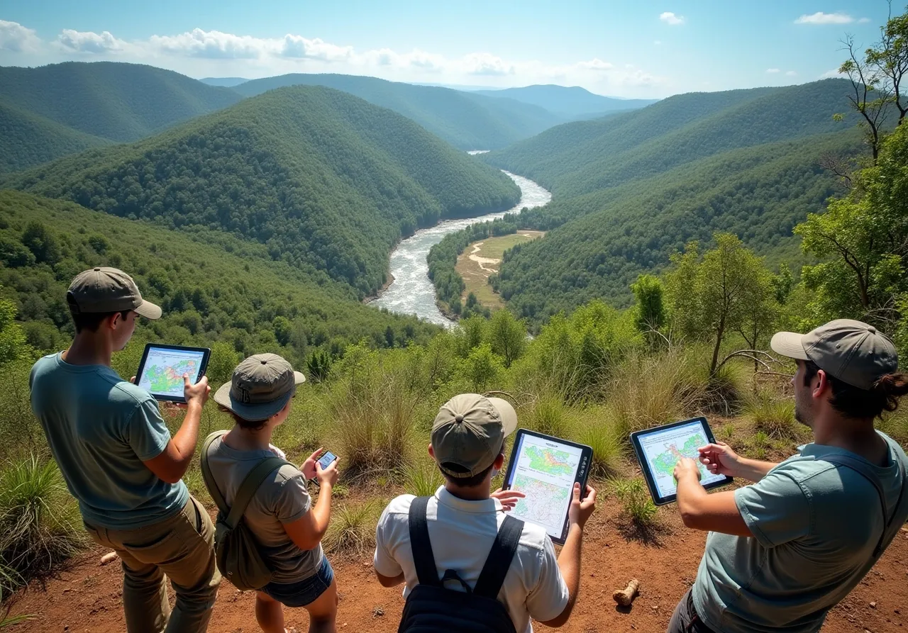
Understand the Role of GIS Mapping in Habitat Conservation
GIS mapping for habitat conservation serves as an essential tool in the realm of ecosystem preservation, facilitating the analysis of spatial data to pinpoint critical areas, evaluate environmental impacts, and strategize sustainable resource management. As of 2025, the incorporation of machine learning and artificial intelligence into GIS has significantly bolstered predictive modeling capabilities. This advancement empowers conservationists to more effectively identify biodiversity hotspots and monitor endangered species. For instance, GIS mapping for habitat conservation has successfully mapped vital habitats for species such as the Galapagos penguin and the Northern spotted owl, underscoring its pivotal role in ecological planning.
Recent innovations in GIS technology allow for the visualization of ecological patterns and the monitoring of species distributions, offering valuable insights into the repercussions of human activities on natural environments. By layering diverse data sets—such as land use, topography, and climate—GIS delivers a holistic perspective of landscapes, which is crucial for devising effective ecosystem protection strategies. Statistics reveal that as of 2016, there were 202,467 terrestrial and inland water protected areas worldwide, encompassing 14.7% of these ecosystems. The adoption of GIS-informed decision-making has yielded superior management outcomes, with targeted preservation efforts enhancing ecosystem connectivity and safeguarding endangered species.
A notable case study is the Kas-Kekova Protected Area (PA) in Turkey, which has utilized GIS-based methodologies to assess biodiversity and formulate preservation strategies in response to pressures from tourism and urbanization. In summary, GIS mapping for habitat conservation represents a transformative approach that equips environmentalists with the tools to make informed decisions and implement impactful ecosystem protection initiatives.

Implement Best Practices for Effective GIS Mapping
To achieve effective GIS mapping for habitat conservation, practitioners must adhere to several best practices:
-
Information Quality Assurance: It is imperative that the information utilized is accurate, up-to-date, and relevant. This necessitates regular validation and cleaning of datasets to eliminate errors. As Professor Harry L. Weinberg cautions, misunderstanding maps as reliable information can lead to significant misconceptions, making quality assurance essential.
-
Layer Management: Organizing information layers systematically is crucial for facilitating easy access and analysis. This includes categorizing layers by type (e.g., vegetation, water bodies, land use) and ensuring compatibility between different datasets. Arthur H. Robinson aptly draws a parallel between cartography and architecture, noting that both are practical arts controlled by their consumers.
-
User Training: Comprehensive training for users of GIS tools is vital to enhance their skills in analysis and interpretation. This investment can significantly improve the quality of insights derived from GIS mapping. Enhanced user skills are directly linked to the efficiency of preservation strategies.
-
Stakeholder Collaboration: Collaborating with local communities, environmental organizations, and governmental bodies is essential for gathering diverse information and viewpoints, which can enrich the GIS mapping process. This collaborative approach ensures that multiple perspectives are considered in habitat preservation initiatives.
-
Regular Updates: Continuously refreshing GIS information to reflect changes in the environment is necessary to ensure that preservation strategies remain relevant and effective. The dynamic nature of ecosystems requires that GIS data is kept current to support timely decision-making. Arnold Schwarzenegger humorously compares GIS to an advanced type of digital mapping technology, underscoring its significance in contemporary environmental initiatives.
By adhering to these best practices, practitioners can substantially enhance the effectiveness of GIS mapping for habitat conservation, ultimately leading to more successful outcomes in preserving vital ecosystems.

Explore the Benefits of GIS Mapping in Conservation Efforts
GIS mapping significantly enhances conservation efforts through several key benefits:
-
Enhanced Decision-Making: Visualizing complex datasets allows conservationists to make informed choices regarding ecosystem protection and restoration. This capability is crucial for identifying critical habitats and assessing the impact of urbanization on biodiversity, contributing to biodiversity loss and environmental degradation.
-
Resource Allocation: GIS technology enables organizations to pinpoint key areas for preservation, facilitating more effective and efficient resource allocation. This focused method ensures that efforts are directed where they are most needed, maximizing the impact of preservation initiatives.
-
Monitoring and Evaluation: Ongoing environmental and species monitoring is streamlined with GIS, allowing conservationists to assess the effectiveness of their strategies. This adaptability is essential for making timely adjustments in response to environmental changes or emerging threats, such as those posed by urban expansion.
-
Public Engagement: Interactive GIS maps serve as effective tools for communicating preservation initiatives to the public. By fostering increased awareness and support for environmental protection initiatives, these visual tools stimulate community engagement and advocacy.
-
Collaboration Opportunities: The sharing of GIS data among various stakeholders promotes teamwork and joint initiatives in environmental protection efforts. This interconnectedness is vital for tackling complex environmental challenges, enabling a unified approach to habitat protection.
Integrating GIS mapping for habitat conservation into preservation strategies not only enhances decision-making but also promotes sustainable practices aligned with ecological preservation objectives. As Jack Dangermond noted, "GIS is waking up the world to the power of geography, this science of integration, and has the framework for creating a better future." This underscores the transformative potential of GIS in advancing effective environmental protection practices.

Address Challenges in GIS Mapping Implementation
Implementing GIS mapping for habitat conservation presents several significant challenges that must be navigated effectively:
-
Information Quality Issues: Inconsistent or outdated information can lead to erroneous analyses, a prevalent concern in conservation efforts. Research indicates that less than 40% of the Tangjiahe Nature Reserve is classified as highly suitable for giant pandas, underscoring the necessity for reliable information. Establishing protocols for routine validation and updates of information is essential to ensure the dependability of GIS outputs.
-
Technical Limitations: The complexity of GIS software can act as a barrier, necessitating specialized skills that may not be readily accessible. Comprehensive training and ongoing support for users are vital, significantly enhancing their proficiency and confidence in effectively utilizing GIS tools.
-
Funding Constraints: Limited budgets often restrict access to advanced GIS tools and technologies. To mitigate this challenge, pursuing partnerships with academic institutions or non-profit organizations can provide additional resources and expertise, facilitating the implementation of effective GIS solutions.
-
Stakeholder Resistance: Early engagement of stakeholders in the GIS mapping process is crucial. Demonstrating the value of GIS through clear communication of its benefits can alleviate concerns and foster cooperation among various groups involved in environmental preservation efforts. As Amanda Suzzi Kadambari Devarajan stated, 'The use of GIS mapping for habitat conservation is a powerful instrument that has transformed preservation efforts by supplying spatially explicit information to guide preservation decision-making.'
-
Integration with Existing Systems: Ensuring compatibility between GIS tools and other data management systems is vital for seamless implementation. Conducting thorough assessments of existing infrastructure prior to adopting new GIS technologies can prevent integration issues and enhance overall project efficiency. A systematic conservation planning workshop held in the Arabian Peninsula exemplifies how GIS can be effectively integrated to address conservation challenges.

Conclusion
GIS mapping stands as a cornerstone in habitat conservation, providing unparalleled capabilities for analyzing spatial data and informing strategic environmental decisions. By leveraging advanced technologies such as machine learning and artificial intelligence, conservationists can effectively identify critical habitats and monitor biodiversity. This ensures that efforts are not only impactful but also sustainable.
Key strategies for enhancing the effectiveness of GIS mapping include:
- Ensuring the quality of information
- Implementing systematic layer management
- Providing user training
- Fostering stakeholder collaboration
- Maintaining regular updates of GIS data
Each of these practices significantly improves decision-making, resource allocation, monitoring, public engagement, and collaborative opportunities in conservation efforts.
The significance of GIS mapping in habitat conservation is profound. It serves as a vital tool that enhances understanding of ecological dynamics and empowers practitioners to confront the pressing challenges of environmental degradation. By embracing these strategies and best practices, stakeholders can collaborate to create a more sustainable future for our planet's precious ecosystems. The call to action is clear: invest in GIS technologies, prioritize collaboration, and commit to ongoing education to ensure that habitat conservation efforts are as effective and impactful as possible.
Frequently Asked Questions
What is the role of GIS mapping in habitat conservation?
GIS mapping serves as an essential tool for ecosystem preservation by analyzing spatial data to identify critical areas, evaluate environmental impacts, and strategize sustainable resource management.
How has technology improved GIS mapping for conservation as of 2025?
The incorporation of machine learning and artificial intelligence into GIS has enhanced predictive modeling capabilities, enabling conservationists to identify biodiversity hotspots and monitor endangered species more effectively.
Can you provide examples of species that have benefited from GIS mapping?
GIS mapping has successfully identified vital habitats for species such as the Galapagos penguin and the Northern spotted owl, highlighting its importance in ecological planning.
What insights does GIS mapping provide regarding human activities?
Recent innovations in GIS technology allow for the visualization of ecological patterns and monitoring of species distributions, providing insights into the impacts of human activities on natural environments.
How does GIS mapping contribute to ecosystem protection strategies?
By layering diverse data sets—such as land use, topography, and climate—GIS offers a holistic view of landscapes, which is crucial for developing effective ecosystem protection strategies.
What statistics reflect the global status of protected areas as of 2016?
As of 2016, there were 202,467 terrestrial and inland water protected areas worldwide, covering 14.7% of these ecosystems.
What are the outcomes of adopting GIS-informed decision-making in conservation?
The adoption of GIS-informed decision-making has led to superior management outcomes, enhancing ecosystem connectivity and safeguarding endangered species through targeted preservation efforts.
Can you provide a case study that illustrates the use of GIS in habitat conservation?
The Kas-Kekova Protected Area (PA) in Turkey utilized GIS-based methodologies to assess biodiversity and develop preservation strategies in response to tourism and urbanization pressures.
List of Sources
- Understand the Role of GIS Mapping in Habitat Conservation
- GIS-Based Assessment of Habitat Networks for Conservation Planning in Kas-Kekova Protected Area (Turkey) (https://mdpi.com/2220-9964/9/2/91)
- Enhancing Conservation Strategies with GIS: Advances, Collaborations, and Future Directions (https://preprints.org/manuscript/202310.1372/v2)
- Leveraging The Power of GIS for Conservation (https://delta.audubon.org/news/leveraging-power-gis-conservation)
- England Prioritizes Nature in Development, with Maps Guiding Biodiversity Gains (https://esri.com/about/newsroom/blog/england-values-nature-development)
- Clark-built dashboard reveals success of conservation efforts where the wild things are | ClarkU News (https://clarku.edu/news/2025/06/18/clark-built-dashboard-reveals-success-of-conservation-efforts-where-the-wild-things-are)
- Implement Best Practices for Effective GIS Mapping
- GIS and Cartography Quotes (https://geographyrealm.com/gis-quotes)
- Explore the Benefits of GIS Mapping in Conservation Efforts
- Sustainable urban policy development in hill cities: A case study of Shimla's LULC changes and urban regeneration efforts (https://sciencedirect.com/science/article/pii/S2664328625000294)
- Ways GIS Mapping Is Proven to Help Environmental Conservation - Meridian (https://meridiansurveys.ca/ways-gis-mapping-is-proven-to-help-environmental-conservation)
- GIS for Conservation: How Data Is Helping to Protect Wildlife (https://id.land/blog/gis-for-conservation-how-data-is-helping-to-protect-wildlife)
- GIS and Cartography Quotes (https://geographyrealm.com/gis-quotes)
- Address Challenges in GIS Mapping Implementation
- (PDF) Enhancing Conservation Strategies with GIS: Advances, Collaborations, and Future Directions (https://researchgate.net/publication/375075674_Enhancing_Conservation_Strategies_with_GIS_Advances_Collaborations_and_Future_Directions)
- How to Apply the Geographic Approach to Conservation | Spring 2025 | ArcNews (https://esri.com/about/newsroom/arcnews/how-to-apply-the-geographic-approach-to-conservation)
- GIS and Cartography Quotes (https://geographyrealm.com/gis-quotes)
- Jack Dangermond Quotes - BrainyQuote (https://brainyquote.com/authors/jack-dangermond-quotes)
- Wildlife GIS: Mapping Conservation Efforts (https://numberanalytics.com/blog/wildlife-gis-mapping-conservation-efforts)