Overview
The article presents seven strategies for effective climate adaptation land modeling, underscoring the critical role of advanced technologies, stakeholder collaboration, and strategic planning in tackling environmental challenges. It highlights the significance of GIS mapping and AI tools in streamlining land acquisition processes, thereby facilitating improved decision-making. These strategies ensure that adaptation efforts remain both efficient and sustainable in the face of climate change.
Introduction
The urgency of climate change necessitates effective strategies in land modeling that can adapt to shifting environmental conditions. As organizations navigate the complexities of land acquisition and management, the integration of advanced technologies such as GIS and AI has become a transformative force. However, how can stakeholders effectively collaborate and implement these strategies to ensure successful outcomes amidst the uncertainties of climate impacts? This article delves into seven innovative approaches to climate adaptation in land modeling, providing insights into how organizations can enhance resilience and secure sustainable land use in an ever-evolving landscape.
Harbinger Land | Comprehensive Solutions for Climate Adaptation Land Modeling
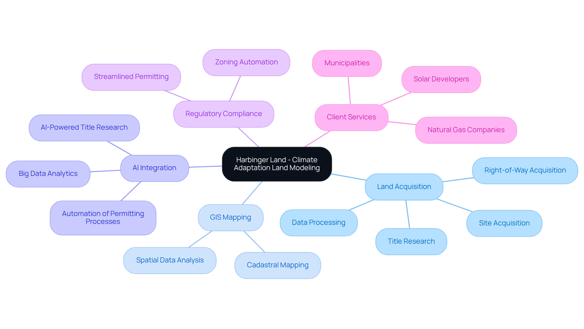
Harbinger Land stands at the forefront of providing comprehensive solutions for climate adaptation land modeling. The complexities of land acquisition, including site and right-of-way acquisition, title research, GIS mapping, and data processing, present significant challenges for clients in the energy and infrastructure sectors. By harnessing advanced technologies, particularly AI-powered tools, Harbinger Land enhances the efficiency and precision of property services, which supports climate adaptation land modeling to enable clients to effectively tackle these environmental challenges.
With a veteran team skilled in rapidly deploying large teams, Harbinger Land ensures timely and customized services for a diverse clientele, including natural gas companies and solar developers. The integration of GIS and AI streamlines the identification of suitable locations and accelerates the permitting process, which supports climate adaptation land modeling to address the growing demand for effective land management solutions in a rapidly evolving market.
As the industry faces increasing regulatory pressures and the need for efficient land use, Harbinger Land’s expertise becomes indispensable. By providing tailored solutions, the company not only meets the immediate needs of its clients but also positions them for long-term success in navigating the complexities of land acquisition.
GIS Mapping: Enhancing Climate Adaptation Strategies
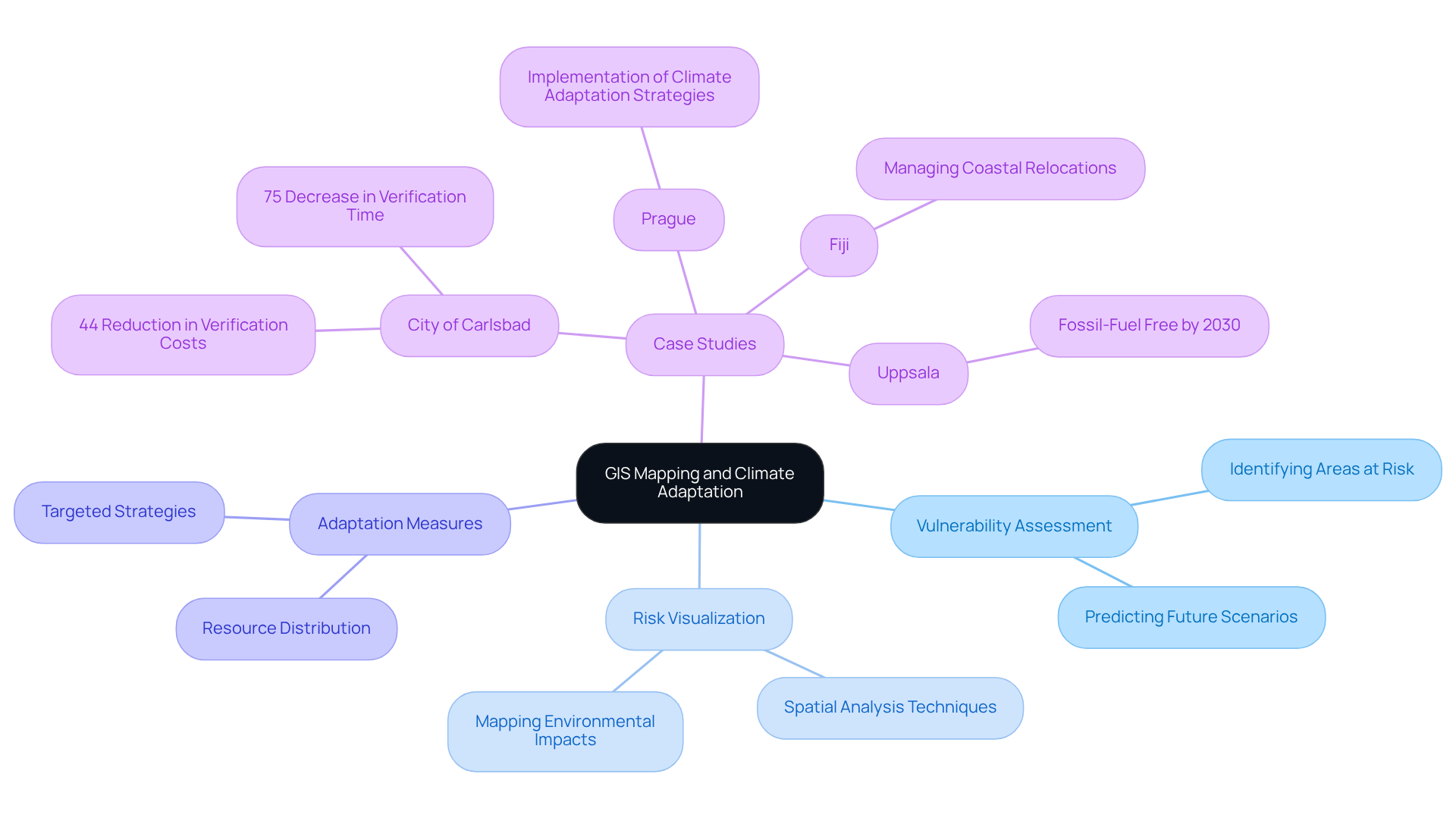
Geographic Information Systems (GIS) mapping is pivotal in enhancing environmental adjustment strategies. By providing in-depth spatial analysis, GIS identifies areas most vulnerable to environmental impacts, such as flooding or drought. This technology allows planners to visualize potential risks and formulate targeted adaptation measures. For instance, GIS can assess land use trends, predict future environmental scenarios, and prioritize regions for conservation or development, ensuring effective resource distribution to mitigate ecological risks.
Notably, the City of Carlsbad has realized significant efficiency gains through GIS applications, achieving a 44% reduction in verification costs and a 75% decrease in the time required to complete and submit verifications. Similarly, cities like Prague, among the first in the Czech Republic to implement these strategies, are leveraging GIS to pinpoint areas requiring immediate intervention, thereby enhancing their resilience to environmental changes. In Fiji, authorities are utilizing GIS and remote sensing technologies to manage the relocation of coastal communities impacted by rising sea levels.
As Robert Rundstrum aptly stated, "Mapping is fundamental to the process of lending order to the world," underscoring the essential role of GIS in environmental adaptation. Overall, GIS serves as a powerful tool in the ongoing effort of climate adaptation land modeling to adjust to and address the challenges posed by environmental change.
AI-Powered Title Research: Securing Land Rights for Adaptation Projects
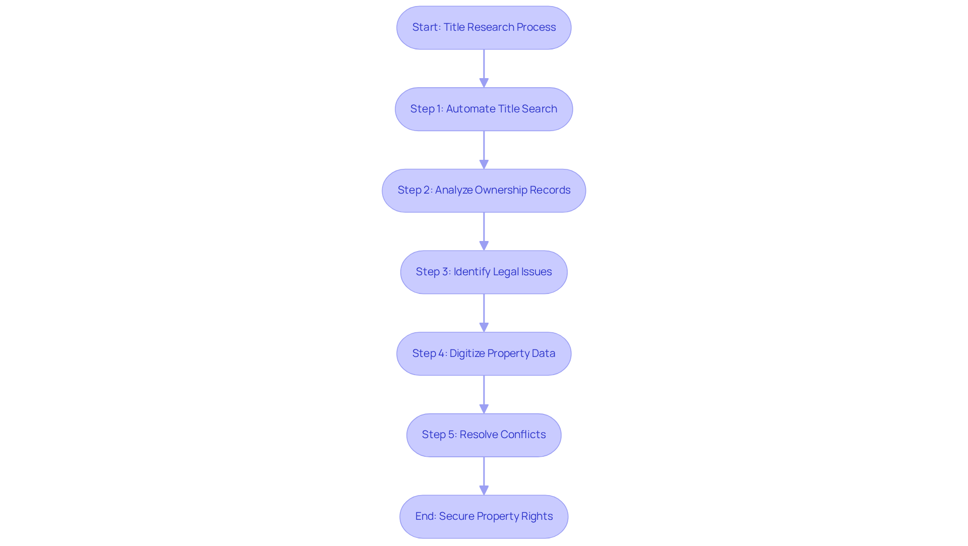
AI-driven title research significantly enhances the effectiveness of securing property rights for environmental resilience initiatives. By automating the title search process, AI tools swiftly analyze vast amounts of data, identify ownership records, and pinpoint potential legal issues. This not only shortens the time required for property procurement but also reduces costly errors.
Harbinger Land complements this with cost-effective document imaging solutions that digitize property data, streamlining title research and leasing processes. Our imaging agents are adept at efficiently deploying to courthouses or obtaining documents through records requests. This capability allows for the rapid identification of conflicting claims or easements that could impact project timelines, facilitating proactive resolutions before project initiation.
Consider the complexities of land acquisition, including legal and regulatory challenges. How can you ensure that your projects proceed without delay? With our advanced solutions, you can navigate these challenges effectively, securing the necessary property rights with confidence.
Stakeholder Collaboration: Navigating Conflicting Interests in Land Acquisition
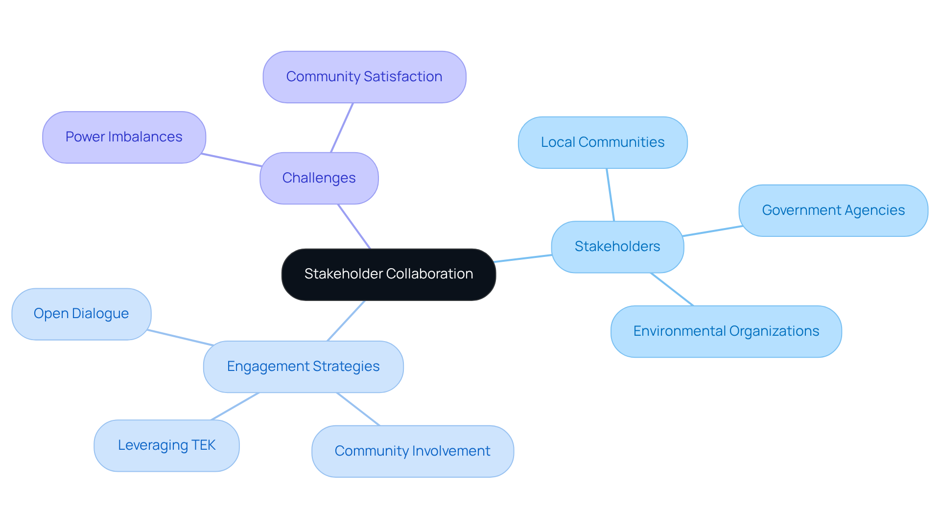
Effective stakeholder collaboration is essential for addressing the conflicting interests that frequently emerge during land acquisition for climate resilience projects. Engaging local communities, government agencies, and environmental organizations fosters transparency and builds trust among all parties involved. By promoting open dialogue, project managers can effectively address concerns, negotiate terms, and identify mutually beneficial solutions. For example, involving community members in the planning process can yield innovative adjustment strategies that leverage local knowledge and priorities, including traditional ecological knowledge (TEK). This approach not only enhances project acceptance but significantly contributes to the success of adjustment initiatives, ensuring their relevance and sustainability.
Furthermore, statistics such as community participation rates and levels of satisfaction provide valuable insights into the effectiveness of these engagement efforts. However, it is crucial to recognize potential challenges, such as power imbalances that may undermine community engagement, to ensure that all voices are heard and included in the decision-making process. As emphasized, 'Community engagement is the foundation of successful adjustment projects,' underscoring its vital role in achieving sustainable outcomes.
Strategic Planning: Essential for Effective Land Acquisition
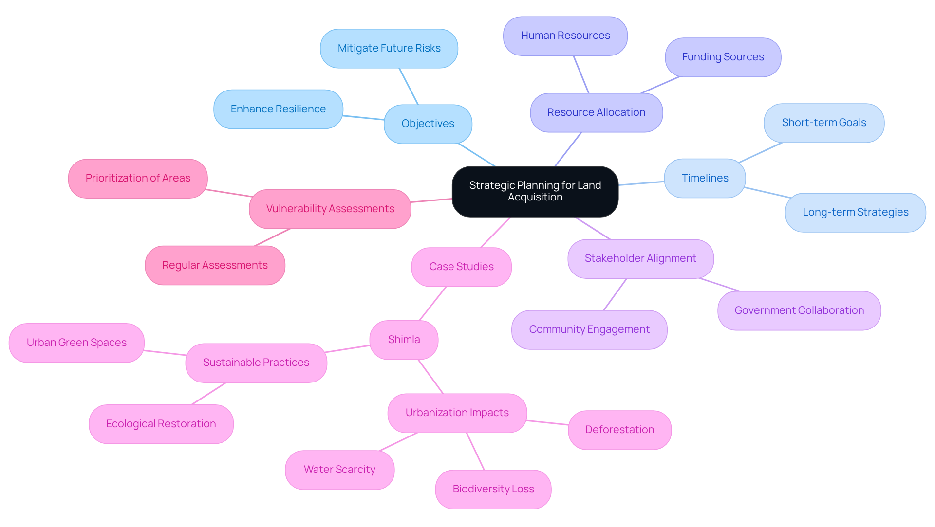
Strategic planning is paramount for successful property procurement in climate adaptation land modeling efforts. A comprehensive plan delineates objectives, timelines, and resource allocation, ensuring alignment among all stakeholders. This method aids in pinpointing priority areas for procurement, guided by vulnerability assessments and anticipated climate impacts, through climate adaptation land modeling.
For instance, prioritizing property acquisition in flood-prone areas for restoration or conservation significantly enhances resilience and mitigates future risks. Recent studies indicate that urban growth in Shimla, India, has led to considerable deforestation and a decline in biodiversity, with urbanization occurring at the expense of essential ecosystems such as forests, open areas, and agricultural fields. This underscores the necessity for focused interventions and the integration of sustainable resource management practices into urban planning.
The case study of Shimla advocates for adopting adaptive urban planning frameworks to balance modernization with ecological preservation. By embracing a strategic approach, property services can effectively contribute to climate adaptation land modeling, ensuring that development aligns with ecological preservation and community well-being.
To optimize property acquisition strategies, stakeholders must regularly conduct vulnerability assessments to inform decision-making and prioritize areas requiring immediate attention.
Evaluating Adaptation Approaches: Assessing Land Modeling Effectiveness
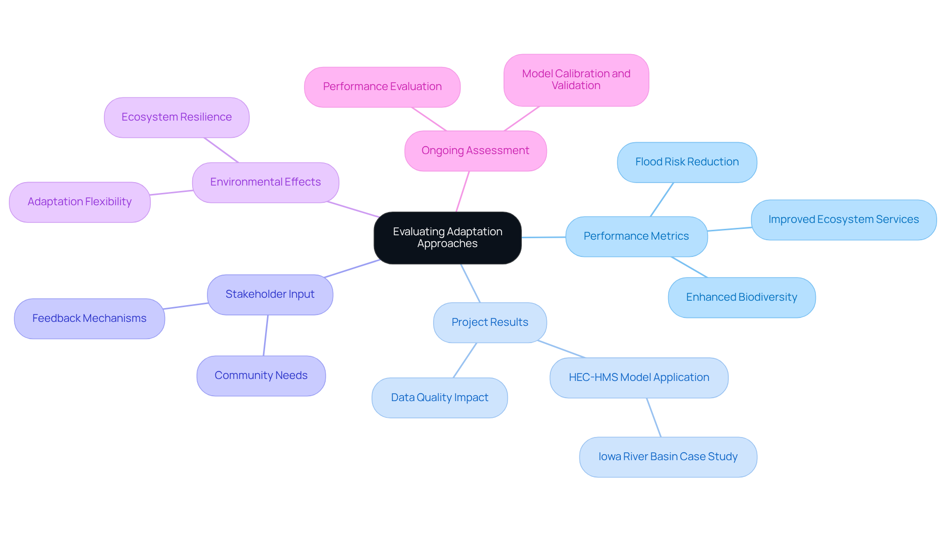
Assessing adjustment methods is crucial for determining the effectiveness of climate adaptation land modeling techniques. This process necessitates a thorough examination of project results, stakeholder input, and environmental effects to evaluate whether modification strategies meet their intended goals. Performance metrics, such as reduced flood risk, enhanced biodiversity, and improved ecosystem services, provide valuable insights into the success of specific interventions.
For instance, in the Iowa River Basin, the application of the HEC-HMS model yielded critical data that informed flood risk management decisions, showcasing the model's effectiveness in real-world scenarios. Importantly, data quality is a key factor in the uncertainty of hydrologic model predictions, underscoring the importance of precise data in evaluating adjustment strategies.
Ongoing assessment not only facilitates the improvement of strategies but also ensures that climate adaptation land modeling enables resource services to remain flexible and responsive to evolving environmental conditions and community needs. By adopting a systematic approach to performance evaluation, stakeholders can effectively navigate the complexities of environmental adjustment and bolster the resilience of their resource management practices.
Furthermore, hydrologic modeling plays a vital role in flood forecasting and warning systems, illustrating its practical applications in efficient resource management.
Coping with Uncertainty: Strategies for Climate Adaptation
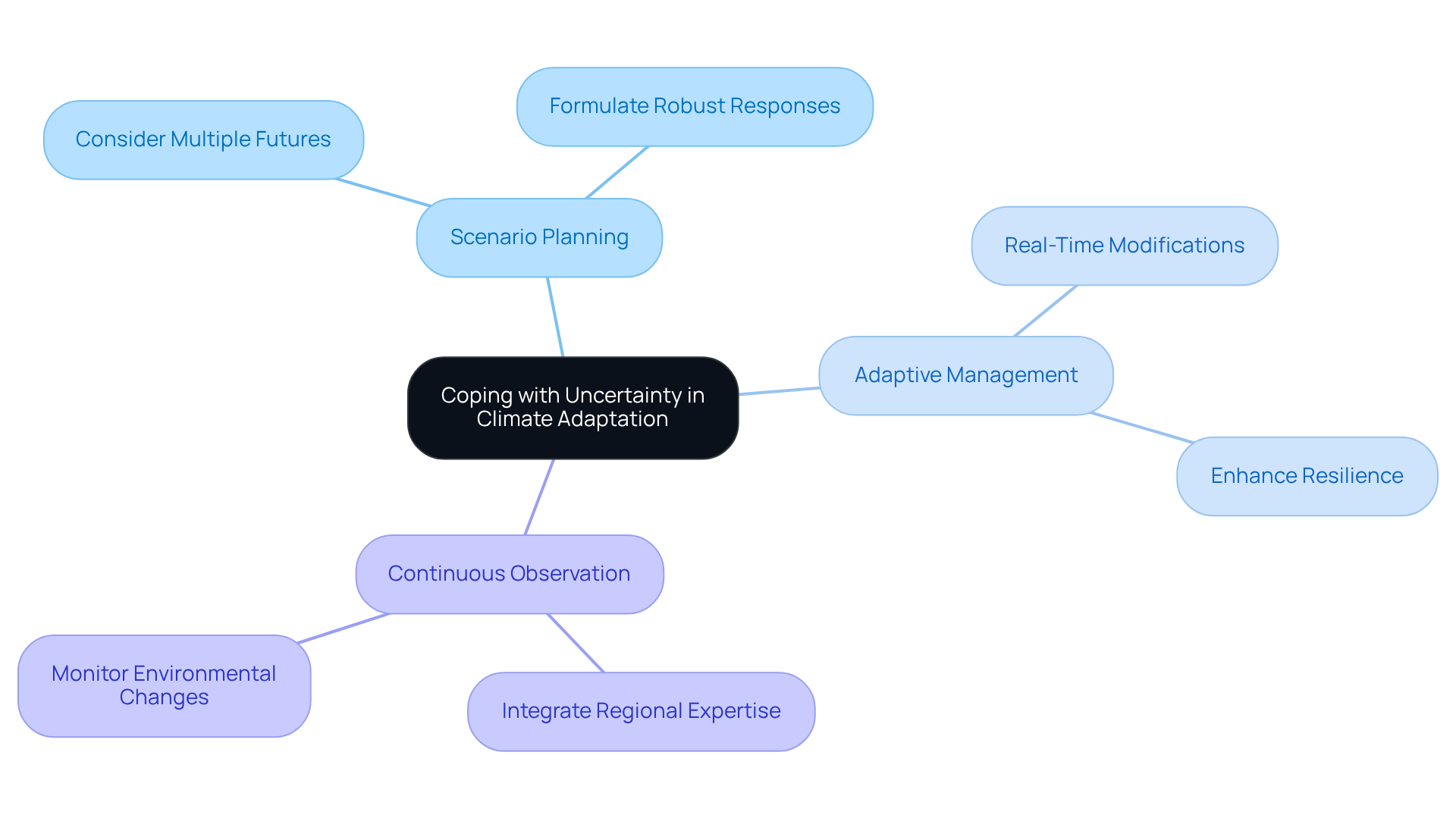
Dealing with uncertainty presents a significant challenge in climate adaptation land modeling, necessitating approaches that are both flexible and responsive to the unpredictable nature of environmental impacts. One effective strategy is scenario planning, which entails considering multiple potential futures to formulate robust responses. For instance, property procurement strategies can benefit from adaptive management practices that facilitate real-time modifications based on emerging information or shifting circumstances. This adaptability not only enhances resilience in planning but also empowers organizations to navigate the complexities of climate adaptation land modeling more effectively.
Current methodologies underscore the importance of continuous observation and the integration of regional expertise in climate adaptation land modeling, ensuring that property procurement efforts remain agile in the face of evolving environmental conditions. As specialists have noted, cultivating such resilience is crucial for addressing the multifaceted challenges posed by environmental change. How prepared is your organization to tackle these uncertainties? By leveraging strategic planning and adaptive management, you can position yourself to respond effectively to the dynamic landscape of environmental impacts.
Case Examples: Successful Climate Adaptation Strategies in Action
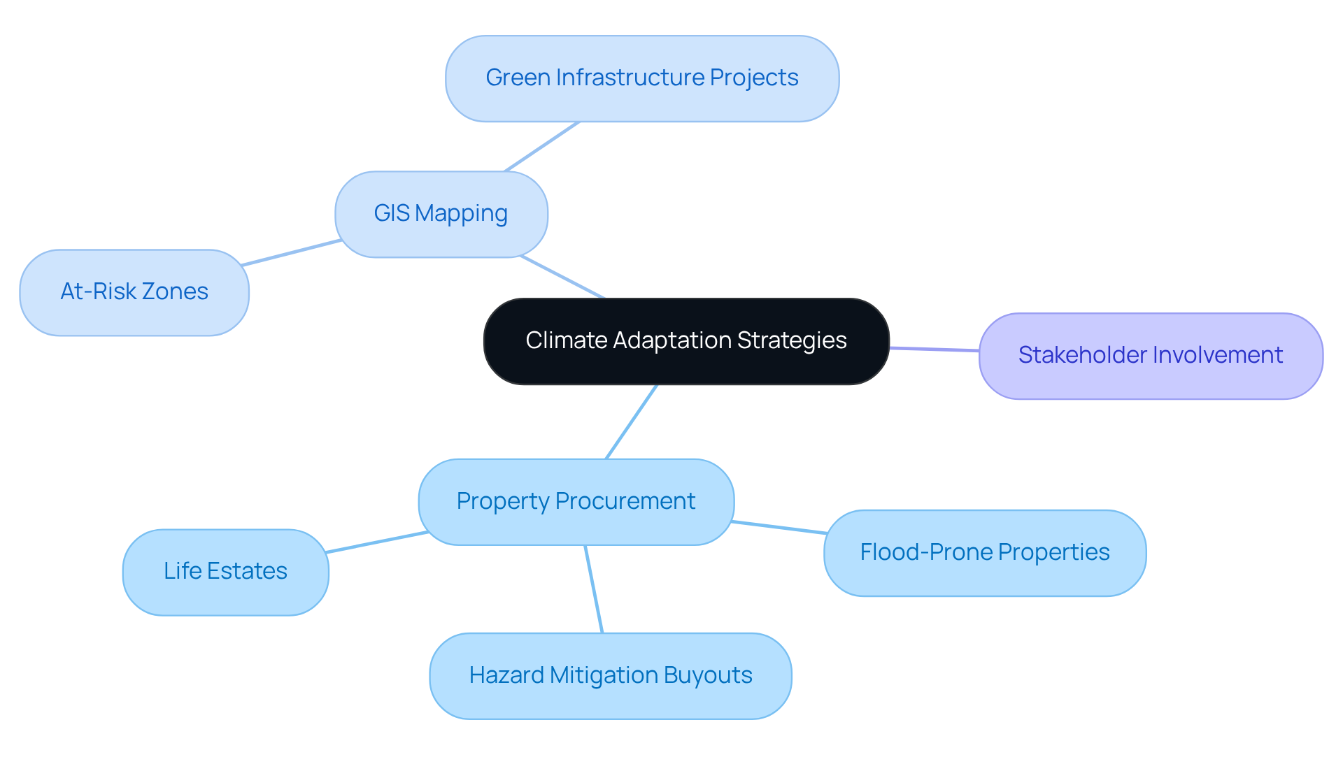
Effective climate adaptation land modeling strategies are illustrated through various case studies that highlight successful property procurement practices. Municipalities have increasingly prioritized the acquisition of flood-prone properties, transforming them into natural floodplains and open spaces. This proactive approach not only mitigates future flood risks but also involves climate adaptation land modeling to enhance community resilience. A notable example is the implementation of hazard mitigation buyouts, where state and local governments acquire residential properties from willing sellers, effectively relocating development away from vulnerable areas. These buyouts have evolved from post-disaster recovery tools to proactive measures aimed at reducing flood risks in coastal and flood-prone regions, demonstrating their effectiveness in climate adaptation land modeling to enhance community safety.
Additionally, GIS mapping has proven invaluable in identifying at-risk zones, thereby facilitating climate adaptation land modeling for targeted green infrastructure projects that bolster environmental health. Given that private owners held 61 percent of property in the U.S. in 2002, strategic acquisition of territory becomes essential in addressing vulnerabilities. For instance, governments have successfully obtained areas with high conservation value to safeguard coastal ecosystems and support migrating habitats, such as wetlands and forests. This approach not only protects communities but also utilizes climate adaptation land modeling to restore vital ecosystems affected by climate change.
Furthermore, the concept of life estates and future interests can enhance seller involvement in hazard mitigation and open space procurement programs, allowing governments to obtain title to property upon the owner's death. By utilizing strategic planning and fostering stakeholder cooperation, these practical applications illustrate how careful property acquisition through climate adaptation land modeling can lead to successful adjustment outcomes, ultimately benefiting both communities and the environment.
Framework for Climate Adaptation: Guiding Land Modeling Efforts
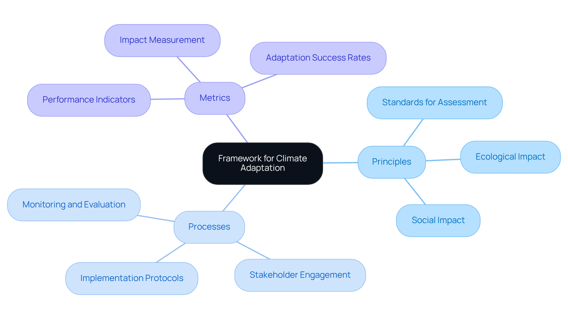
A framework for climate adaptation land modeling serves as a crucial guiding structure for terrain modeling efforts. It delineates essential principles, processes, and metrics for evaluating climate adaptation land modeling strategies. By establishing clear protocols, organizations ensure that their property services are in alignment with broader environmental objectives.
For example, such a framework may include standards for assessing the ecological and social impacts of property decisions, thereby promoting sustainable practices that bolster resilience to environmental changes. This approach not only addresses the complexities of land acquisition but also navigates the legal and regulatory challenges inherent in the process.
Ultimately, adopting this framework empowers organizations to implement effective solutions that meet both their operational needs and environmental responsibilities.
Tactical Value of the Framework: Practical Applications for Land Acquisition
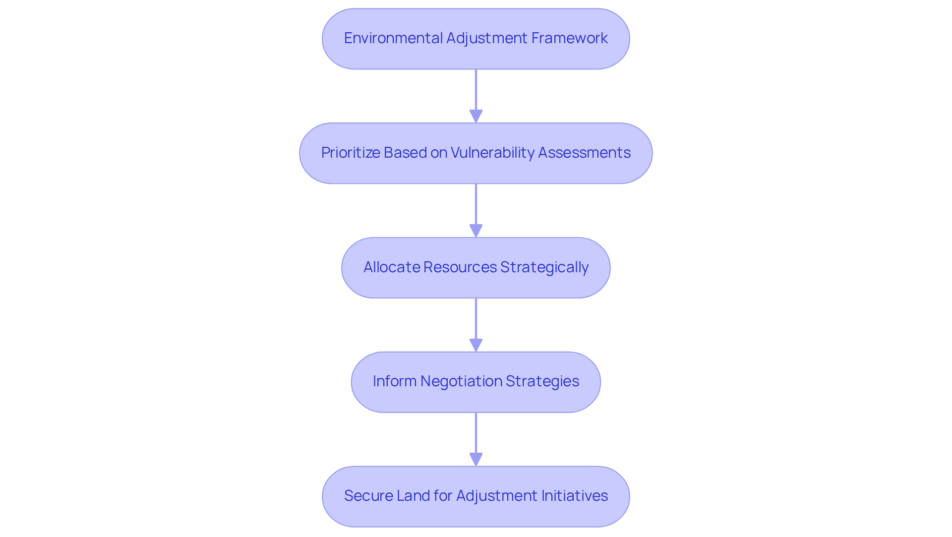
The strategic significance of the environmental adjustment framework is evident in its practical applications for property procurement. By transforming theoretical concepts into actionable strategies, organizations can effectively implement climate adaptation land modeling measures.
For instance, climate adaptation land modeling can be enhanced by prioritizing property acquisitions based on vulnerability assessments, which allows for the strategic allocation of resources to the most at-risk regions, thereby improving resilience against environmental impacts. Additionally, this framework can inform negotiation strategies with stakeholders, facilitating navigation through complex legal and regulatory landscapes to secure land for adjustment initiatives. This approach not only streamlines the acquisition process but also ensures that efforts are concentrated where they are most needed, ultimately contributing to more effective climate adaptation land modeling initiatives.
The commitment of the First Movers Coalition, which pledged $12 billion towards green technologies, underscores the substantial financial support for these adaptation strategies. Furthermore, international discussions at COP27, including the establishment of a 'loss and damage' fund, highlight the pressing need to address environmental impacts. Leaders such as Joe Biden have stressed that the climate crisis is intricately linked to human and national security, reinforcing the urgency for immediate action in land acquisition strategies.
Conclusion
The exploration of effective climate adaptation land modeling strategies underscores a critical need for innovative solutions to navigate the complexities of land acquisition and environmental challenges. By integrating advanced technologies such as GIS mapping and AI-driven title research, organizations can significantly enhance their operational efficiency while addressing the urgent demands posed by climate change. This multifaceted approach not only streamlines processes but also fosters resilience in both communities and ecosystems.
Key strategies such as:
- Stakeholder collaboration
- Strategic planning
- Ongoing evaluation of adaptation methods
emerge as essential components in crafting successful climate adaptation initiatives. Case studies illustrate the tangible impacts of these strategies, demonstrating how municipalities and organizations can transform vulnerable areas into resilient landscapes through proactive land management. The emphasis on continuous assessment and adaptive management further highlights the importance of flexibility in responding to the unpredictable nature of environmental changes.
The significance of these strategies extends beyond immediate project needs; they represent a collective commitment to sustainable practices that safeguard communities and ecosystems for future generations. As the urgency for climate action intensifies, embracing these comprehensive solutions empowers organizations to not only meet their operational goals but also contribute meaningfully to the global effort against climate change. Engaging in these practices is not merely an option; it is a necessity for fostering a resilient and sustainable future.
Frequently Asked Questions
What services does Harbinger Land provide for climate adaptation land modeling?
Harbinger Land offers comprehensive solutions including site and right-of-way acquisition, title research, GIS mapping, and data processing to support climate adaptation land modeling.
How does Harbinger Land enhance property services?
The company utilizes advanced technologies, particularly AI-powered tools, to improve the efficiency and precision of property services, aiding clients in addressing environmental challenges.
Who are the typical clients of Harbinger Land?
Harbinger Land serves a diverse clientele, including natural gas companies and solar developers, ensuring timely and customized services.
What role does GIS mapping play in climate adaptation strategies?
GIS mapping provides in-depth spatial analysis to identify areas vulnerable to environmental impacts, allowing planners to visualize risks and formulate targeted adaptation measures.
Can you provide examples of cities using GIS for climate adaptation?
The City of Carlsbad achieved a 44% reduction in verification costs and a 75% decrease in verification time using GIS. Similarly, cities like Prague and authorities in Fiji utilize GIS to enhance resilience to environmental changes.
How does AI-powered title research benefit land acquisition for adaptation projects?
AI-driven title research automates the title search process, quickly analyzing data to identify ownership records and potential legal issues, thus reducing errors and expediting property procurement.
What additional solutions does Harbinger Land offer for title research?
Harbinger Land provides cost-effective document imaging solutions that digitize property data, streamlining title research and leasing processes to facilitate rapid identification of conflicting claims.
How does Harbinger Land help clients navigate legal and regulatory challenges?
By offering advanced solutions for title research and land acquisition, Harbinger Land helps clients secure necessary property rights confidently and effectively, preventing delays in project initiation.
List of Sources
- Harbinger Land | Comprehensive Solutions for Climate Adaptation Land Modeling
- Streamlining Land Acquisition with Advanced Software Solutions (https://blog.harbingerland.com/streamlining-land-acquisition-with-advanced-software-solutions)
- GIS Mapping: Enhancing Climate Adaptation Strategies
- Climate action (https://esrisingapore.com.sg/industries/government/climate-action)
- Climate Change: The Trio of Tricky Problems (https://esri.com/arcgis-blog/products/arcgis/water/climate-change-the-trio-of-tricky-problems)
- GIS and Cartography Quotes (https://geographyrealm.com/gis-quotes)
- Stakeholder Collaboration: Navigating Conflicting Interests in Land Acquisition
- Why Is Community Engagement Important for Adaptation Projects? → Question (https://climate.sustainability-directory.com/question/why-is-community-engagement-important-for-adaptation-projects)
- Strategic Planning: Essential for Effective Land Acquisition
- Sustainable urban policy development in hill cities: A case study of Shimla's LULC changes and urban regeneration efforts (https://sciencedirect.com/science/article/pii/S2664328625000294)
- Evaluating Adaptation Approaches: Assessing Land Modeling Effectiveness
- Hydrologic Modeling for Effective Flood Risk Management (https://numberanalytics.com/blog/hydrologic-modeling-for-effective-flood-risk-management)
- 40 Quotes on Adapting to Change | BOS Inspired. (https://bos.com/inspired/40-quotes-on-adapting-to-change)
- Coping with Uncertainty: Strategies for Climate Adaptation
- Climate change creates uncertainty for commercial fishing on Lake Inari (https://arcticcentre.org/news/Climate-change-creates-uncertainty-for-commercial-fishing-on-Lake-Inari/39649/4f1a0150-89b2-4be8-8de8-9c57f712897d)
- 30 of the Most Impactful Climate Change Quotes - Curious Earth (https://curious.earth/blog/climate-change-quotes)
- 12 great examples of how countries are adapting to climate change - Global Center on Adaptation (https://gca.org/12-great-examples-of-how-countries-are-adapting-to-climate-change)
- Land‐based measures to mitigate climate change: Potential and feasibility by country (https://onlinelibrary.wiley.com/doi/10.1111/gcb.15873)
- Uncertainty in climate change and climate action (https://unescap.org/blog/uncertainty-climate-change-and-climate-action)
- Case Examples: Successful Climate Adaptation Strategies in Action
- Managed Retreat Toolkit » Acquisition Tools - Georgetown Climate Center (https://georgetownclimate.org/adaptation/toolkits/managed-retreat-toolkit/acquisition-tools.html)
- Framework for Climate Adaptation: Guiding Land Modeling Efforts
- National Adaptation Strategy for Canada - Canada.ca (https://canada.ca/en/services/environment/weather/climatechange/climate-plan/national-adaptation-strategy/full-strategy.html)
- PMAP - Policy brief 8 (https://pik-potsdam.de/~wrobel/mediation-platform/pbs/pb8/case_studies.html)
- 15 quotes on climate change by world leaders (https://weforum.org/stories/2015/11/15-quotes-on-climate-change-by-world-leaders)
- Tactical Value of the Framework: Practical Applications for Land Acquisition
- COP27: The top quotes from climate and world leaders at the UN summit (https://weforum.org/stories/2022/11/cop27-quotes-climate-leaders)
- 15 quotes on climate change by world leaders (https://weforum.org/stories/2015/11/15-quotes-on-climate-change-by-world-leaders)


