Introduction
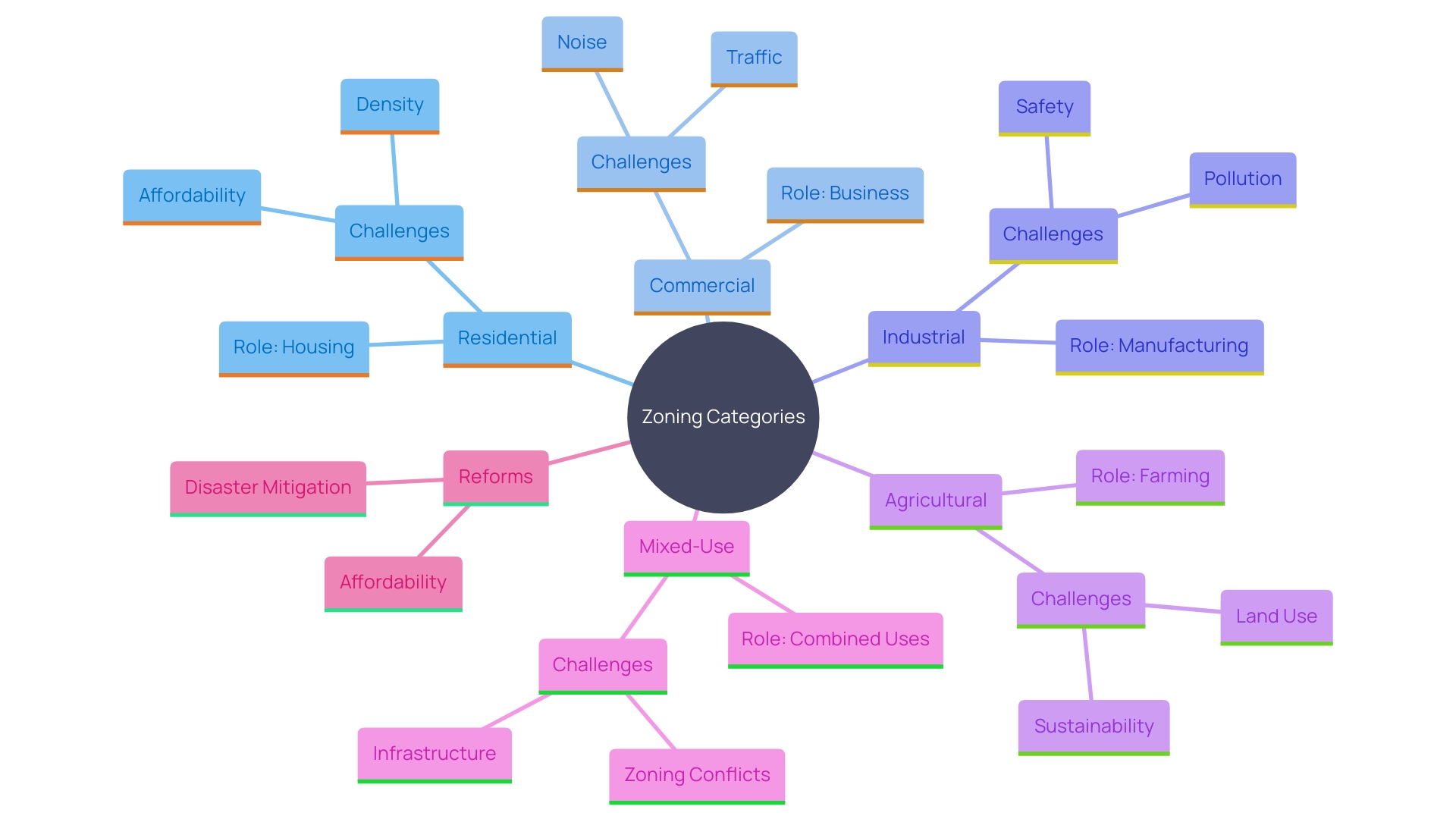
Land zoning is a critical aspect of urban planning that categorizes land into specific zones, guiding its use and development. This practice, originating in the early 20th century, was first implemented by New York City in 1916 and has since become a standard tool for local governments across the United States. The primary zoning categories include residential, commercial, industrial, agricultural, and mixed-use zones, each serving unique purposes and contributing to the overall organization and functionality of a community.
Residential zones focus on creating conducive living environments, while commercial zones support business activities. Industrial zones are designated for manufacturing, agricultural zones protect farming activities, and mixed-use zones promote versatile community development. While zoning helps protect property values and ensure compatible land use, it also faces challenges such as addressing housing affordability and mitigating natural disaster impacts.
Recent reforms highlight the ongoing evolution of zoning practices, demonstrating their significant impact on community development and sustainability.
Types of Land Zones
Land classification is an essential component of urban planning, delineating land into specific categories that govern its utilization. This practice, which dates back to the early 20th century, began as a means for local leaders to separate different land uses, such as residential from industrial areas. New York City pioneered this approach with its 1916 ordinance, the first land use code, which laid out clear guidelines and a map of districts. By the 1920s, the federal government had created a model law embraced by all state legislatures, enabling local authorities to enforce land-use regulations.
The primary zoning categories include residential, commercial, industrial, agricultural, and mixed-use zones, each serving distinct roles within a locality. Residential zones are designed for living spaces, ensuring a conducive environment for homes. Commercial zones cater to businesses and retail establishments, fostering economic activity. Industrial zones are earmarked for manufacturing and other large-scale operations, often located away from residential areas to minimize conflicts. Agricultural areas safeguard farming operations and rural settings, while mixed-use zones combine various land purposes, encouraging more adaptable and cohesive development.
Zoning not only organizes communities but also helps protect property values and ensure compatible land use. However, it comes with its challenges, such as mitigating the impacts of natural disasters and addressing the affordability of living spaces. 'Recent reforms, like those in Houston, have facilitated infill construction and demonstrated the potential to reduce land values, countering concerns about rising property prices due to increased development rights.'. Furthermore, state-level changes, like New Jersey's Mount Laurel Doctrine, have greatly aided in the establishment of affordable living spaces, emphasizing the wider consequences of land-use choices on community growth and sustainability.
Residential Zones
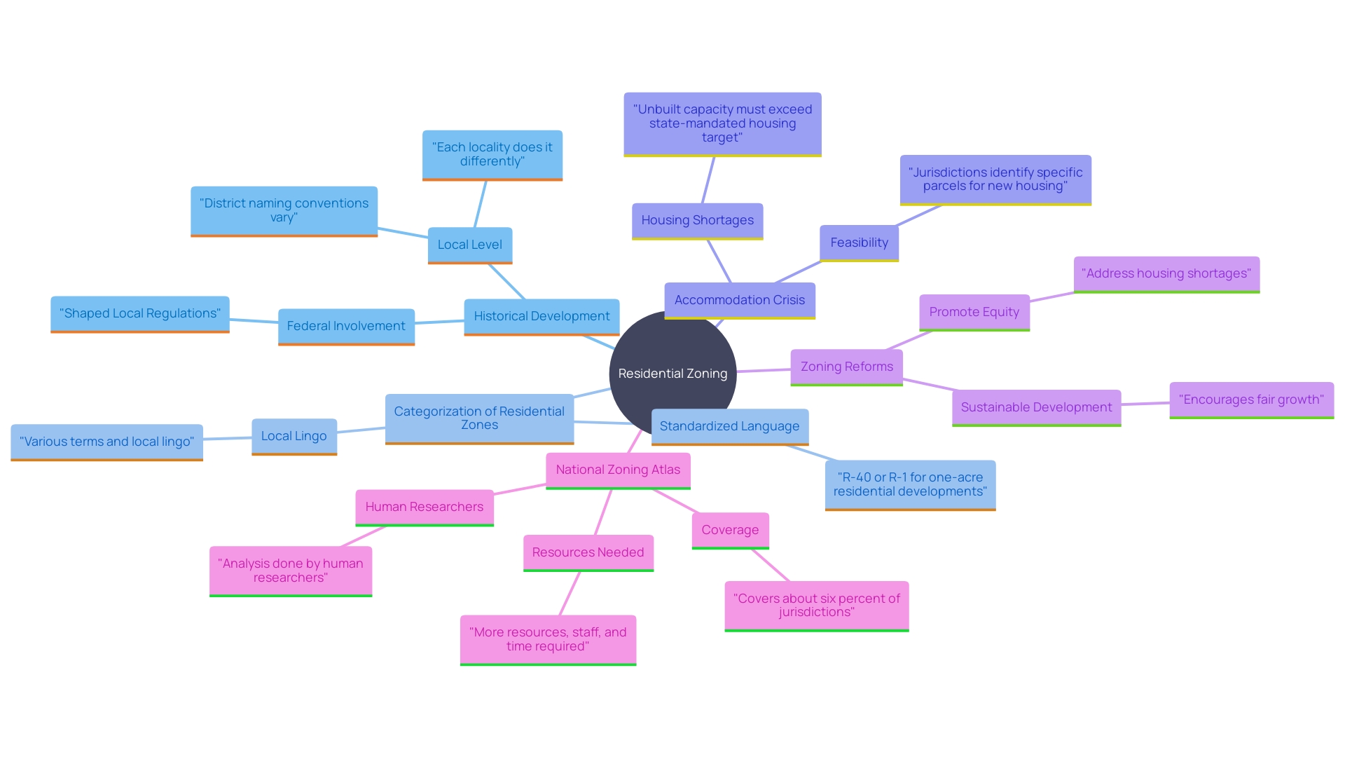
Residential zones are designated areas primarily for housing, structured to serve various types of residential developments. Emerging from the necessity to divide land uses, land use regulations have developed considerably since their beginning in the early 20th century. For instance, New York City’s 1916 ordinance was the pioneering land-use code, defining permitted uses and developments within each district. Over time, federal involvement led to widespread adoption of zoning statutes, allowing local governments to manage land use effectively.
These residential areas are further categorized into sub-zones to accommodate different types of dwellings, such as single-family homes, multi-family units, and high-density apartments. This categorization aims to maintain the neighborhood's character and manage population density. A significant instance is the Kingfield neighborhood in Minneapolis, where a new 12-unit apartment building enhances the area's varied accommodation requirements.
To tackle the ongoing accommodation crisis in America, many cities are reexamining their land-use regulations. The U.S. confronts a deficit of millions of living spaces, with half of renters allocating more than a third of their earnings on accommodation. This has encouraged cities to investigate land use changes to enable the development of different residential options, beyond just single-family dwellings. For example, the Carmel Task Force in Indiana has recognized important obstacles such as supply shortages and affordability, resulting in suggestions for ongoing regulations and residential strategy reforms.
Moreover, land use regulations play a crucial role in facilitating fair and sustainable development of neighborhoods. As noted by city planners and specialists, zoning reforms can greatly enhance access to residences, fostering social mobility and racial equity. These reforms are crucial for addressing current housing market challenges and ensuring that communities can meet the housing needs of all residents.
Commercial Zones
Commercial zones are specifically designated areas for business activities, including retail shops, office buildings, and service establishments. These zones are governed by rules that address the types of businesses that can operate, their hours of operation, and their impact on surrounding residential areas. For instance, land-use policies in New York City are experiencing major revisions for the first time in 60 years to update obsolete mandates. These changes aim to make it easier for businesses to grow, allow amusements in more parts of the city, and expand where scientific research labs can locate. This effort aligns with the broader goal of activating empty storefronts and supporting small producers and growing industries. By modifying these guidelines, cities can promote small business expansion and safeguard industrial sectors, ensuring economic advantages reach all communities while improving quality of life.
The Institute for Justice’s Justice Project emphasizes the significance of safeguarding property rights, which have been undermined by harmful land-use practices. These practices often emphasize top-down planning over individual liberties, leading to social and economic problems. The project offers solutions to restore the balance between necessary regulations and property owners' freedoms.
In Boise, a last-minute tweak to the land use code, made under the guise of minor updates, significantly changed setback requirements in mixed-use zones, demonstrating how land use decisions can dramatically affect urban development. By reassessing public welfare as a planning objective, municipalities can challenge ineffective restrictions and focus on public safety and health, creating more adaptable and compatible urban environments.
Additionally, studies like those conducted by the Transportation Research and Education Center at Portland State University show that new infrastructure for walking and biking can positively impact the local economy. These well-designed facilities encourage residents and visitors to spend more time and money in city centers, creating an attractive sense of place and fostering a slower pace that benefits local businesses. For instance, the introduction of new bicycle facilities in Medford, Oregon, has already attracted more visitors and created a more pleasant environment, supporting local economic growth.
Overall, modernizing commercial zoning policies not only supports economic development but also enhances the vibrancy and resilience of urban areas, benefiting both businesses and communities.
Land Use Regulations and Permits
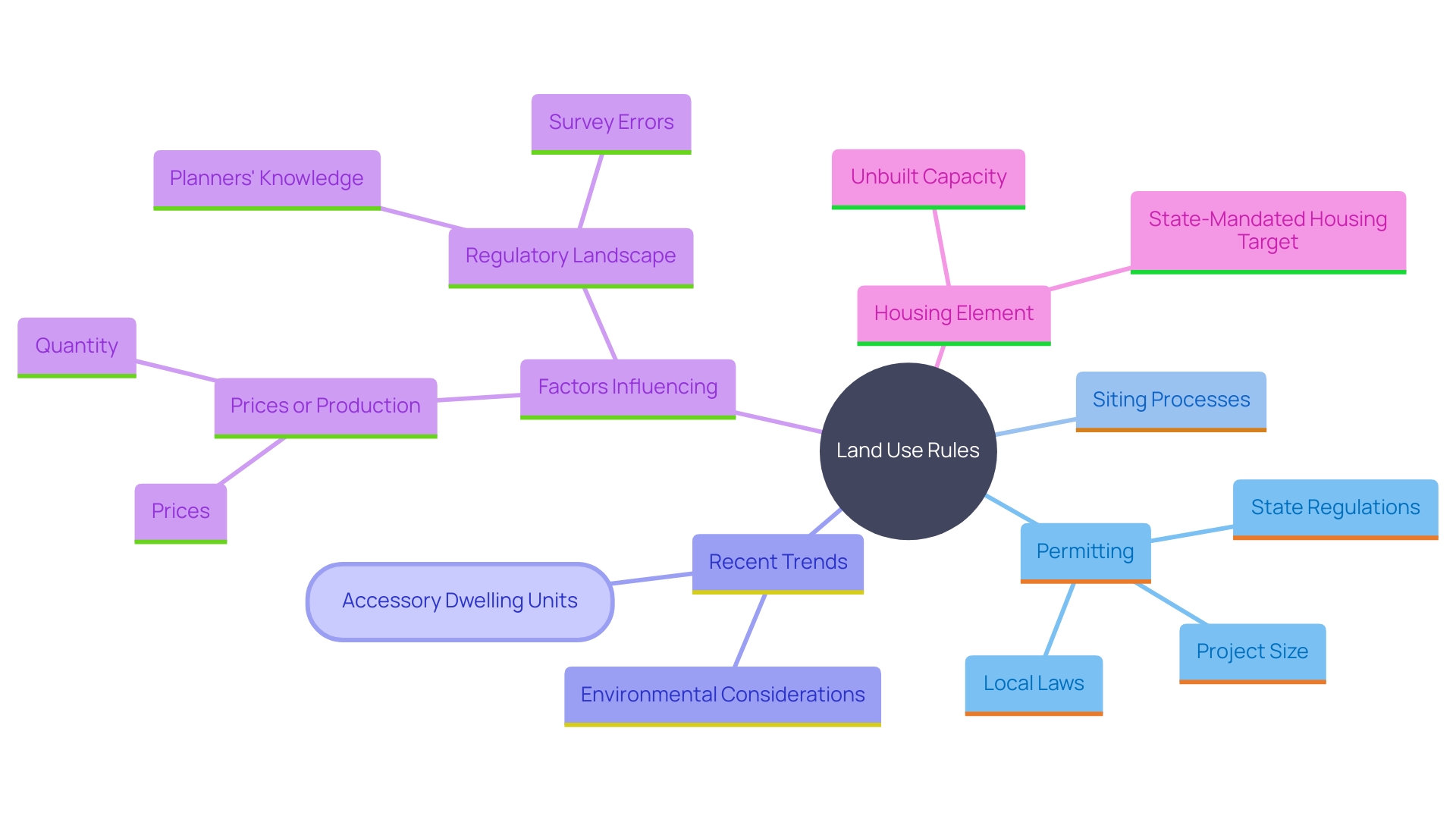
Land use rules encompass a broad range of laws and policies that dictate how land can be utilized within a specific jurisdiction. Property owners and developers must navigate these guidelines by obtaining necessary permits for activities such as construction, remodeling, or changes in land use. The intricacy of these rules is highlighted by the fact that permitting and siting processes can differ greatly from one state to another, affected by factors such as project size and scope. For instance, in 27 states, the principal authority for siting and permitting shifts based on the size of the project, with larger projects often requiring state-level approval. This variability necessitates a thorough understanding of the regulatory framework to ensure compliance and avoid legal complications.
The landscape of land use management is continuously evolving, with recent trends highlighting a growing emphasis on environmental stewardship. For example, Ontario has streamlined environmental site assessment requirements to expedite infrastructure project approvals, reflecting a broader movement towards modernizing regulatory standards. 'Furthermore, the increase of accessory dwelling units (ADUs) in Los Angeles County, propelled by new guidelines, demonstrates how local laws can significantly influence land use patterns and development.'.
Grasping the complexities of these rules is essential for developers and property owners. As Jeff Marootian, Principal Deputy Assistant Secretary for Energy Efficiency and Renewable Energy, points out, “How renewable energy is planned and approved varies widely across the United States.” This sentiment is echoed by Tom Kirchstetter from Berkeley Lab, who notes that creating an inventory of state siting and permitting policies can facilitate valuable research into which policies most effectively influence siting outcomes.
Moreover, the development application process itself, particularly for large projects, involves extensive negotiation and analysis, often spanning several years before any construction begins. This emphasizes the significance of early and comprehensive involvement with regulatory structures to navigate the complexities of land use policies effectively.
Understanding Zoning Maps and Codes
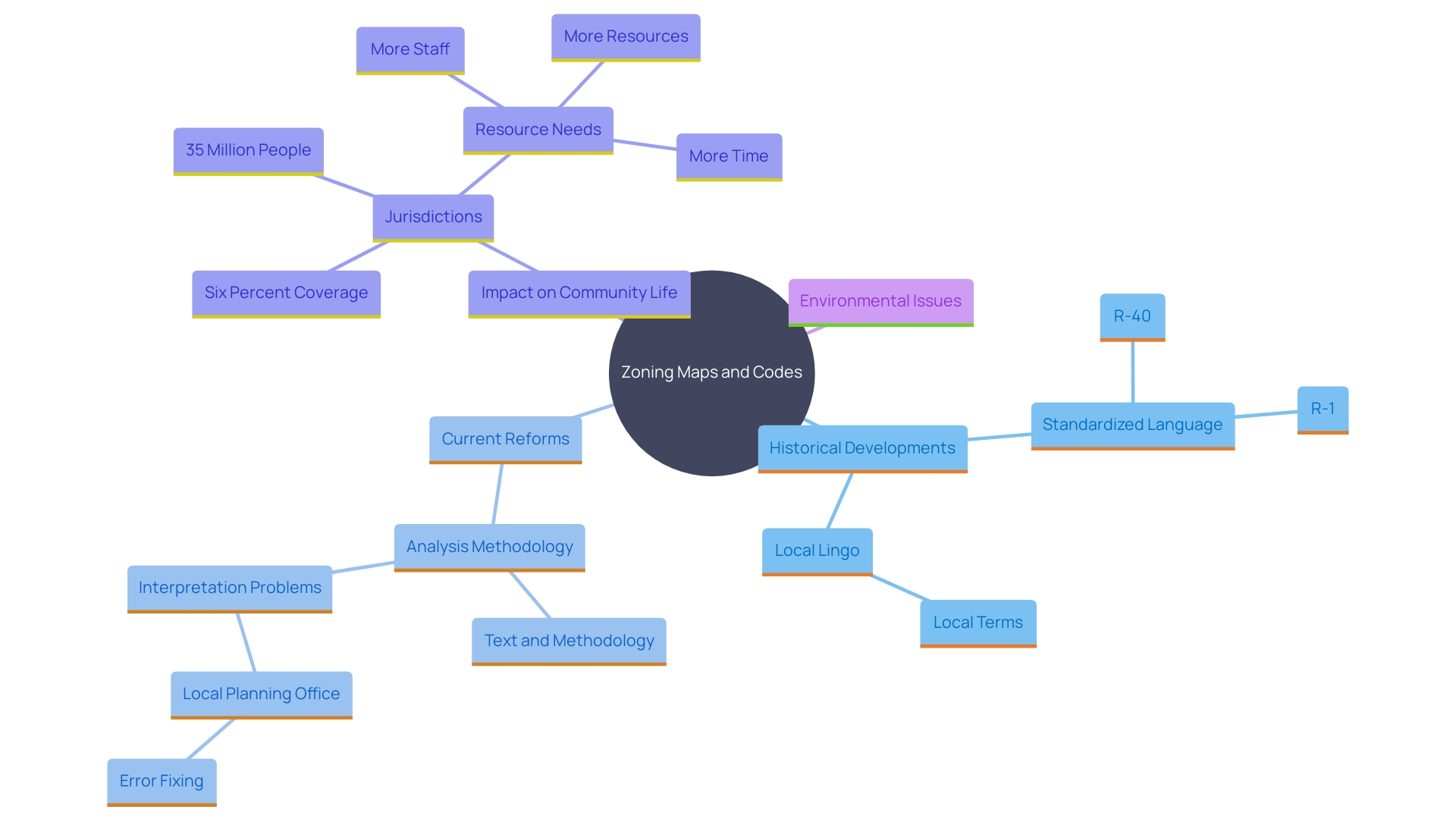
Zoning maps and codes are indispensable tools for effective land use planning. These maps offer a visual depiction of different areas within a neighborhood, while land use codes provide detailed explanations of the rules and allowed activities for each area. Understanding these documents is crucial for property owners, developers, and planners to navigate the complexities of land use.
Historically, land-use planning began about a century ago to separate different land uses, such as residential from industrial areas, and to segregate communities. New York City's 1916 ordinance is acknowledged as the first land-use code, setting a precedent with a text identifying permissible uses and types of developments in each district, along with a map locating these areas. By the 1920s, the federal government created a model statute, accepted by all 50 states, permitting local authorities to participate in land use planning. Since then, thousands of land use regulations have emerged across cities, towns, villages, and counties.
Despite their significance, land use maps and codes often present ambiguities. For example, land-use maps might not always correspond with the text of land-use resolutions and amendments, creating challenges in interpretation. Each area has its distinct collection of land-use rules, with different terms and district naming conventions, which can differ greatly. This patchwork of land use guidelines influences different facets of community life, including accommodation availability, transportation systems, and environmental impact.
Recent land use reforms have aimed to address some of these issues. Numerous cities and states have enacted reforms to promote additional accommodations and clarify regulations. For example, the St. Paul City Council recently voted to modify the city’s land use regulations to increase neighborhood-scale density, allowing for multi-unit housing in areas previously restricted to single-family homes. This mirrors earlier changes in Minneapolis, which legalized triplexes city-wide in 2019.
Zoning also plays a significant role in addressing broader issues such as climate change and community equity. Joint research is investigating the connection between land-use planning, sea level rise, urban heat clusters, and carbon emissions. Resources such as the National Zoning Atlas strive to enhance accessibility of land-use planning, assisting planners and the public in comprehending the effects of land-use regulations and promoting informed modifications.
In summary, while planning maps and codes are complex and sometimes ambiguous, they are essential for managing land use and development. Continuous reforms and tools like the National Zoning Atlas help demystify zoning, making it more understandable and effective for all stakeholders involved.
Local Architectural Review Committees and Homeowners Associations
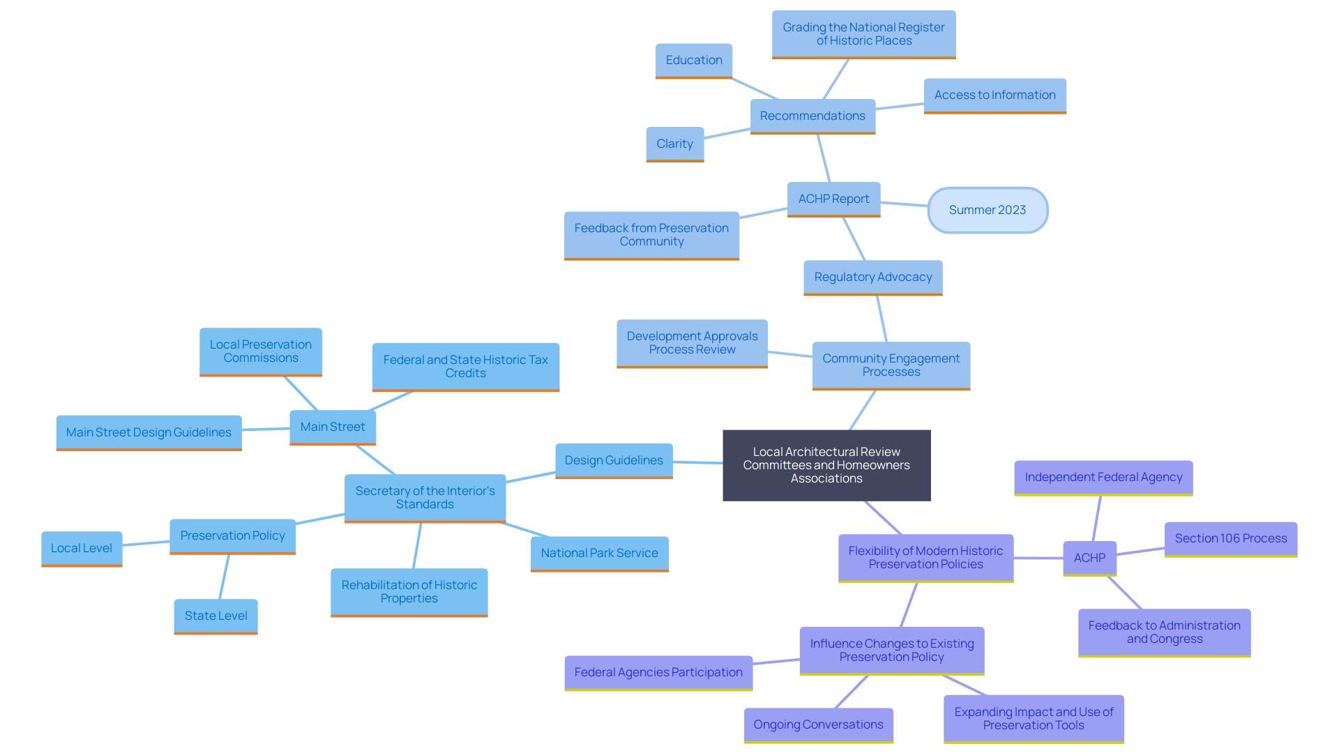
Local architectural review committees and homeowners associations (HOAs) play a crucial role in preserving the aesthetic and functional integrity of neighborhoods. These organizations implement design guidelines and local standards, ensuring that new developments harmonize with the established character of the area. For instance, in a recent effort to streamline design rules, a city council reduced the number of regulations from 64 to 19 after public hearings. This simplification aims to balance neighborhood aesthetics with residents' privacy concerns, such as restricting roof decks and limiting bay windows facing public streets.
Interacting with these organizations is crucial for developers and homeowners to achieve project objectives while honoring societal expectations. The Development Approvals Process Review, initiated in October 2023, exemplifies this engagement. This comprehensive review involves stakeholders to enhance permit, inspection, and planning processes, ensuring they meet changing local needs and objectives. Such proactive planning, like the award-winning design exploration in Belmont, highlights the importance of aligning new developments with community standards.
The flexibility in modern historic preservation policies further supports this balance, allowing for the integration of contemporary needs such as solar power installations while maintaining the historical essence of properties. As developers and homeowners navigate these regulations, collaboration with architectural review committees and HOAs remains vital in achieving a cohesive and functional neighborhood environment.
Conclusion
Land zoning is a fundamental aspect of urban planning, categorizing land into residential, commercial, industrial, agricultural, and mixed-use zones. Each type serves a specific purpose, promoting harmony among different land uses and protecting property values. The evolution of zoning practices since the early 20th century highlights its significance in managing urban growth and addressing challenges such as housing affordability and sustainability.
Residential zones are adapting to the housing crisis by allowing a variety of housing options, while commercial zones are being updated to encourage economic development and support local businesses. Navigating the complexity of land use regulations and permit processes is crucial for developers and property owners.
Zoning maps and codes are essential tools that provide clarity for land use planning. Recent reforms aimed at simplifying these regulations reflect a commitment to enhancing community equity and environmental stewardship. Furthermore, local architectural review committees and homeowners associations are vital in ensuring that new developments align with community standards while preserving neighborhood character.
In conclusion, the ongoing evolution of land zoning practices has a profound impact on community development and sustainability. By embracing reform and fostering stakeholder engagement, cities can create resilient and inclusive environments that meet the diverse needs of their residents, ultimately enhancing the functionality and vitality of urban areas.


