Overview
GIS solutions for urban utilities are essential for maximizing efficiency, enabling effective visualization, analysis, and management of spatial data related to infrastructure. This capability ultimately enhances operational effectiveness and service delivery.
How do urban utilities face the complexities of land acquisition and regulatory challenges? The integration of GIS facilitates real-time data collection and predictive analytics, which not only leads to significant cost reductions but also improves community relations.
Successful case studies in the field evidence these benefits, showcasing how stakeholder engagement is transformed through these advanced technologies. By adopting GIS solutions, urban utilities can navigate their challenges more effectively, ensuring a streamlined approach to service delivery.
Introduction
As urban populations swell and infrastructure demands increase, the role of Geographic Information Systems (GIS) in urban utilities is more critical than ever. These innovative solutions streamline the management of essential services like water and energy, enhancing operational efficiency and fostering community engagement. Yet, many organizations grapple with the complexities of integrating GIS into their existing frameworks.
How can urban utilities effectively harness the power of GIS to meet current demands and anticipate future challenges?
Understand the Role of GIS in Urban Utilities
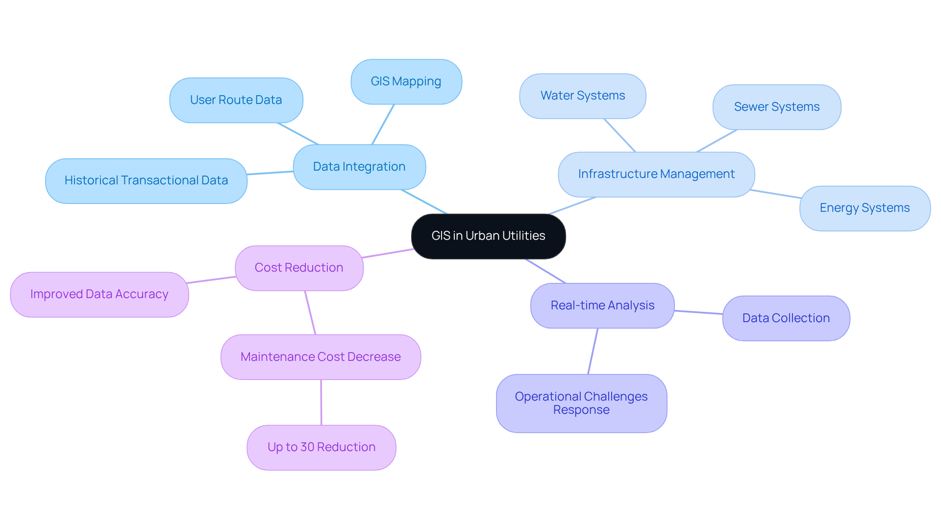
GIS solutions for urban utilities act as a powerful instrument for urban services, enabling the visualization, analysis, and management of spatial data related to infrastructure. By integrating diverse data sources, GIS solutions for urban utilities empower organizations to gain insights into their assets, such as water, sewer, and energy systems.
For instance, GIS can accurately map the locations of underground services, which is crucial for planning maintenance and avoiding service interruptions. Moreover, GIS facilitates real-time data collection and analysis, equipping service providers to respond swiftly to operational challenges.
As urban areas continue to grow, the implementation of GIS solutions for urban utilities becomes increasingly vital in ensuring that services effectively and sustainably meet community needs.
Empirical evidence indicates that organizations leveraging GIS can achieve significant reductions in operational costs, with some studies reporting maintenance cost decreases of up to 30% due to improved data accuracy and accessibility.

Leverage GIS for Enhanced Operational Efficiency
To leverage GIS for enhanced operational efficiency, urban utilities must adopt best practices that drive results:
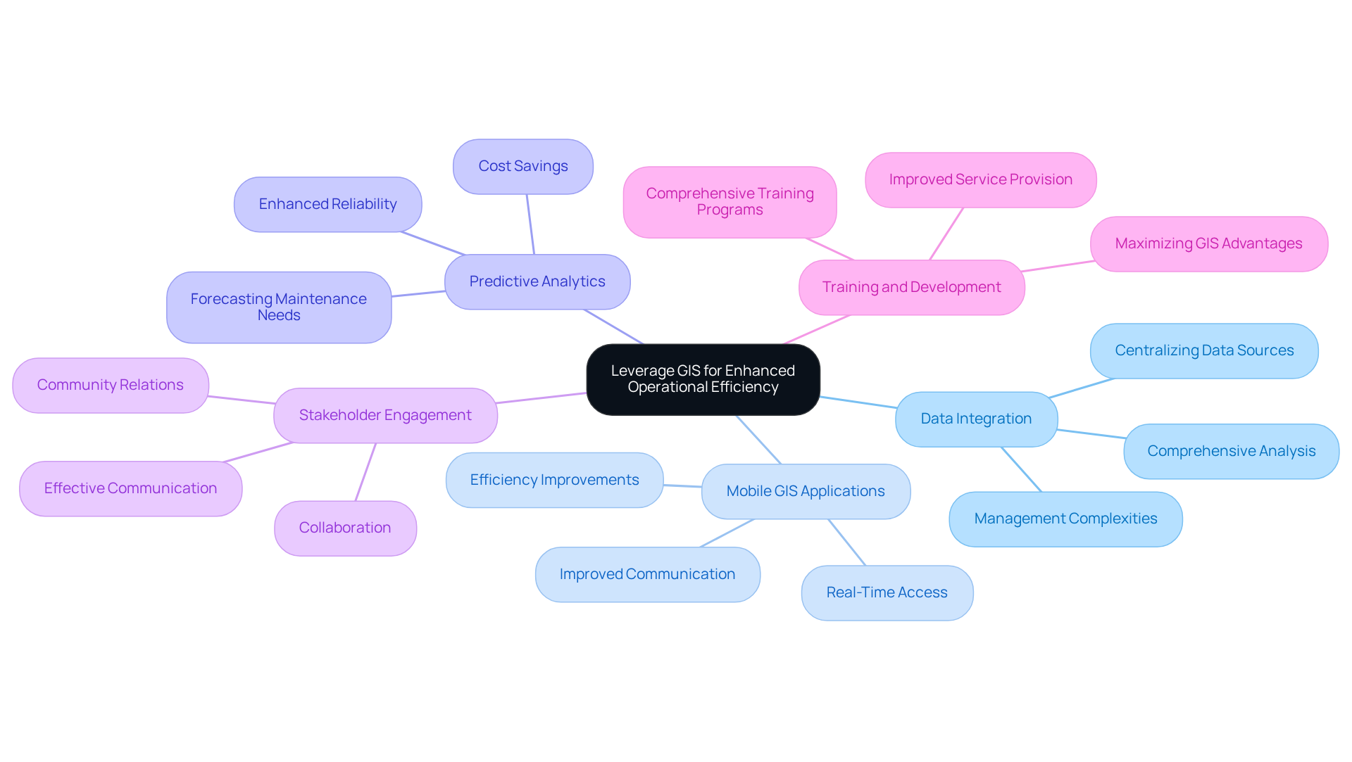
- Data Integration: Centralizing various data sources—such as asset management systems and real-time monitoring tools—within a GIS platform is crucial. The use of GIS solutions for urban utilities facilitates comprehensive analysis and informed decision-making, ultimately enhancing operational effectiveness. Many service providers face challenges when attempting to store pipeline inspection information alongside GIS data in the same geodatabase, leading to management complexities over time.
- Mobile GIS Applications: Equipping field personnel with mobile GIS applications that provide real-time access to resource maps and information is essential. This capability enables quicker responses to issues and fosters improved communication among teams, significantly enhancing operational workflows. Case studies demonstrate that companies utilizing mobile GIS applications have seen substantial improvements in efficiency, with many reporting reduced response times and better resource allocation.
- Predictive Analytics: Utilizing GIS to analyze historical data and forecast future maintenance needs is vital. By recognizing patterns and trends, companies can proactively use GIS solutions for urban utilities to address potential problems before they escalate, resulting in cost savings and enhanced reliability.
- Stakeholder Engagement: Leveraging GIS visualizations to communicate effectively with stakeholders—including city planners and community members—can foster collaboration and garner support for infrastructure projects. Involving stakeholders through interactive maps improves community relations and project backing.
- Training and Development: Investing in comprehensive training programs for staff ensures proficiency in GIS tools. A skilled workforce maximizes the advantages of GIS technology, leading to improved service provision and operational efficiency.
By implementing these strategies, city services can significantly enhance their operational efficiency, improve service reliability, and increase customer satisfaction. The anticipated impact includes operational improvements and a strengthened relationship with the community, as evidenced by successful case studies in the field.

Implement GIS for Infrastructure Planning and Management
GIS technology plays a pivotal role in enhancing infrastructure planning and management for urban utilities through several key practices:
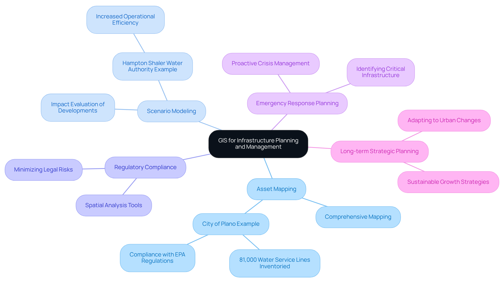
- Asset Mapping: Comprehensive mapping of current infrastructure, including water lines, sewer systems, and electrical grids, enables service providers to visualize their assets effectively. This process aids in identifying areas that require maintenance or upgrades, ultimately improving operational efficiency. For instance, the City of Plano, Texas, successfully inventoried over 81,000 water service lines using Esri’s ArcGIS, ensuring compliance with EPA regulations while enhancing data quality. This initiative aligns with the EPA's Lead and Copper Rule Revisions, emphasizing the importance of accurate asset mapping in regulatory compliance.
- Scenario Modeling: GIS allows organizations to model various infrastructure scenarios, such as evaluating the impact of new developments on existing systems. This capability supports informed decision-making and strategic planning for future growth. A notable example is the Hampton Shaler Water Authority, which implemented GIS-based solutions to enhance operational efficiency, resulting in increased work completion.
- Regulatory Compliance: GIS aids service providers in adhering to local regulations by offering spatial analysis tools that assess the environmental impact of projects. This guarantees that service providers can navigate compliance requirements effectively, minimizing potential legal and operational risks.
- Emergency Response Planning: Developing GIS-based emergency response plans is crucial for identifying critical infrastructure and potential hazards. This proactive strategy allows providers to react quickly during crises, thus reducing interruptions and strengthening community resilience.
- Long-term Strategic Planning: Utilizing GIS data for long-term strategic planning enables organizations to adapt to evolving urban landscapes and community needs. By incorporating GIS into their planning processes, service providers can ensure sustainable growth and enhanced service delivery.
Integrating GIS solutions for urban utilities into infrastructure planning and management not only enhances operational effectiveness but also allows urban services to better assist their communities, ultimately resulting in more resilient and efficient urban environments. Moreover, the Underground Mapping Market is expected to expand at a CAGR of over 9.61% to attain USD 2.29 billion by 2030, emphasizing the rising investment in GIS solutions for urban utilities. As Bart Reynaert, Manager of Geo-ICT and Asset Application, stated, "We are very happy to have taken this step toward a digital, data-driven approach, and to have thus significantly improved the mapping processes.

Enhance Customer Engagement through GIS
Enhancing customer engagement through GIS necessitates several effective strategies:
-
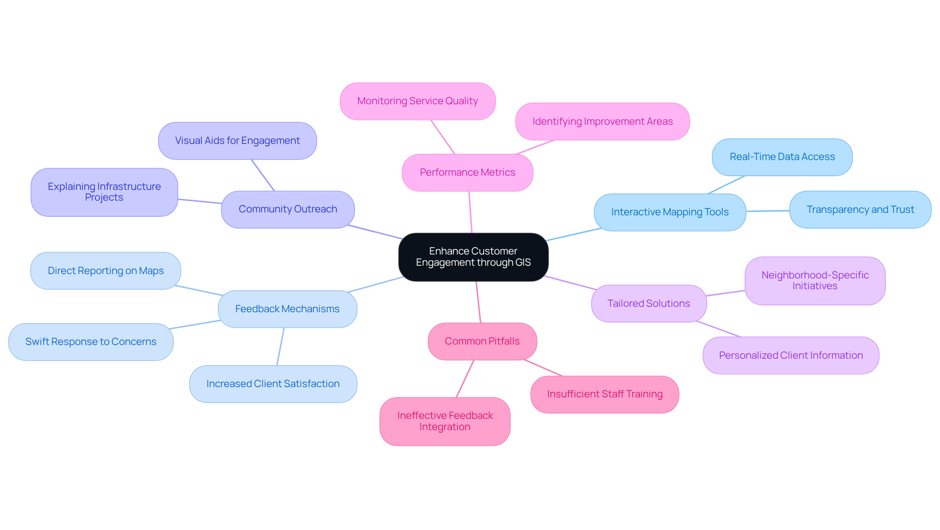
Interactive Mapping Tools: Providing users with access to interactive maps that illustrate service details, outage locations, and maintenance timelines fosters transparency and builds trust. This real-time data keeps clients informed and engaged with their service providers.
-
Feedback Mechanisms: The implementation of GIS-based feedback tools empowers users to report issues directly on maps. This capability allows service providers to respond swiftly to client concerns, significantly enhancing service delivery and client satisfaction. Research indicates that a highly satisfied client generates 2.6 times more revenue than a somewhat satisfied individual, underscoring the critical role of these tools.
-
Community Outreach: Utilizing GIS solutions for urban utilities in community outreach initiatives aids in explaining infrastructure projects and their benefits. Engaging the community through visual aids enhances comprehension and garners support for service projects, resulting in a more informed audience.
-
Tailored Solutions: Leveraging GIS data enables companies to offer personalized solutions tailored to client locations and needs. For instance, service providers can deliver detailed information about energy-saving initiatives or water conservation advice relevant to specific neighborhoods, thereby enhancing the user experience.
-
Performance Metrics: Employing GIS to monitor and evaluate performance metrics related to service, such as response times and reliability, allows providers to identify areas requiring improvement. By tracking these metrics, companies can enhance overall client satisfaction and service quality.
-
Common Pitfalls: Awareness of common pitfalls in implementing GIS strategies is crucial, including insufficient staff training or ineffective integration of client feedback. Proactively addressing these challenges can lead to more successful outcomes.
By focusing on these strategies, city services can use GIS solutions for urban utilities to strengthen their connections with communities and significantly improve service outcomes. As Jeff Bezos remarked, "If you create a great experience, clients share that with one another. Word of mouth is very powerful," highlighting the substantial impact of enhanced customer engagement on utility reputation and success.

Conclusion
GIS solutions are transforming the management of urban utilities by providing essential tools that enhance efficiency, reliability, and community engagement. By harnessing the power of spatial data, organizations can optimize their infrastructure management, streamline operations, and ultimately deliver superior services to the communities they serve. The integration of GIS not only facilitates real-time decision-making but also promotes transparency and collaboration among stakeholders.
Key insights from the article underscore the significance of:
- Data integration
- Mobile applications
- Predictive analytics
- Stakeholder engagement
These strategies empower urban utilities to reduce operational costs, improve response times, and ensure compliance with regulatory requirements. Moreover, the ability to visualize data through interactive mapping tools enhances customer engagement, enabling service providers to build trust and foster community support for infrastructure initiatives.
In an increasingly urbanized world, the adoption of GIS solutions for urban utilities is not merely advantageous but essential for sustainable development. Embracing these technologies can lead to more resilient urban environments, improved service delivery, and stronger relationships with the community. As cities continue to evolve, investing in GIS capabilities will be crucial for addressing the growing demands of urban populations and ensuring the efficient management of vital resources.
Frequently Asked Questions
What is the role of GIS in urban utilities?
GIS solutions for urban utilities enable the visualization, analysis, and management of spatial data related to infrastructure, helping organizations gain insights into their assets like water, sewer, and energy systems.
How does GIS assist in managing underground services?
GIS can accurately map the locations of underground services, which is essential for planning maintenance and avoiding service interruptions.
What are the benefits of real-time data collection through GIS?
Real-time data collection and analysis through GIS equip service providers to respond swiftly to operational challenges.
Why is the implementation of GIS solutions becoming more important in urban areas?
As urban areas grow, GIS solutions are vital for ensuring that services effectively and sustainably meet community needs.
What cost reductions can organizations achieve by using GIS?
Organizations leveraging GIS can achieve significant reductions in operational costs, with some studies indicating maintenance cost decreases of up to 30% due to improved data accuracy and accessibility.


