Overview
Oil site reclamation planning tools are indispensable for the effective restoration of land impacted by oil extraction. These tools offer critical features such as GIS mapping, management software, and environmental monitoring applications. By enhancing compliance and project efficiency, they empower stakeholders to navigate the complexities of restoration. This enables informed decision-making and real-time data monitoring, ultimately leading to sustainable outcomes.
The challenges of land acquisition are multifaceted, encompassing legal and regulatory hurdles that can complicate restoration efforts. However, with the right planning tools, these challenges can be effectively addressed. The integration of advanced technology into reclamation planning not only streamlines processes but also fosters a proactive approach to environmental stewardship.
In conclusion, leveraging oil site reclamation planning tools is essential for any stakeholder looking to achieve successful restoration outcomes. By investing in these technologies, you can navigate the complexities of land reclamation with confidence, ensuring compliance and promoting sustainability. Embrace these tools to transform your reclamation efforts today.
Introduction
Oil site reclamation is not merely a regulatory requirement; it is an essential step in restoring ecosystems and ensuring sustainable land use following extraction activities.
The effective utilization of oil site reclamation planning tools can significantly bolster restoration efforts, equipping stakeholders with the necessary data and insights to navigate complex environmental challenges.
However, with a myriad of tools at their disposal, how can organizations ascertain which ones are best suited to their specific needs?
This article explores the key features and benefits of these planning tools, providing a comparative analysis that empowers decision-makers to make informed choices for a sustainable future.
Understanding Oil Site Reclamation Planning Tools
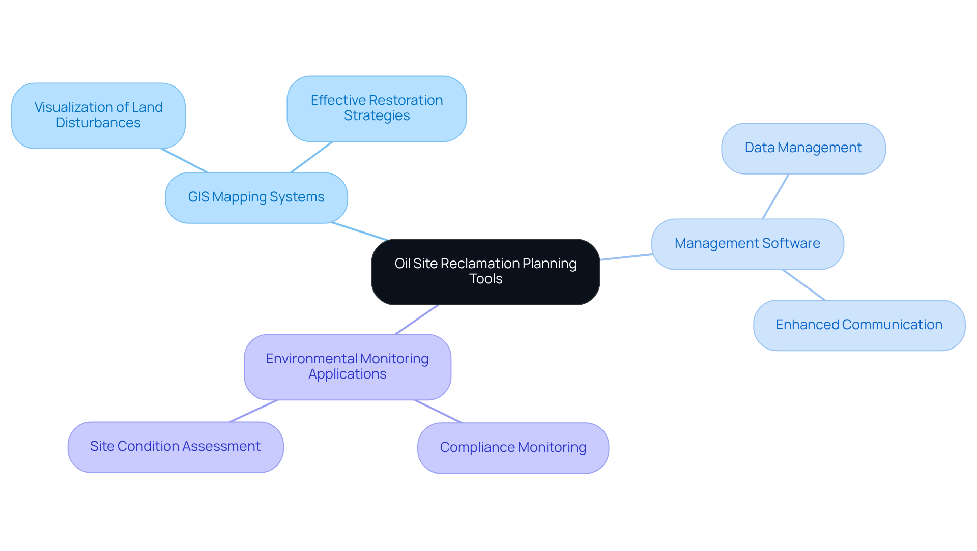
Oil site reclamation planning tools are essential resources designed to facilitate the restoration of land affected by oil extraction activities. These resources typically encompass:
- GIS mapping systems
- Management software
- Environmental monitoring applications
They play a crucial role in assessing site conditions, ensuring compliance with regulatory standards, and managing data effectively. Understanding oil site reclamation planning tools is vital for stakeholders within the oil and gas sector, as these tools significantly contribute to the success of restoration initiatives, ensuring they are effective, compliant, and environmentally responsible.
For instance, GIS mapping allows for a clear visualization of land disturbances, aiding in the formulation of effective restoration strategies. Meanwhile, management software enhances communication and data management among various teams involved in the recovery process. By leveraging these resources, stakeholders can navigate the complexities of land restoration with confidence, ultimately leading to more sustainable outcomes.

Comparative Analysis of Key Features
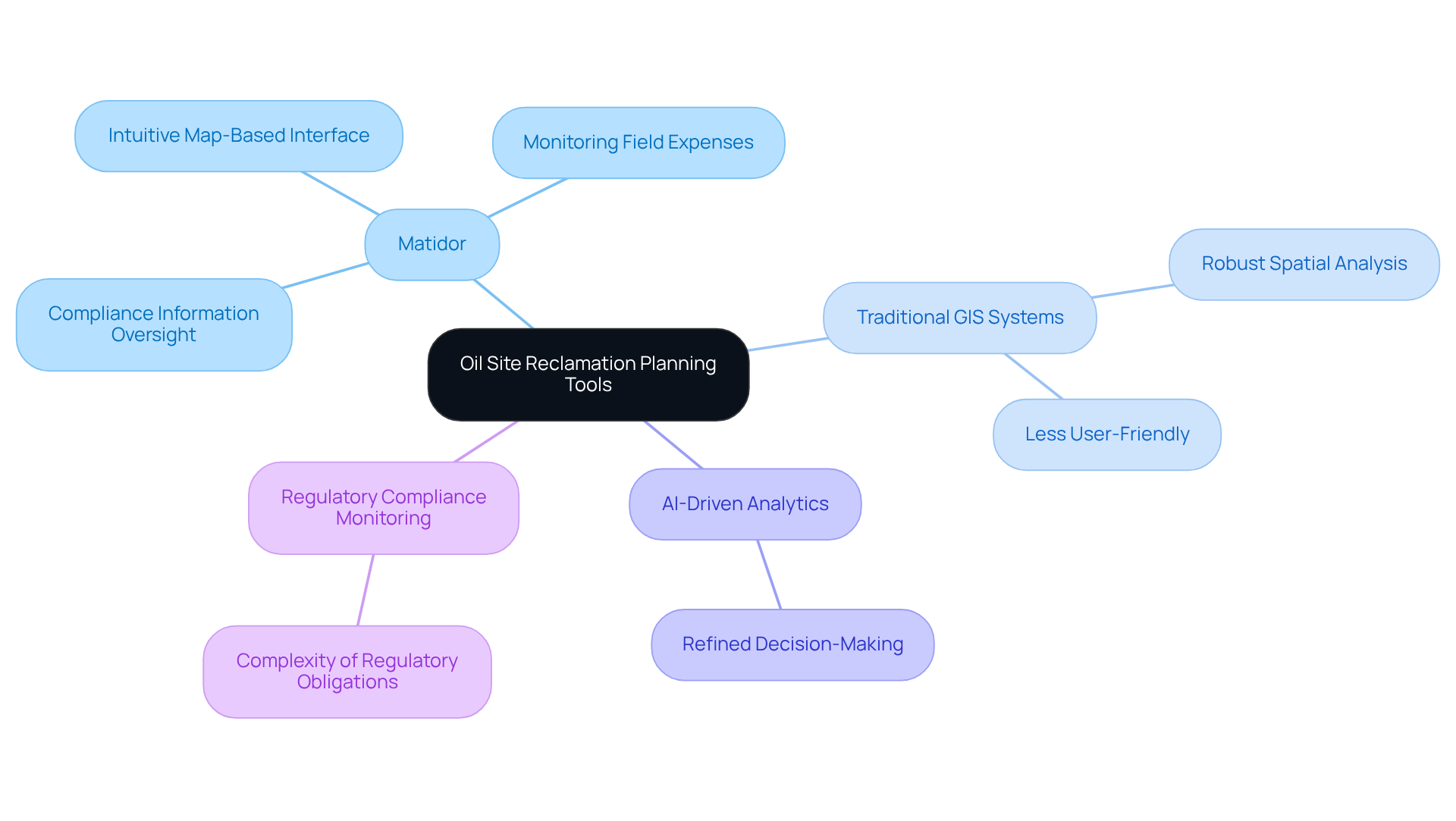
Evaluating oil site reclamation planning tools is crucial for effective land recovery. Several essential characteristics emerge as vital to this process. For example, applications like Matidor offer an intuitive, map-based interface that simplifies the monitoring of field expenses and compliance information, thus enhancing oversight of restoration efforts. In contrast, traditional GIS systems may deliver more robust spatial analysis capabilities but often lack user-friendliness.
Moreover, certain resources incorporate AI-driven analytics to refine decision-making processes, while others focus on regulatory compliance monitoring. The choice of instruments typically hinges on the specific demands of the project, encompassing the extent of restoration, the complexity of regulatory obligations, and the level of detail required in environmental evaluations. Understanding these factors is essential for selecting the most effective oil site reclamation planning tools to ensure successful land recovery.

Evaluating Benefits and Suitability for Land Acquisition
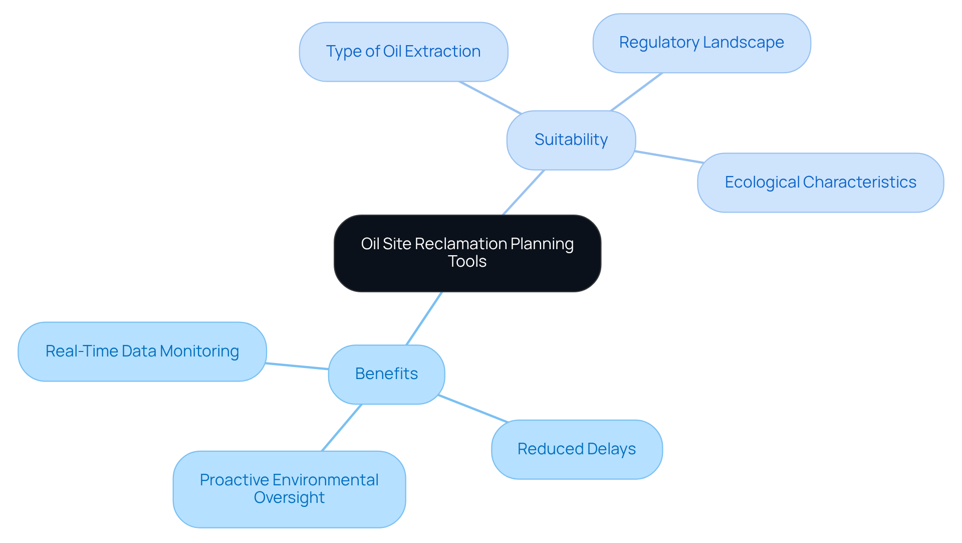
The advantages of employing oil site reclamation planning tools extend far beyond mere compliance; they significantly enhance project effectiveness and ecological outcomes. Consider the impact of resources that offer real-time data monitoring and reporting: they enable organizations to swiftly adapt to changing circumstances or regulatory demands, thereby reducing delays and mitigating potential penalties. Furthermore, oil site reclamation planning tools that integrate environmental monitoring capabilities facilitate proactive oversight of reclamation initiatives, ensuring that restoration objectives are met with efficiency.
The suitability of each tool often hinges on the specific circumstances surrounding land acquisition, including the type of oil extraction activity, the regulatory landscape, and the ecological characteristics of the site. For instance, a resource excelling in GIS mapping may be better suited for projects demanding extensive spatial analysis, while a management solution might be preferable for teams tasked with coordinating multiple stakeholders.
In navigating the complexities of land acquisition, organizations must recognize the critical role of oil site reclamation planning tools in achieving not only compliance but also sustainable environmental stewardship.

Summary of Findings and Recommendations
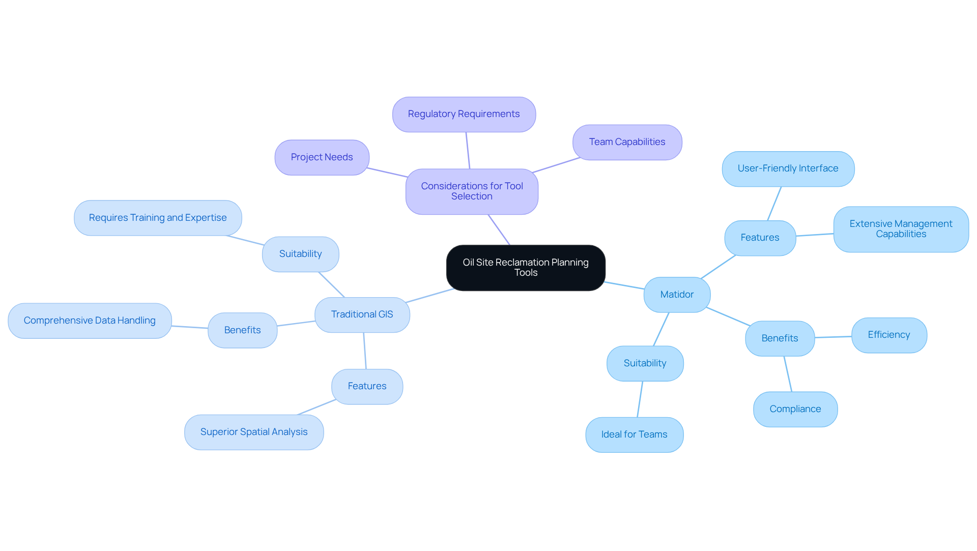
In summary, the comparative examination of oil site reclamation planning tools reveals significant differences in features, benefits, and suitability for various reclamation endeavors. Tools like Matidor stand out due to their user-friendly interfaces and extensive management capabilities, making them ideal for teams focused on efficiency and compliance. Conversely, traditional GIS resources may offer superior spatial analysis but require more training and expertise for effective use.
Stakeholders must evaluate their specific project needs, regulatory requirements, and team capabilities when selecting a restoration tool. Ultimately, investing in the right oil site reclamation planning tools can lead to more successful reclamation outcomes, ensuring that land is restored effectively and sustainably.

Conclusion
Oil site reclamation planning tools are essential for the effective restoration of land affected by oil extraction. These tools not only ensure compliance with regulatory standards but also enhance the efficiency and sustainability of reclamation efforts. By leveraging advanced technologies, such as GIS mapping and management software, stakeholders can make informed decisions that significantly improve land recovery outcomes.
The article highlights key features of various reclamation tools, emphasizing the necessity of user-friendliness, real-time data monitoring, and specific functionalities tailored to project needs. Tools like Matidor are recognized for their intuitive interfaces, while traditional GIS systems provide robust analytical capabilities. Understanding these distinctions is vital for selecting the most appropriate tools for diverse reclamation projects, ensuring that environmental stewardship remains a priority.
Ultimately, the successful implementation of oil site reclamation planning tools not only meets regulatory obligations but also fosters sustainable practices in land management. Stakeholders are urged to carefully evaluate their specific requirements and invest in the most suitable tools to facilitate effective reclamation initiatives. By doing so, they contribute to the restoration of ecosystems and the overall health of the environment, reinforcing the critical role of these tools in the oil and gas sector.
Frequently Asked Questions
What are oil site reclamation planning tools?
Oil site reclamation planning tools are essential resources designed to facilitate the restoration of land affected by oil extraction activities. They include GIS mapping systems, management software, and environmental monitoring applications.
Why are oil site reclamation planning tools important?
These tools are crucial for assessing site conditions, ensuring compliance with regulatory standards, and managing data effectively. They contribute significantly to the success of restoration initiatives, making them effective, compliant, and environmentally responsible.
How does GIS mapping aid in oil site reclamation?
GIS mapping allows for a clear visualization of land disturbances, which aids in the formulation of effective restoration strategies.
What role does management software play in oil site reclamation?
Management software enhances communication and data management among various teams involved in the recovery process, facilitating better coordination and efficiency.
Who benefits from understanding oil site reclamation planning tools?
Stakeholders within the oil and gas sector benefit from understanding these tools, as they help navigate the complexities of land restoration and lead to more sustainable outcomes.


