Overview
Remote sensing is pivotal in optimizing greenfield projects, delivering essential data on land use, topography, and environmental conditions. This information underpins informed decision-making in site selection and land acquisition. By leveraging technologies such as satellite imagery, aerial drones, and GIS software, project managers can analyze and monitor potential sites effectively. This ultimately enhances the efficiency of land acquisition strategies, even amidst challenges like information quality and regulatory compliance.
The complexities of land acquisition often present significant hurdles, including legal and regulatory challenges. However, the integration of remote sensing technology provides a robust solution, enabling project managers to navigate these complexities with confidence. As the landscape of land acquisition evolves, the ability to utilize accurate data becomes increasingly crucial.
In conclusion, embracing remote sensing technologies not only streamlines the decision-making process but also positions organizations to overcome the inherent challenges of land acquisition. It is imperative for project managers to adopt these innovative solutions to ensure successful project outcomes.
Introduction
Remote sensing has emerged as a transformative tool in the realm of greenfield optimization, offering unparalleled insights into land use and environmental conditions from a distance. By harnessing advanced technologies like satellite imagery and drones, project managers can make informed decisions that streamline site selection and enhance land acquisition strategies.
However, as the integration of these technologies becomes increasingly vital, challenges such as data quality and stakeholder resistance raise important questions:
- How can organizations effectively navigate these obstacles to fully leverage the benefits of remote sensing?
This guide delves into a step-by-step approach to optimizing land acquisition through remote sensing, equipping readers with the knowledge to overcome common challenges and maximize project success.
Understand Remote Sensing and Its Role in Greenfield Optimization
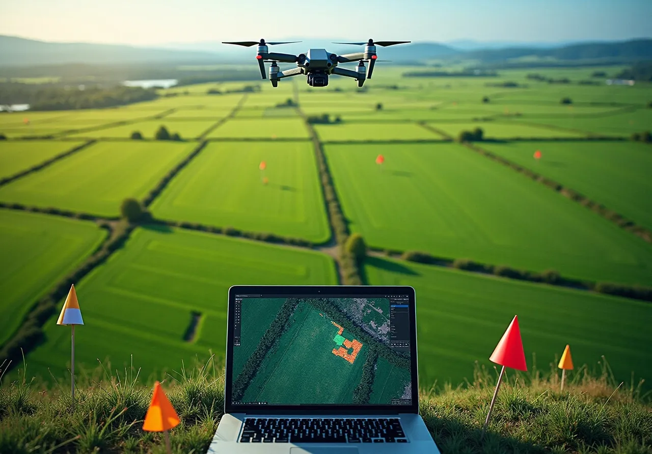
Remote observation is a vital technique for gathering information about an object or area from a distance, primarily through satellite or aerial imagery. In the context of remote sensing for greenfield optimization, this method is crucial, as it provides accurate and up-to-date insights on land use, topography, and environmental conditions. Such information is essential for informed decision-making regarding site selection and land acquisition strategies. By utilizing remote sensing for greenfield optimization, project managers can effectively identify potential locations that meet specific criteria, evaluate environmental impacts, and streamline the planning process.
For example, the deployment of multispectral and hyperspectral imaging technologies allows for a detailed analysis of land characteristics, enhancing land use planning. Looking ahead to 2025, the integration of remote observation in land acquisition strategies is expected to significantly improve efficiency, particularly within the disaster management sector, which is projected to grow at a CAGR of 16.4% due to its reliance on real-time information for effective decision-making.
Moreover, industry leaders recognize the transformative potential of distance measurement technologies in refining land acquisition processes. Successful case studies, such as the collaboration between OSASI Technos Inc. and Hexagon AB, demonstrate practical applications of distance measurement in disaster management. Additionally, North America held a significant market share of 35% in the distance monitoring technology market in 2024, underscoring the region's critical role in advancing these innovations.

Identify Essential Tools and Technologies for Remote Sensing
To effectively leverage remote sensing for greenfield optimization, it is essential to identify several key tools and technologies that can greatly improve decision-making processes.
-
Satellite Imagery: High-resolution satellite images provide comprehensive insights into land cover and usage, facilitating informed decision-making. The worldwide technology market for distance observation is projected to reach USD 42.64 billion by 2030, expanding at a CAGR of 11.6% from 2023 to 2030. This statistic underscores the growing importance of satellite imagery in modern applications.
-
Aerial Drones: Drones equipped with advanced cameras and sensors are pivotal in capturing high-resolution images and data from targeted areas, significantly enhancing analysis precision. In 2022, the aerial systems sector represented 70.7% of the market share, reflecting the increasing dependence on drones for mapping and monitoring. Notably, North America accounted for 36.3% of this technology market share, indicating a robust regional presence.
-
GIS Software: Geographic Information Systems (GIS) play a vital role in analyzing spatial information and visualizing remote sensing details. Experts emphasize that GIS software is essential for integrating various information sources, thereby facilitating effective resource management and urban planning, particularly through remote sensing for greenfield optimization. As one GIS specialist aptly noted, "GIS software is essential for understanding intricate spatial information and facilitating informed decision-making in land management."
-
AI-Driven Analytical Instruments: These groundbreaking tools enhance data handling capabilities, enabling faster and more precise evaluation of distant observation metrics. The integration of AI and machine learning is revolutionizing project management by providing deeper insights and predictive analytics.
-
Data Processing Software: Robust software capable of managing extensive datasets and performing intricate analyses is crucial for deriving actionable insights from distant observation information. This technology addresses the increasing demand for high-resolution satellite imagery and detailed environmental monitoring. However, challenges such as high costs of satellite launches and data privacy concerns must be considered when implementing these technologies.
By familiarizing themselves with these critical tools, managers can effectively prepare for the execution of distance observation in their initiatives, ensuring optimized results and improved resource management. Successful applications of GIS software in distant observation initiatives have demonstrated its efficiency in enhancing results and resource distribution.

Apply Remote Sensing Data to Optimize Land Acquisition Strategies
A structured approach that significantly enhances decision-making and stakeholder engagement is required for optimizing land acquisition strategies using remote sensing for greenfield optimization. This process begins with a critical challenge: the complexities of land acquisition, which include legal and regulatory hurdles. By addressing these challenges head-on, project leaders can leverage remote sensing for greenfield optimization to develop effective solutions.
Information Gathering: Begin by collecting relevant remote sensing information, including satellite imagery from IRS 1C LISS III, IRS 1D LISS III, and P6, alongside aerial photographs. Focus specifically on the area of interest to ensure thorough coverage.
Data Examination: Employ GIS software to assess the gathered information. This analysis reveals land use patterns, environmental characteristics, and potential limitations that may influence site selection.
Site Selection: Utilize the insights gained from the analysis to identify and shortlist potential sites that meet project criteria, such as accessibility, environmental impact, and compliance with zoning regulations.
Stakeholder Engagement: Engage stakeholders effectively by utilizing insights from remote sensing for greenfield optimization data. Present evidence-based arguments that justify site selection. For example, case studies demonstrate that detailed land use maps can facilitate discussions with local authorities and community members, fostering transparency and collaboration.
Regulatory Compliance: Ensure that selected sites adhere to local regulations and environmental standards. Remote monitoring data can substantiate applications and permits, showcasing due diligence in environmental assessments.
Continuous Monitoring: Establish a system for ongoing observation of the chosen locations using distance measurement technologies. This approach allows for monitoring changes over time, ensuring compliance, and adapting strategies as necessary throughout the project lifecycle.
By implementing these steps, project leaders can effectively harness remote sensing for greenfield optimization to enhance the efficiency and effectiveness of land acquisition strategies, ultimately leading to more successful project outcomes.

Troubleshoot Common Challenges in Remote Sensing Applications
Remote sensing presents numerous benefits; however, several common challenges may arise during its application:
-
Information Quality Issues: It is imperative to ensure that the information gathered is of high quality. Subpar information can lead to flawed analyses. Consistently adjusting sensors and verifying information against ground truth is essential. The Quality Assurance Framework for Earth Observation (QA4EO) underscores the importance of traceable quality indicators, ensuring that products meet established standards. For instance, the Kappa coefficient for various sampling techniques, such as MG-SSM, was found to be 0.46, illustrating the necessity for careful evaluation of information quality in distance observation applications.
-
Integration with Existing Systems: Remote observation data must be seamlessly integrated with existing GIS and project management systems. Ensuring compatibility and investing in staff training is crucial for facilitating smooth integration. Industry experts, including Martin Bachmann, assert that combining remote detection with GIS enhances spatial analysis capabilities, leading to more informed decision-making.
-
Cost Constraints: The expense of remote sensing technologies can be significant. It is advisable to explore economical alternatives, such as utilizing drones for focused information gathering instead of relying solely on satellite imagery for extensive regions. This approach not only reduces costs but also enhances data detail, making it a viable option for numerous initiatives.
-
Regulatory Compliance: Navigating regulatory requirements can be intricate. Staying updated on local regulations regarding distance monitoring and land usage is essential, as is consulting with legal professionals when necessary. Understanding these regulations is vital to avoid potential pitfalls in task execution.
-
Stakeholder Resistance: Resistance from some stakeholders to adopting new technologies can pose a challenge. Presenting clear evidence of the advantages of distance observation through case studies and data-informed presentations is key to securing their support. Demonstrating successful applications can foster trust and endorsement among stakeholders.
By proactively addressing these challenges, project managers can significantly enhance the effectiveness of remote sensing for greenfield optimization applications.

Conclusion
Utilizing remote sensing for greenfield optimization represents a pivotal advancement in land acquisition and management. This methodology not only enhances decision-making processes but also streamlines the planning and implementation phases for project managers. By leveraging advanced technologies such as satellite imagery, aerial drones, and GIS software, stakeholders can gain critical insights into land characteristics, ultimately leading to more informed site selection and resource management.
Key arguments throughout the article underscore the necessity of understanding remote sensing tools and addressing the common challenges associated with their application. Ensuring data quality and regulatory compliance, along with effectively engaging stakeholders, are crucial steps in optimizing land acquisition strategies. Furthermore, the integration of AI-driven analytical instruments enhances the capacity to process large datasets, providing deeper insights that can drive successful project outcomes.
The significance of remote sensing in greenfield optimization cannot be overstated. As the demand for efficient land use planning continues to grow, embracing these technologies and methodologies will be essential for future developments. By proactively addressing the challenges and leveraging the insights gained from remote sensing, project managers can improve their decision-making processes and contribute to sustainable land development practices. Engaging with these innovative solutions today will pave the way for more efficient and effective land acquisition strategies in the years to come.
Frequently Asked Questions
What is remote sensing and how is it used in greenfield optimization?
Remote sensing is a technique for gathering information about an object or area from a distance, primarily through satellite or aerial imagery. In greenfield optimization, it provides accurate insights on land use, topography, and environmental conditions, which are essential for informed decision-making regarding site selection and land acquisition strategies.
What technologies are employed in remote sensing for land analysis?
Multispectral and hyperspectral imaging technologies are utilized for detailed analysis of land characteristics, enhancing land use planning.
How is remote sensing expected to impact land acquisition strategies by 2025?
The integration of remote observation in land acquisition strategies is expected to significantly improve efficiency, particularly in the disaster management sector, which is projected to grow at a CAGR of 16.4% due to its reliance on real-time information for effective decision-making.
What role do distance measurement technologies play in land acquisition?
Distance measurement technologies are recognized for their transformative potential in refining land acquisition processes, helping to enhance the efficiency and effectiveness of these operations.
Can you provide an example of a successful application of distance measurement in disaster management?
A successful case study is the collaboration between OSASI Technos Inc. and Hexagon AB, which demonstrates practical applications of distance measurement technologies in disaster management.
What was the market share of North America in the distance monitoring technology market in 2024?
North America held a significant market share of 35% in the distance monitoring technology market in 2024, highlighting the region's critical role in advancing these innovations.
List of Sources
- Understand Remote Sensing and Its Role in Greenfield Optimization
- Remote Sensing Technology Market 2023: Industry Size, Regions, Emerging Trends, Growth Insights, Opportunities, and Forecast By 2033 (https://marketstatsville.com/remote-sensing-technology-market)
- Remote Sensing Technology Market to Hit USD 51.04 Billion by 2032, at 11.32% CAGR | Research by SNS Insider (https://finance.yahoo.com/news/remote-sensing-technology-market-hit-143000780.html)
- Remote Sensing Technology Market Size, Share & Trends Analysis, 2032 (https://psmarketresearch.com/market-analysis/remote-sensing-technology-market)
- Remote Sensing Technology Market Size, Share Report 2030 (https://grandviewresearch.com/industry-analysis/remote-sensing-technologies-market)
- Remote Sensing Technology Market Size & Industry Growth 2030 (https://futuredatastats.com/remote-sensing-technology-market?srsltid=AfmBOoo-IRYc96_e5OxVh_zAdByyEqvA9XPmPxJcIouGUKxRUykbatpn)
- Identify Essential Tools and Technologies for Remote Sensing
- Drone Market Size, Share, Industry Report, Revenue Trends and Growth Drivers (https://marketsandmarkets.com/Market-Reports/unmanned-aerial-vehicles-uav-market-662.html)
- Drone Market Size, Share & Growth | Industry Report, 2030 (https://grandviewresearch.com/industry-analysis/drone-market-report)
- Remote Sensing Technology Market Size, Share Report 2030 (https://grandviewresearch.com/industry-analysis/remote-sensing-technologies-market)
- Remote Sensing Market Size & Industry Growth 2030 (https://futuredatastats.com/remote-sensing-market?srsltid=AfmBOoryEFuu0eP3RgQ3FaKs3tBXPLIqQTrvnk9P6gAhyZcrKnSEEnax)
- Apply Remote Sensing Data to Optimize Land Acquisition Strategies
- (PDF) Effectiveness and Capability of Remote Sensing (RS) and Geographic Information Systems (GIS): A Powerful Tool for Land use and Land Cover (LULC) Change and Accuracy Assessment (https://researchgate.net/publication/370108640_Effectiveness_and_Capability_of_Remote_Sensing_RS_and_Geographic_Information_Systems_GIS_A_Powerful_Tool_for_Land_use_and_Land_Cover_LULC_Change_and_Accuracy_Assessment)
- Remote Sensing Services Market Size, Share & Growth Analysis 2032 (https://marketsandmarkets.com/Market-Reports/remote-sensing-services-market-87605355.html)
- Troubleshoot Common Challenges in Remote Sensing Applications
- Remote sensing data quality model: from data sources to lifecycle phases (https://tandfonline.com/doi/full/10.1080/19479832.2019.1625977)
- Assessing the accuracy of remote sensing data products: A multi-granular spatial sampling method (https://sciencedirect.com/science/article/pii/S0167739X24002097)
- Mastering Data Quality in Ocean Remote Sensing (https://numberanalytics.com/blog/mastering-data-quality-ocean-remote-sensing)
- (PDF) DATA QUALITY IN REMOTE SENSING (https://researchgate.net/publication/319866075_DATA_QUALITY_IN_REMOTE_SENSING)