Introduction
Harnessing the power of advanced software has become a cornerstone in the land acquisition process, particularly in the realm of renewable energy development where site selection is paramount. This article explores the role of advanced software in land acquisition, highlighting its benefits, key features, and its impact on various aspects of the process. From streamlining data management and organization to automating title and ownership records, cadastral mapping, and zoning tasks, advanced software solutions offer a range of functionalities that enhance efficiency, accuracy, and collaboration among stakeholders.
The integration of artificial intelligence and geospatial technology further revolutionizes the way professionals engage with land data, providing valuable insights and driving innovation in the industry. With the real estate software market experiencing robust growth, the adoption of smart software solutions becomes increasingly important for businesses seeking a competitive edge in the marketplace. By leveraging advanced software, professionals can navigate the complexities of land acquisition, optimize workflows, and make well-informed decisions that drive successful outcomes.
The Role of Advanced Software in Land Acquisition
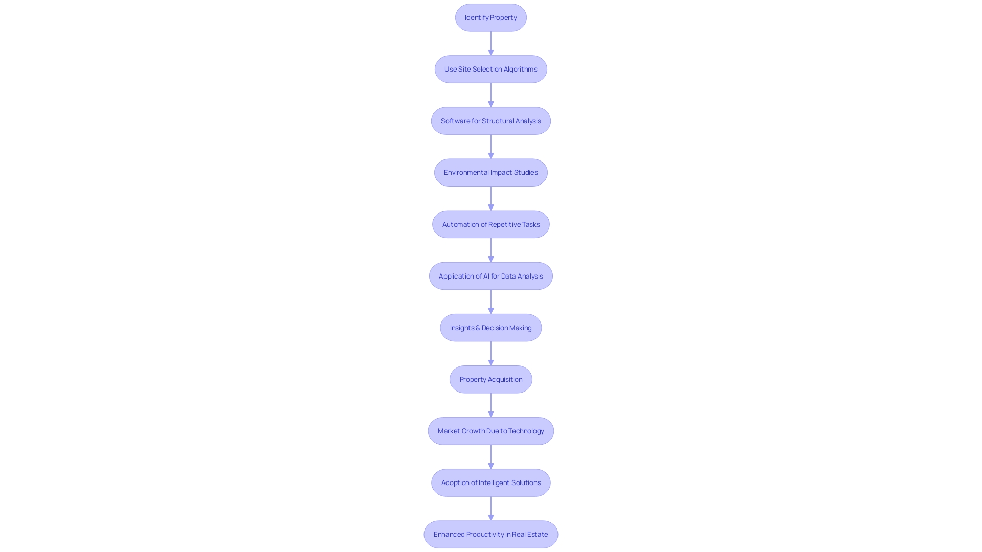
Utilizing the potential of cutting-edge technology has become a foundation in the process of obtaining property, especially in the field of sustainable energy advancement where choosing the right location is crucial. Take, for example, the innovative approach by Inicio using their in-house algorithm, Eywa. This technology expedites the identification of optimal locations for solar power plants that harmonize with local constraints and agricultural activities, while also addressing visibility concerns from housing and historical monuments. Inicio's quick prediction capabilities underscore the importance of early-stage risk identification without the need for extensive field visits.
The integration of various software tools is essential not only for site selection but also for a multitude of tasks such as structural analysis, environmental impact studies, and project management. This ecosystem of interconnected applications facilitates seamless transitions between different phases of the property acquisition process, enhancing overall productivity. The automation of repetitive tasks, such as generating reports or managing documentation, is a pivotal feature that liberates professionals to focus on more strategic and creative aspects of their projects.
Moreover, the emergence of artificial intelligence (AI) is revolutionizing the way we engage with land information. The ability to sort through vast amounts of information to determine the value of a field or predict potential buyers is revolutionizing the industry. Yet, the development and refinement of databases that aggregate sales prices, soil types, and crop history are still in their nascent stages. These databases are the bedrock upon which AI can build to deliver meaningful insights and drive innovation within the sector.
The real estate market is experiencing strong growth, driven by a demand for better data management, increased digitization, and improvements in automation technologies. For example, the business sector is expected to experience a compound annual growth rate of 13.7% throughout the projected time frame, with technology playing a crucial part in handling transactions, documents, and property accounts. As urbanization continues and infrastructure projects proliferate, the adoption of intelligent solutions becomes increasingly important for businesses seeking to enhance productivity and secure a competitive edge in the marketplace.
Key Features of Land Management Software
Land acquisition and management are integral components of successful property development and conservation efforts. Utilizing advanced technological tools can significantly enhance the efficiency and accuracy of these tasks. Modern property management applications offer a range of sophisticated features that address the multifaceted challenges of handling and acquiring real estate. These features include streamlined data management systems that keep vital information organized and readily accessible, and a suite of automated tools for managing title and ownership records with precision.
Furthermore, these software platforms incorporate cadastral mapping and Geographic Information Systems (GIS), which are crucial for spatial analysis and decision-making in acquisition processes. Moreover, the automation of permitting and zoning tasks simplifies the often complex legal landscape that professionals must navigate.
For instance, institutions such as the National Trust, which is accountable for preserving a wide range of historical and natural locations throughout the UK, utilize this technology to effectively oversee more than 250,000 hectares of territory. They have adopted ArcGIS Image for ArcGIS Online to enhance collaboration and improve the way they process and share remotely sensed data.
The program additionally aids in property appraisal and tax evaluation, guaranteeing that all monetary aspects of property administration are precise and in accordance with regulations. Document management and records retention are further streamlined, allowing for better organization and long-term storage of important records. With the growing demand for real estate applications in both residential and commercial sectors, these tools contribute to the increased productivity of businesses as highlighted by the commercial segment's anticipated growth at a CAGR of 13.7% during the forecast period.
In the agricultural sector, precision and data-driven decision-making are also vital. Netafim USA, a pioneer in sustainable farming solutions, highlights the significance of cutting-edge technology in managing agricultural areas. Their precision irrigation solutions, such as the SDI-E system, demonstrate how technology can significantly reduce greenhouse gas emissions and promote water efficiency.
From organizations dedicated to conserving natural resources to businesses involved in property development and agricultural advancements, the integration of advanced technological features into land management practices is proving to be an invaluable asset, driving forward an era of efficient, data-driven land control and care.
Efficient Data Management and Organization
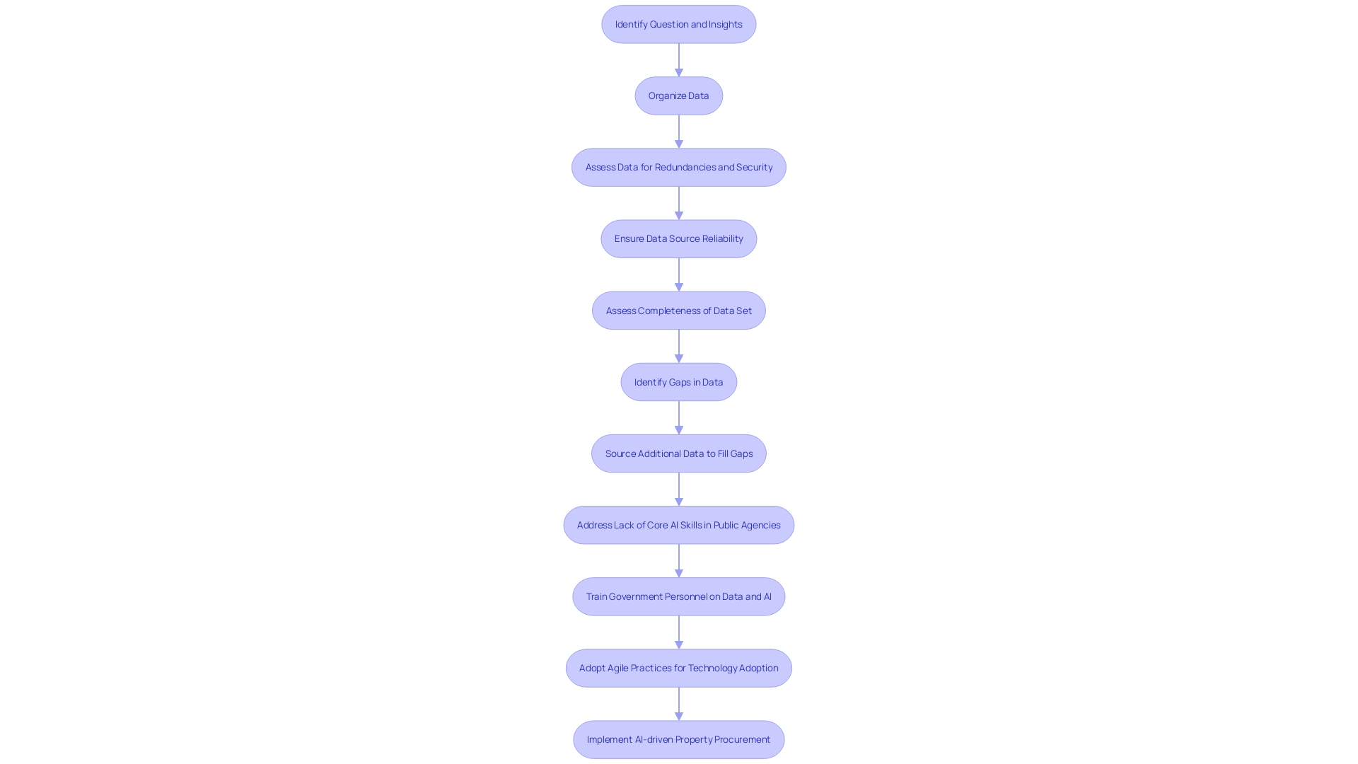
In the realm of land acquisition, the ability to efficiently manage a wealth of information is crucial. Modern solutions are transforming this field by providing strong management tools. These tools empower professionals to store, categorize, and effortlessly retrieve information, enabling them to base their decisions on information that is both timely and precise.
For instance, the journey of John Dee Warwick's upgrade, as recounted by Soeren Schauki, was a multi-stage process starting from an initial analysis up to the seamless integration of an automated system tailored to their unique business needs. This illustration showcases the transformative influence that tailor-made solutions can have on organization and process efficiency.
In another instance, the adoption of cloud-based point cloud technology has greatly improved visualization and integration of information sources in the construction sector, resulting in enhanced precision, reduction of mistakes, and savings in expenses. This is reflected in the broader trend where companies are investing heavily in cloud solutions, with spending reaching over $626 billion and projected to continue growing.
Furthermore, the real estate software market has been witnessing a rise, with a projected compound annual growth rate (CAGR) of 12.8% from 2023 to 2030, indicating an increasing need for digital tools that improve information management and business efficiency. These tools not only streamline the handling of property accounts and legal documentation but also provide valuable insights into customer behavior and market trends, thereby driving better business outcomes.
As we look to the future, the emphasis on precise and accessible data management continues to grow, with industry leaders recognizing its critical role in driving informed decision-making and enhancing the delivery of land-related services.
Title and Ownership Records Automation
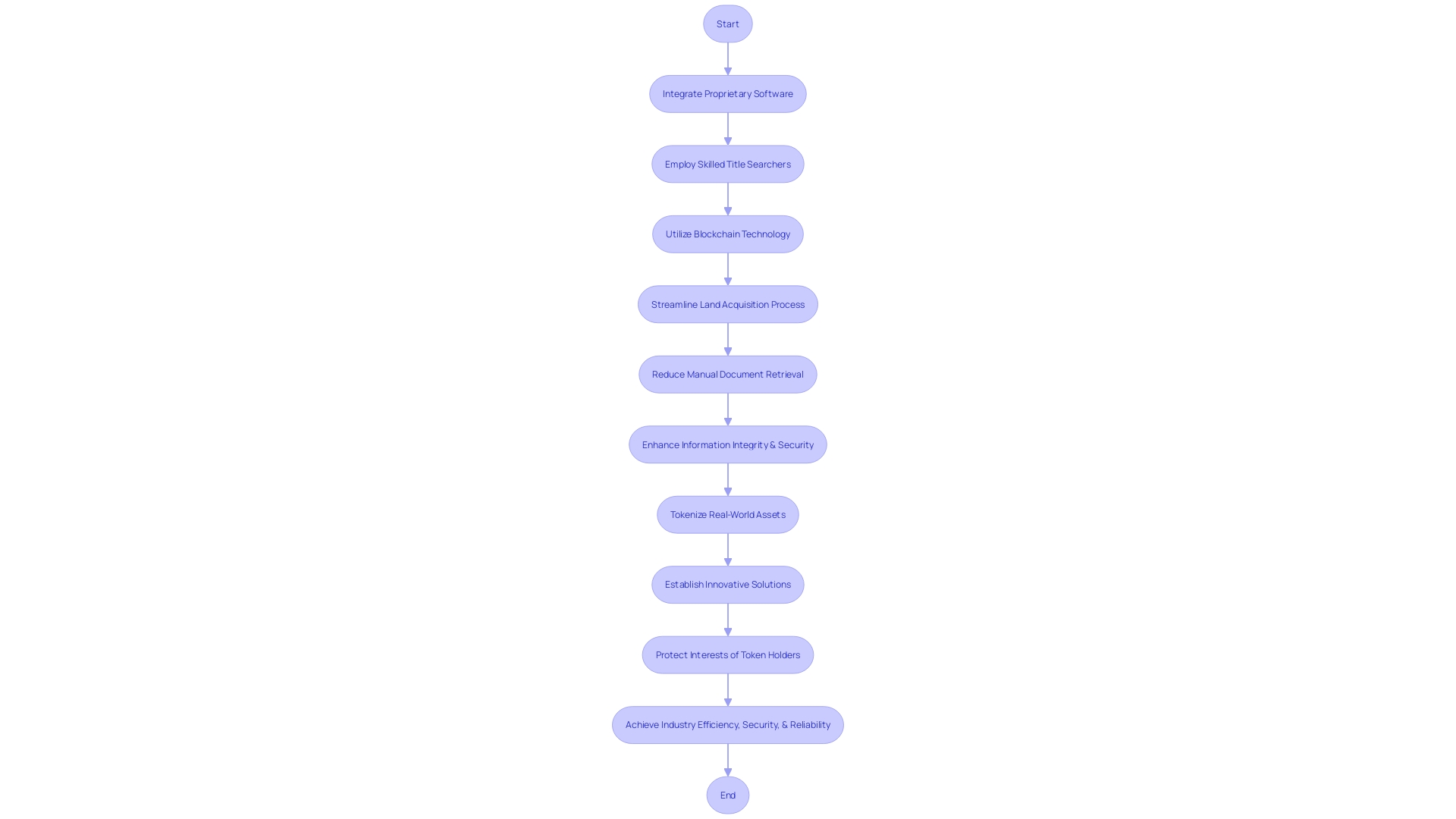
The modernization of title search technology has transformed land acquisition processes, addressing long-standing challenges and streamlining due diligence. By integrating proprietary software with a network of skilled title searchers, companies like Pippin have propelled title verification into the digital age. This integration has reduced the need for manual document retrieval, eliminating the inconsistencies of traditional title reports and significantly cutting down the time-consuming legwork previously required.
The advent of blockchain technology furthers this evolution, bringing a heightened level of security and immutability to title and ownership records. The blockchain's inherent features prevent the alteration of past transactions, offering an unprecedented standard of information integrity. This is particularly important given the vulnerability of older systems to data corruption and loss, and the increasing frequency of data breaches in major companies. With blockchain, authorities now have a robust, publicly accessible digital storage solution that acts as an independent source of truth, mitigating disputes over document authenticity.
Additionally, the tokenization of real-world assets on blockchain platforms introduces a novel approach to representing ownership rights, although it comes with its own set of technological and traditional risks. To counter potential fraudulent actions by real estate owners, innovative solutions involving corporate resolutions and tokenization standards have been established to protect the interests of token holders.
These progressions in technology not just streamline the process of obtaining but also offer improved protection for stakeholders involved in property transactions. With organizations like First American Financial Corporation leading the digital transformation of the title and settlement industry, backed by over 130 years of experience and a revenue of $7.6 billion in 2022, the field is witnessing a significant shift towards efficiency, security, and reliability.
Cadastral Mapping and GIS Integration
The combination of cadastral mapping with Geographic Information Systems (GIS) has become a cornerstone in the realm of property procurement, revolutionizing the way professionals engage with spatial information. The utilization of advanced software not only facilitates the creation and management of detailed cadastral maps but also their seamless integration with GIS systems. This amalgamation enhances the visualization and analysis of spatial data, thereby streamlining the identification and evaluation of potential parcels for acquisition.
The significance of this integration is further exemplified by the emergence of blockchain technology in the real estate sector. The tokenization of real-world assets (RWAs), where rights of these assets are converted into digital tokens, introduces an innovative layer of transparency and security in property transactions. Although blockchain and RWAs may seem disparate, their convergence through tokenization establishes a new paradigm in safeguarding the rights of token holders against risks such as fraud and cyber threats.
In the context of social impact, the participatory mapping project in Mayo-Kebbi Est has demonstrated the empowering effect of inclusive mapping practices, particularly for women in traditionally male-dominated societies. By engaging women in decision-making processes related to property management, the initiative has demonstrated concrete outcomes in fair distribution and administration of resources.
Furthermore, Xcalibur Multiphysics has exemplified the role of technology in natural capital mapping, emphasizing the company's commitment to responsible discovery and the protection of biodiversity. This aligns with the global trend towards digitalization, as highlighted by the World Bank Group's "Digital Progress and Trends Report 2023", which underscores the critical importance of digital public infrastructure and AI in shaping our digital future.
In the professional sphere, the expertise of property surveyors is indispensable. Surveyors use specialized tools to obtain precise property lines and document the physical characteristics of the area, which is crucial for preventing boundary conflicts and providing information to prospective purchasers.
The efficient utilization of public information in territory governance also has a crucial part in guaranteeing lasting socio-economic and ecological supervision. It necessitates not only accessibility but also the provision of necessary conditions and skills for diverse users to utilize this information for equitable outcomes. This approach is crucial in preventing a 'data divide' that could otherwise worsen inequality, as shown by the digitization of property records in Bangalore, India, where the disadvantaged were further marginalized.
In general, the fusion of cadastral mapping, GIS, and emerging technologies like blockchain, alongside the strategic use of open data and the expertise of surveyors, constitutes a comprehensive approach to modern practices of acquiring property. These advancements collectively cater to the growing need for accuracy, safety, and inclusivity in the management of terrain resources.
Permitting and Zoning Automation
In the realm of land acquisition, the imperative to secure permits and adhere to zoning laws is a well-known hurdle, often creating a bottleneck in the process. Advanced technology, particularly artificial intelligence (AI), is now paving the way for a revolution in how these regulatory requirements are managed. Generative AI, a type of machine learning, has the potential to significantly reduce the time and costs associated with pre development phases, which includes the crucial permitting and zoning stages.
AI-driven solutions are being utilized to automate and streamline these aspects, enabling for quicker navigation through the intricate tapestry of regulations. For instance, Tyler Technologies has been instrumental in connecting information and processes across various systems, thereby transforming how actionable insights are obtained to address community issues. Their comprehensive software services are designed to enhance efficiency and transparency for government entities, which is crucial for directors who handle a multitude of legal and logistical hurdles.
Moreover, the adoption of such technology is not just a theoretical exercise; municipalities are already experiencing its benefits. As noted by government officials, the migration from outdated paper processes to agile, analytics-driven approaches is shortening project timelines. This shift is increasingly important in light of the housing industry's embrace of AI to improve housing access and expedite production, while governments are actively contemplating regulations to maximize AI's advantages and mitigate potential risks.
The requirement for strong governance and the correct system architecture, whether on-premises or cloud-based, is also emphasized in best practice discussions among industry experts. These considerations are crucial for ensuring the privacy and security of data in real estate procurement efforts.
As the landscape of housing finance and development evolves, the role of technology in overcoming traditional barriers cannot be overstated. The integration of AI in property procurement processes is poised to create a more dynamic, efficient, and equitable system, ultimately benefiting those who navigate the complexities of securing real estate for development.
Land Valuation and Tax Assessment
Cutting-edge software solutions are transforming the field of property acquisition by improving the accuracy of property valuations and tax assessments. These advanced tools examine market trends, evaluate property values, and calculate tax obligations, providing professionals with the comprehensive financial information required for informed decision-making.
- A property survey defines precise boundaries and features of a parcel, using specialized techniques for accuracy.
- Accurate valuation is critical; as the International Association of Assessing Officers notes, traditional manual methods are time-intensive, but technological advancements offer swifter, more efficient approaches. Advancements in technology regarding information, artificial intelligence, and analysis offer a wide range of specialized assessment choices, catering to the changing needs in the industry and assisting well-informed property procurement strategies.
- Comprehensive property data reports and real estate document access facilitate legal due diligence and sound business decisions, as emphasized by industry leaders like Real Info, Inc.
- Automated Valuation Models (AVMs) have transformed property valuation, streamlining the process and offering scalable solutions for various real estate needs.
These progressions guarantee that professionals involved in obtaining property can navigate the intricate legal and environmental regulations that frequently impede development projects, such as those highlighted by NEPA and CEQA, with greater ease and accuracy. Moreover, they address the challenges of long-term ownership and the shifts in property values over time, as mentioned by experts discussing tax policy and valuation practices.
In the end, the incorporation of these state-of-the-art tools into the property procurement procedure guarantees a fairer and forward-thinking method to property appraisal and taxation, aligning with the requirements of contemporary development projects.
Workflow Automation and Notification Tools
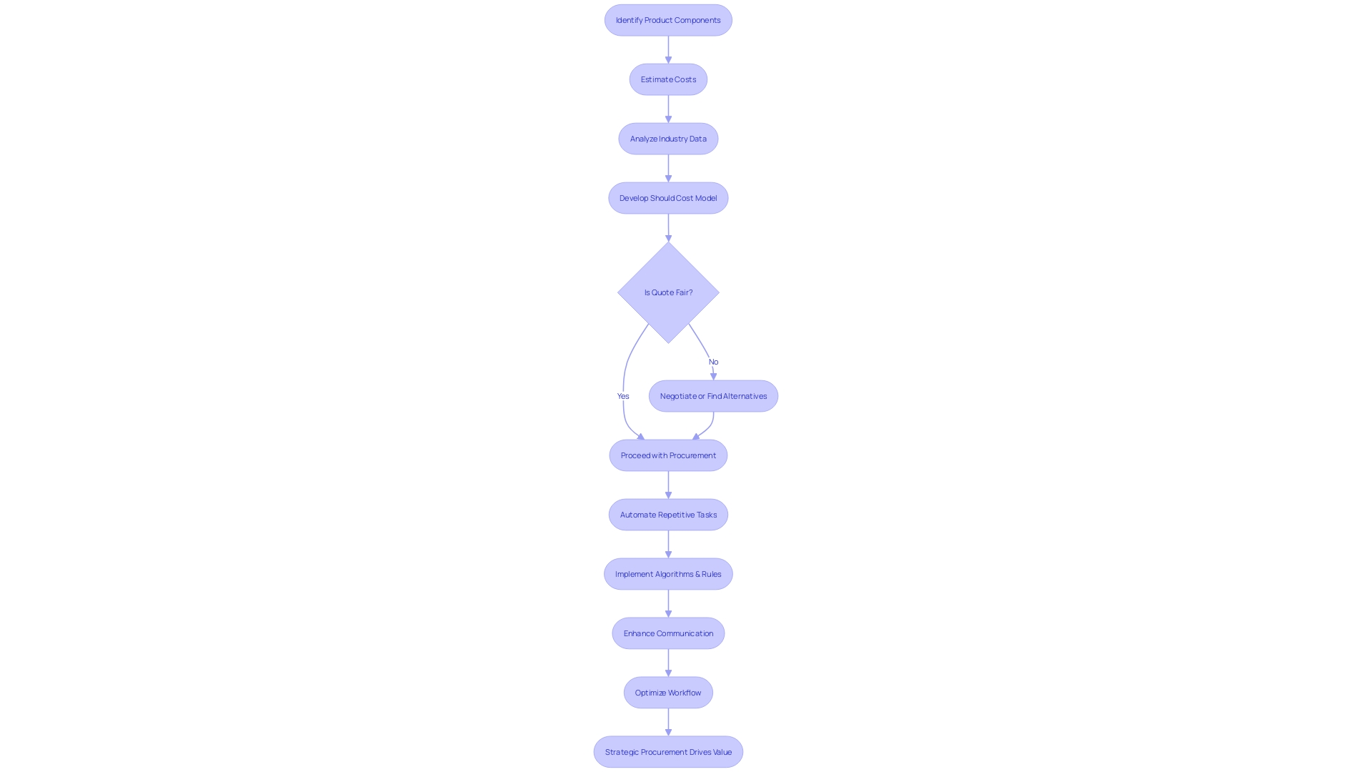
Workflow automation plays a crucial role in improving the effectiveness of property procurement procedures. By incorporating technology to automate repetitive tasks, land specialists are able to minimize manual efforts and human error. Utilizing cutting-edge software, this approach streamlines complex procedures by implementing algorithms and predefined rules that foster effective communication and task management among stakeholders. A significant proportion of businesses, particularly smaller ones, rely on such automation to handle routine tasks, such as sending notifications and managing permissions. According to a Zapier report, this is a common theme across nearly all small business workers. This technological empowerment not only simplifies collaboration but also ensures that every party involved stays updated on the project's milestones, thereby optimizing the overall workflow.
Case Study: How GIS Technology Enhances Land Acquisition
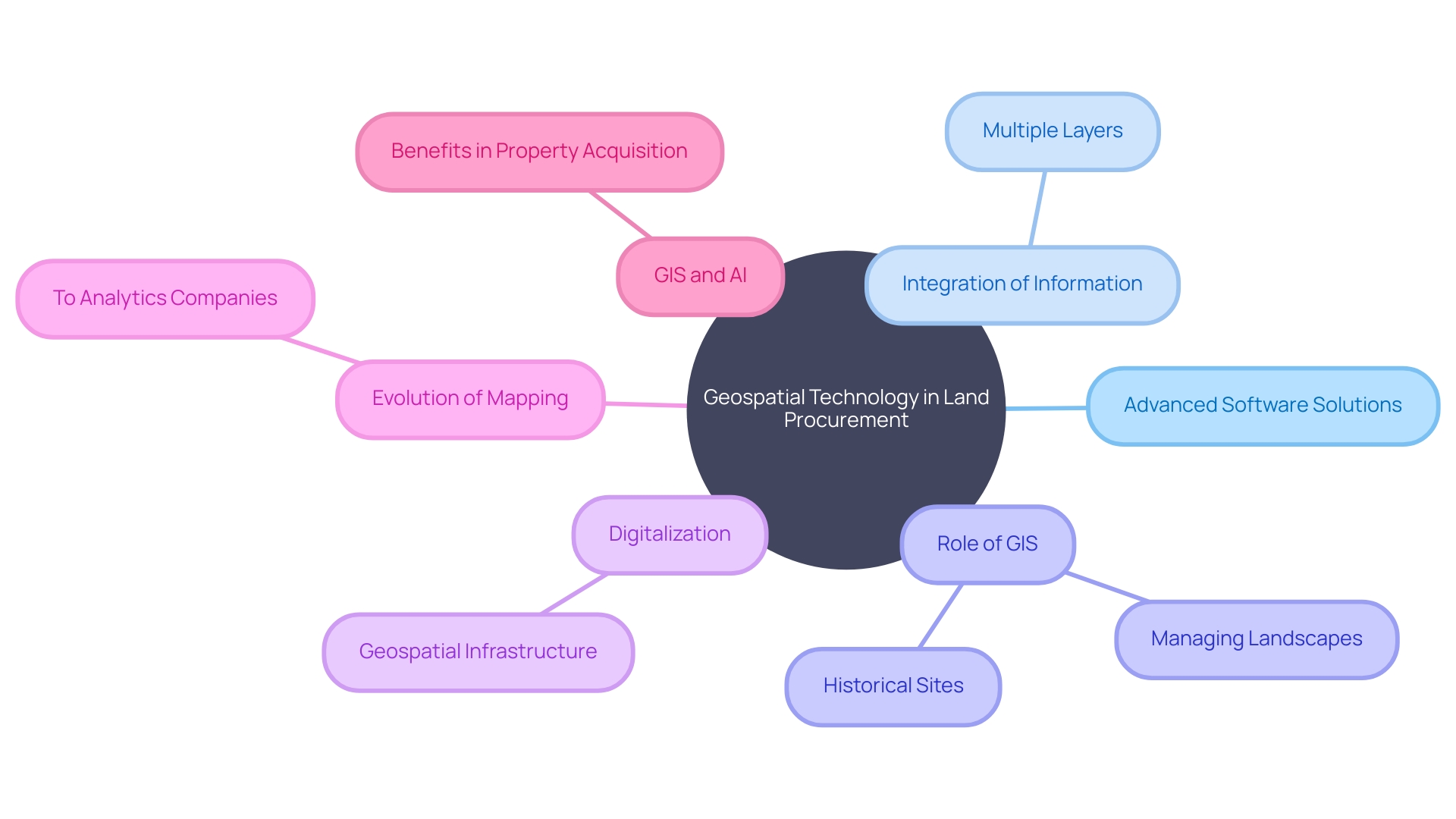
Geospatial technology, especially Geographic Information Systems (GIS), has completely transformed the process of obtaining land, altering the manner in which parcels are identified, assessed, and safeguarded. By utilizing advanced software solutions, acquisition teams can navigate complex spatial information to pinpoint optimal land while respecting local constraints. For instance, Inicio's innovative approach, utilizing their proprietary algorithm Eywa, showcases the capability to locate potential sites for solar power plants that harmonize with agricultural activities and adhere to rigorous planning regulations. Such precision is achieved by integrating multiple layers of information, including topographical, historical, and housing visibility constraints.
The National Trust's experience further illustrates the power of GIS in managing vast landscapes and historical sites. By moving from static PDFs to dynamic geospatial analyses, the Trust's archaeologists can better evaluate changes and conserve the cultural and natural heritage across their territories. The transformation echoes the broader shift in the AEC sector, where the digitalization of geospatial infrastructure underpins the development of digital twins, enhancing decision-making in urban planning, environmental conservation, and transportation.
Geospatial intelligence's profound impact is evidenced by Bayanat's evolution from a traditional mapping firm to an AI-powered analytics company, offering predictive solutions across several sectors. The escalating demand for precise and actionable insights is driving the geospatial data marketplace toward an era where high-definition mapping, 3D modeling, and digital twins become standard tools for professionals.
In the context of acquiring property, this technological advancement represents a significant enhancement in effectiveness and precision. The integration of GIS and AI enables faster identification of suitable locations, speeds up the permit process, and facilitates stakeholders' negotiations. The benefits are clear: time and resource savings, as well as a more harmonious balance between development and environmental sustainability. With the growing necessity for Earth Observation in response to global challenges like climate change and food security, the reliance on geospatial information will only continue to surge, further establishing its role in shaping the future of land procurement.
Benefits of Advanced Software in Land Acquisition
Incorporating cutting-edge technological solutions into the process of obtaining property enhances the efficiency of operations in the real estate sector. These technological tools are instrumental in enhancing precision and facilitating cooperation among various stakeholders. By optimizing workflows and providing strong information management capabilities, such technology enables industry professionals to make well-informed decisions, thereby streamlining the entire land acquisition journey.
For instance, the consolidation of various systems into a cohesive framework was a strategic move for Somerset Academies of Texas. This integration addressed operational inefficiencies and improved process management across multiple departments. Similarly, Tyler Technologies' comprehensive solutions have been transforming public sector operations by enabling a seamless flow of data and insights across different systems.
The use of Graphisoft's suite of tools in the Higher Roch Tower project in Montpellier, France, exemplifies the transformative impact of advanced programs in real estate development. These tools provided a flexible platform that allowed for the realization of a complex and innovative architectural vision, effectively integrating the natural environment and local culture into the design.
With the real estate market evolving rapidly, the demand for efficient digital tools is increasing, as evidenced by the anticipated growth in the commercial sector. The application of these tools extends beyond basic transaction management to include intricate data analysis and strategic planning, essential for navigating the competitive landscape of real estate.
Real estate technology has also proven to be a key driver in addressing the needs of an expanding population and the surge in urban development projects. The adoption of cloud computing and artificial intelligence within the industry is propelling the growth of smart solutions in real estate. As businesses seek to maximize productivity through various platforms, including social media and online advertising, the need for advanced tools becomes increasingly critical.
The combined advantages of these technological solutions are transforming the future of real estate development, establishing a fresh benchmark for excellence and innovation in the sector.
Streamlining Entitlement Processes with Site Intelligence
Utilizing the power of advanced software solutions in land procurement results in a competitive advantage in evaluating land parcels for development. These comprehensive site intelligence tools delve into a myriad of critical factors, including the examination of environmental implications, the evaluation of existing infrastructure, and adherence to complex regulatory frameworks. By leveraging such technology, professionals are equipped to expedite the entitlement process and secure successful acquisition outcomes.
A prominent example of the efficiency gains from integrating technology in operational processes can be seen in the case of John Dee, a meat processing company. With the assistance of experts like Soeren Schauki, Business Development Manager at Dematic, John Dee transitioned from manual operations to a sophisticated system that addressed their unique industry challenges. This transformation involved a thorough analysis of the company's current and future needs, leading to a customized solution that significantly improved product tracking, accuracy, and safety, thereby optimizing their entire operation.
In the realm of public sector planning, embracing digital transformation has proven to be an invaluable step. Local authorities worldwide are managing an ever-increasing volume of applications for development permissions with limited resources. The shift from paper-based to digital project plans has substantially streamlined the submission, review, amendment, and approval processes, ultimately benefiting communities and stakeholders alike.
Moreover, the advent of machine learning and AI is reshaping the industry, as demonstrated by CityBldr, which operates across numerous cities in the US and Canada. This platform has mastered the intricate zoning laws through its innovative use of technology. Similarly, Attentive.ai has revolutionized site measurement and scheduling through computer vision and AI, marking a significant departure from the time-consuming manual methods of the past.
The progression towards digital solutions is echoed in the wider industry sentiment. According to the insights shared by industry professionals, the process from capturing and cleansing information to effectively utilizing it to drive desired outcomes is critical. This pathway to success is encapsulated in the concept of 'Data Tales', which underscores the transformative impact of data in achieving tangible results.
These advancements highlight the crucial function that technology plays in the contemporary environment of property procurement and growth, providing a roadmap for achievement through strategic planning, innovation, and digital expertise.
Full Transparency and Collaboration in Land Acquisition
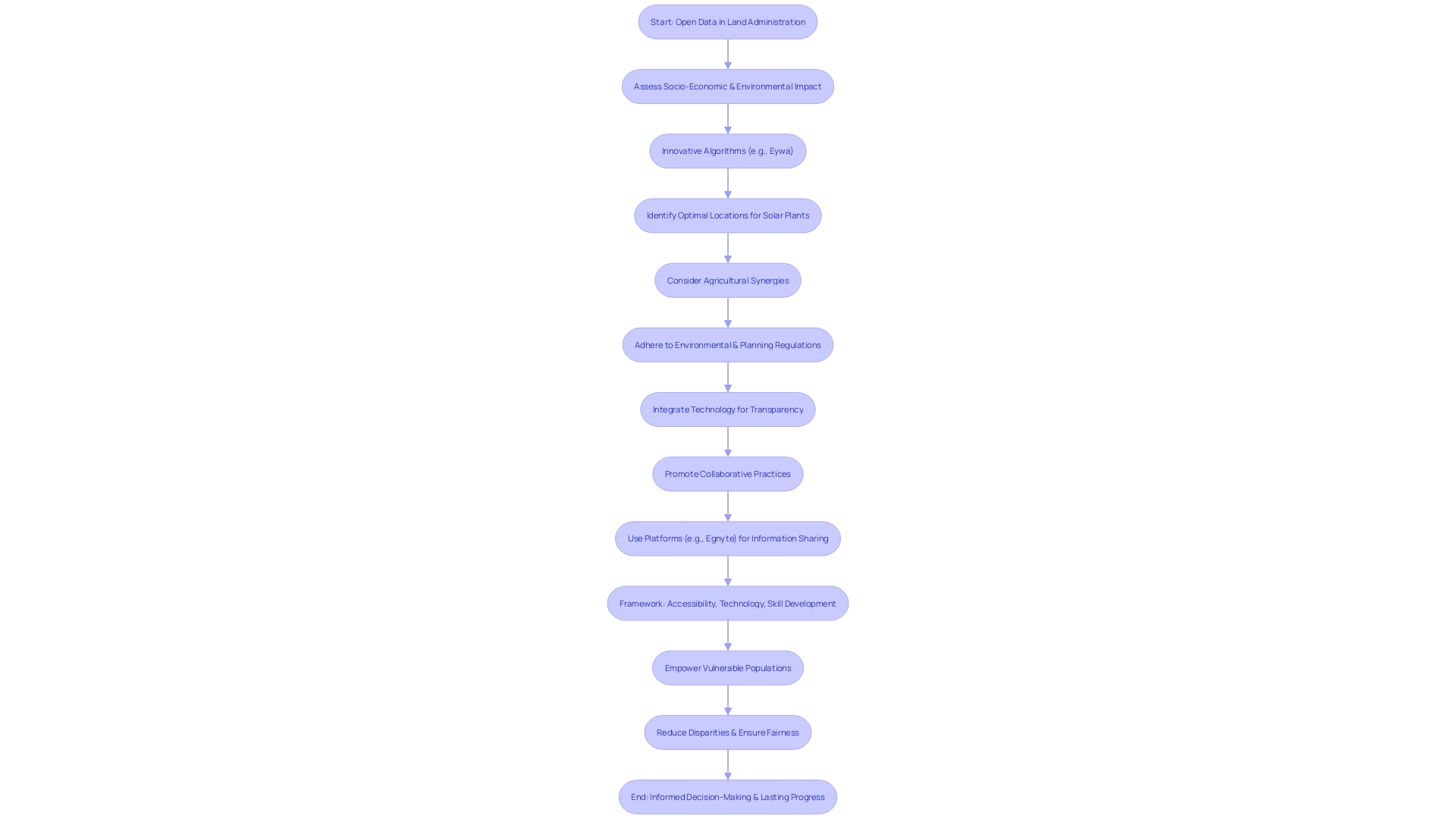
The importance of integrating transparent and collaborative practices in acquisition of property is emphasized by the experiences of industry leaders. For instance, Inicio employs an innovative algorithm named Eywa to scout optimal locations for solar power plants while upholding local agricultural synergies and adhering to strict environmental and planning regulations. This accuracy in identifying appropriate territory without disturbing local limitations is a prime example of how technology can assist in transparent dealings, a concept echoed by open information advocates.
Open information is celebrated as a tool that can improve land management systems, promoting fairness in socio-economic and environmental spheres. However, caution is advised as open information can unintentionally widen the gap of inequality if not managed correctly. To bridge this divide, a strong framework for efficient information utilization has been proposed, focusing on accessibility, technology, skill development, and governance. Only by providing a diverse user base with the necessary tools and knowledge can open information fulfill its promise of empowering the vulnerable rather than exacerbating disparities.
Echoes of these principles have been witnessed in the architecture, engineering, and construction industries, where companies like Egnyte have secured significant client growth by offering secure, transparent information-sharing platforms. These platforms not only foster collaboration but also ensure that all stakeholders have equal access to vital information, aligning with the broader goals of open data utilization.
This diverse strategy for transparency and technological progress in obtaining property is not just about gaining access to information but about guaranteeing that such information results in well-informed decision-making, fair chances, and lasting progress for all parties concerned.
Accelerating Project Timelines with Data-Driven Insights
Utilizing the potential of large-scale information analysis is changing the scenery of land acquisition, empowering experts to optimize the entire process with unparalleled efficiency. By collecting and integrating information from diverse sources such as social media, transaction records, and market trends, analytics tools provide a holistic view of the real estate market. These solutions assist in cleansing and preprocessing information, addressing inaccuracies and inconsistencies to ensure actionable insights can be drawn. For instance, in the realm of luxury real estate, the field of information science has proven to be invaluable in identifying high-value properties, as demonstrated by the analysis of top-tier homes in Ames using Python's pandas library. This capability for meticulous analysis facilitates better decision-making, often leading to an expedited acquisition process with fewer delays. Similarly, a case study in the Chiba Prefecture illustrates the practical application of insights, where a client's criteria were met by identifying suitable Akiya properties through careful evaluation driven by information. Furthermore, recent industry reports emphasize that almost 52% of professionals encounter difficulties with clarity and audit trails in decision-making, underscoring the increasing requirement for strong information management practices. With big data's key characteristics—volume, velocity, variety, and veracity—professionals are equipped to make informed decisions, ensuring compliance with regulations and optimizing the efficiency of land acquisition projects.
Conclusion
In conclusion, advanced software solutions play a crucial role in the land acquisition process, particularly in renewable energy development. These solutions enhance efficiency, accuracy, and collaboration among stakeholders by offering functionalities such as efficient data management and organization, automation of title and ownership records, streamlined permitting and zoning processes, transparent and collaborative practices, and data-driven insights.
Efficient data management and organization empower professionals to make well-informed decisions based on timely and precise data. The automation of title and ownership records, coupled with blockchain technology, ensures data integrity and enhances protection for stakeholders involved in land transactions.
Streamlining the permitting and zoning processes through AI-driven software solutions reduces time and costs associated with predevelopment phases. The integration of AI creates a dynamic, efficient, and equitable system for securing land for development.
Incorporating transparent and collaborative practices in land acquisition promotes equity in socio-economic and environmental spheres. Technology plays a vital role in ensuring transparent and equitable information-sharing platforms, benefiting all stakeholders involved.
Harnessing the power of big data analytics accelerates project timelines by providing data-driven insights. Analytics tools offer a holistic view of the real estate market, facilitating better decision-making and expediting the acquisition process.
In summary, advanced software solutions have become indispensable in the land acquisition process, offering benefits such as efficient data management, automation of tasks, streamlined permitting and zoning, transparent and collaborative practices, and data-driven insights. By adopting these solutions, businesses gain a competitive edge in the marketplace, ensuring efficiency, accuracy, and collaboration in land acquisition endeavors.
Discover how our advanced software solutions can enhance your land acquisition process today!


