Introduction
Geographic Information Systems (GIS) have transformed the field of land acquisition, providing a dynamic visual platform for analyzing and selecting land parcels. This technology offers a comprehensive depiction of property lines and ownership records, streamlining the identification process for development prospects. GIS enables stakeholders to gain insights into topography, infrastructure adjacency, and environmental attributes, empowering them to make well-informed decisions.
Beyond data representation, GIS fosters enhanced communication and cooperation among various parties involved in land acquisition. The ability to share interactive maps and spatial analysis results helps synchronize efforts, minimize misunderstandings, and optimize project management. With advancements in spatial data science and AI, GIS is enriched with more nuanced interpretations of data, facilitating scenario testing and bringing clarity to complex land use decisions.
The integration of GIS in smart city planning and sustainable development further highlights its role in enhancing inclusivity and addressing societal challenges. As GIS continues to evolve, it remains a cornerstone of modern land acquisition strategy, providing an indispensable tool for visualizing, analyzing, and collaborating in the pursuit of optimal land use.
Benefits of GIS Mapping in Land Acquisition
Geographic Information Systems (GIS) have transformed the field of acquisition, providing a dynamic visual platform for analyzing and selecting parcels. This technology presents a comprehensive depiction of property lines and ownership records, streamlining the identification process for development prospects. By utilizing GIS, stakeholders acquire insights into the topography of the area, infrastructure adjacency, and environmental attributes, enabling them to make well-informed decisions.
The power of GIS extends beyond mere representation; it fosters enhanced communication and cooperation among various parties engaged in land acquisition. The ability to share interactive maps and spatial analysis results helps synchronize efforts, minimize misunderstandings, and optimize project management.
A striking example of GIS's impact can be seen in the state of Minnesota, where it has been employed to address societal challenges such as child poverty and environmental conservation. The state's commitment to geospatial technology, championed by Governor Tim Walz, underscores GIS' potential to effectuate positive change.
Furthermore, advancements in spatial science and AI, as explored by The Geospatial Commission in partnership with The Alan Turing Institute, are enriching the capabilities of GIS. These advancements enable more nuanced interpretations of data, facilitate scenario testing, and bring clarity to complex use decisions.
The integration of GIS in smart city planning, particularly in Khon Kaen, Thailand, illustrates its role in enhancing inclusivity. Through tools like Mistakes, stakeholders from diverse sectors are represented, ensuring that the myriad impacts of urban development are considered and understood.
In historic context, the evolution of surveying—from simple tools like string and rocks to sophisticated total stations—mirrors the advancements in mathematical applications that underpin today's GIS technologies. The profound transformation from early surveying methods to the intricate GIS mapping of our era demonstrates the continuous quest for precision and efficiency in territory analysis and acquisition.
As GIS continues to evolve, it remains a cornerstone of modern acquisition strategy, providing an indispensable tool for visualizing, analyzing, and collaborating in the pursuit of optimal use.
Key Components of GIS Mapping for Land Acquisition
Geographic Information Systems (GIS) have become a pivotal tool in property acquisition, offering a multifaceted approach to comprehending and managing resources. At the heart of GIS mapping lies spatial information, representing the vital details of parcels such as location, size, and various other attributes that are essential to the decision-making process in managing the territory. The efficient organization and storage of this information are made possible through sophisticated management systems, which support the rapid retrieval and processing of information critical for analysis and strategic planning.
Innovative analysis tools within GIS enable professionals to manipulate and interpret spatial information, leading to informed decisions and effective land use strategies. These tools have proven their worth across diverse fields, as highlighted by Inicio's use of proprietary algorithms like Eywa to identify optimal locations for renewable energy projects while respecting local constraints.
The strength of GIS lies not only in information handling and examination but also in its visual representation abilities. Advanced visualization techniques, such as dynamic maps and interactive charts, transform complex spatial information into comprehensible and actionable insights. These techniques are not just about showcasing information but also about unveiling the connections between distinct layers of information, allowing stakeholders to understand the consequences of use choices and promoting inclusive decision-making procedures.
The impact of GIS mapping is further amplified through the integration of artificial intelligence (AI), as demonstrated by the Geospatial Commission's collaboration with The Alan Turing Institute. AI enhances the interpretation of data and scenario testing, providing a new dimension to use decision-making. Such technological advancements are reshaping the geospatial industry, as evidenced by the development of digital twins and the expansion of Earth Observation applications, which are crucial for addressing global challenges like climate change and food security.
From the historical use of simple tools like string and rocks in ancient civilizations to the current era of digital mapping and AI, the evolution of surveying and GIS technology has been remarkable. As we navigate the Triple Planetary Crisis of climate change, biodiversity loss, and pollution, the role of GIS in property acquisition and management has never been more significant, offering a path forward for sustainable development and environmental conservation.
GIS Mapping Techniques for Land Acquisition
Geographic Information Systems (GIS) have become an indispensable tool in the realm of property acquisition, combining various data collection methods like aerial and satellite imagery, LiDAR scanning, and field surveys to analyze and understand property features comprehensively. High-resolution aerial images offer detailed snapshots of terrain, aiding in the delineation of property boundaries and the identification of significant land features. On a larger scale, satellite imagery captures extensive swaths of terrain, revealing patterns of land use and changes over time that are crucial for strategic planning. LiDAR technology, with its precision laser scanning, affords meticulous topographical data, facilitating advanced applications such as floodplain mapping and terrain modeling. Meanwhile, field surveys provide a granular level of information gathering through direct measurements, observations, and stakeholder interviews, which are essential for an in-depth understanding of specific parcels.
In the context of sustainable development, such as the siting of solar power plants, GIS mapping is particularly valuable. Tools like Inicio's Eywa algorithm demonstrate the power of GIS in reconciling the need for renewable energy with local spatial limitations. These constraints may include zoning regulations, agricultural planning, or preservation of historical sites, where visibility from nearby housing and monuments represents a significant challenge. Traditional methods like manual viewshed analysis can be time-consuming and imprecise. However, advanced GIS technologies offer a more efficient and accurate approach to identifying suitable locations that minimize environmental impact and align with community planning goals.
The innovation in GIS mapping is not limited to land acquisition for energy projects. It extends to urban development and public health, as evidenced by McGill University Health Centre's interactive tool that leverages GIS information to analyze environmental health factors in neighborhoods. Such applications underscore the far-reaching benefits of GIS in making informed decisions that prioritize sustainability and well-being. As we continue to rely on spatial data for everyday conveniences and critical industry functions, the historical evolution of surveying technologies reminds us of the profound impact that advancements in GIS have on our understanding and interaction with the world around us.

Legal and Regulatory Considerations
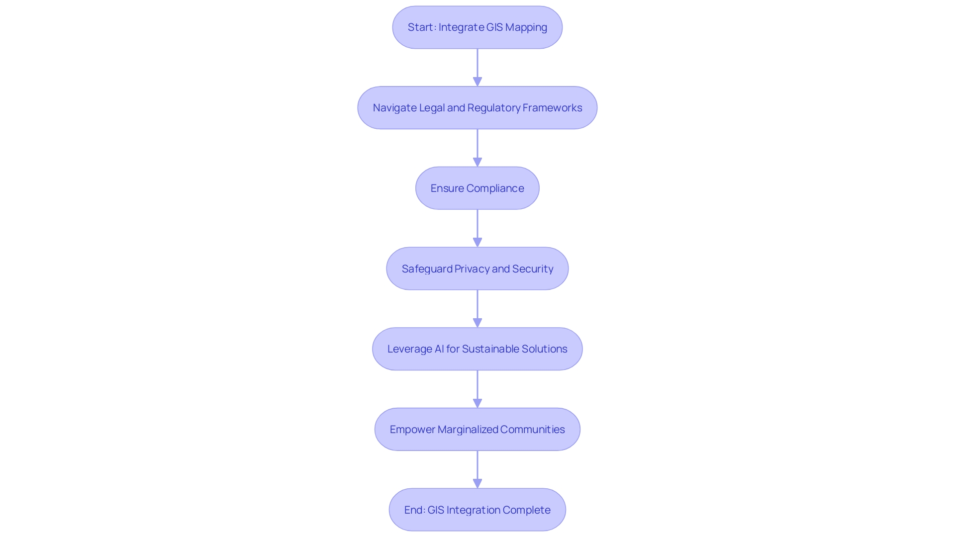
Integrating Geographic Information System (GIS) mapping into the acquisition process brings a range of benefits, such as improved decision-making abilities and enhanced environmental management. However, it's crucial to navigate the legal and regulatory frameworks governing the use of property meticulously. Every locale comes with its distinct set of rules pertaining to land ownership, zoning, and ecological stewardship, calling for thorough compliance to avert potential conflicts and procedural hold-ups.
Proactive measures in governance are also paramount. As the City of Plano, Texas, has demonstrated through its adoption of Esri's ArcGIS, employing sophisticated digital tools can streamline data-driven decision-making, even in compliance with stringent Lead and Copper Rule Revisions (LCRR). When handling sensitive information, placing importance on privacy and security is crucial. By instituting robust consent and confidentiality protocols, the rights and interests of all parties, including landowners and stakeholders, can be safeguarded.
This focus on abiding by the law and safeguarding information is not only about reducing risk; it's about unleashing the revolutionary capability of AI and accessible information in property acquisition. As seen in the collaboration between Columbia University, the University at Albany, and Esri, and the partnership between the Geospatial Commission and The Alan Turing Institute, leveraging AI in land use planning can expedite sustainable solutions to environmental challenges. However, these advancements must be tempered with a commitment to fair information use. The empowerment of marginalized communities, such as the First Nations in Canada, to manage their information is a testament to the positive change that responsible information handling can bring.
In the end, the convergence of innovation and legal regulations in property procurement is a fragile equilibrium—one that must recognize the intricacies of contemporary property investment, as exemplified by the diverse scenery of Las Vegas. It is not just a technical pursuit but a strategic approach that covers socio-economic and environmental aspects, guaranteeing that the advantages of cutting-edge mapping technologies and open information do not worsen disparities but instead contribute to the betterment of society.

Practical Applications of GIS Mapping in Land Acquisition
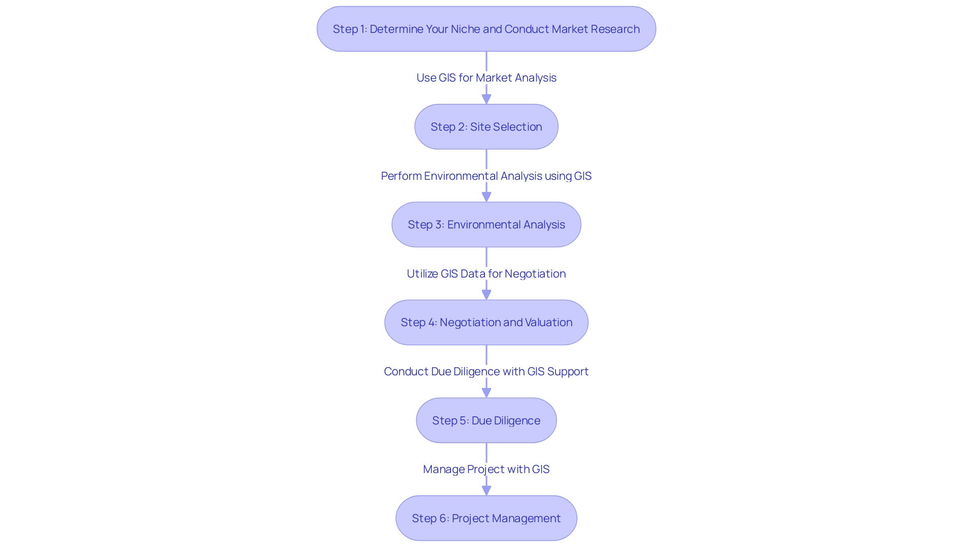
Geographic Information Systems (GIS) play a crucial role in streamlining the acquisition process by providing accurate and layered information essential for informed decision-making. This technology is invaluable for site selection, providing comprehensive insights into parcel characteristics such as topography, accessibility, and suitability for specific purposes. GIS analytics extend to environmental analysis, enabling stakeholders to evaluate potential impacts on ecological sensitivities, proximity to protected areas, and the presence of water bodies. In the realm of negotiation and valuation, GIS supplies stakeholders with robust data on terrain features and prevailing market conditions, contributing to fair and data-driven negotiations.
The due diligence phase benefits from GIS by uncovering legal constraints, identifying property encumbrances, and resolving conflicts. This is further evidenced by the innovative approach taken in Uzbekistan, where the integration of GIS technology with cadastral services has led to the creation of electronic maps across extensive areas, fostering better resource management. Furthermore, GIS' usefulness expands to project management, where it improves the capability to monitor and oversee the advancement of property acquisition activities in real-time.
GIS mapping's transformative potential is not limited to property acquisition but also empowers societal change. For example, the participatory mapping project in Mayo-Kebbi Est has transformed land administration by involving women in the decision-making process, previously a domain dominated by men. Meanwhile, initiatives like the partnership between the Geospatial Commission and The Alan Turing Institute exemplify the fusion of AI and GIS, enhancing use decision-making.
As the world grapples with the Triple Planetary Crisis—climate change, biodiversity loss, and environmental pollution—GIS and AI emerge as critical tools in developing scalable solutions. The partnership between Columbia University, the University at Albany, and Esri to create a Landscape Assessment report demonstrates the need to utilize such tools in addressing environmental challenges. The inclusion of GIS in these efforts underscores its foundational role in addressing our most pressing global challenges.

Challenges and Solutions in Implementing GIS Mapping for Land Acquisition
The integration of Geographic Information Systems (GIS) in land acquisition has revolutionized the field, presenting a nuanced tapestry of both opportunities and challenges. As an example, the progressive development of surveying, starting from the basic instruments of past societies to the advanced GPS and GIS systems of the present, showcases the tremendous improvement in accuracy and capabilities for spatial analysis. Yet, the crux of GIS mapping's challenge lies in the procurement and assimilation of up-to-date, precise data—a feat that is often resource-intensive and demands technical finesse.
The intricacy of the software and the proficiency needed to navigate GIS tools are not insignificant, echoing the notion that successful utilization of open information requires fair access to tools and analytical abilities. It's a sentiment validated by recent initiatives, such as the collaboration between Columbia University and Esri to harness artificial intelligence (AI) for climate and environmental solutions, underscoring the transformative potential of integrating advanced technologies in data interpretation.
Furthermore, the Geospatial Commission's collaboration with The Alan Turing Institute demonstrates the creative utilization of AI in use decision-making, emphasizing the benefits of visualization tools in clarifying use trade-offs. This is further complemented by initiatives like the participatory mapping project in Mayo-Kebbi Est that have catalyzed inclusive decision-making processes, particularly in the management of areas.
Despite these advances, there's an awareness of the 'data divide', as evidenced by the digitization of property records in Bangalore, which inadvertently favored the affluent. Such scenarios highlight the need for a more democratic information ecosystem, where interventions are crucial to guarantee that the poorest and most marginalized can effectively utilize open information for their benefit.
To address these difficulties, a strategic method involving careful information gathering techniques, thorough information verification procedures, and comprehensive training programs for acquisition personnel is crucial. The pursuit of standardized information formats and collaborative stakeholder efforts could greatly improve the efficiency and reliability of GIS mapping, shifting the balance in favor of more equitable and effective property acquisition processes.
Future Trends and Innovations in GIS Mapping for Land Acquisition
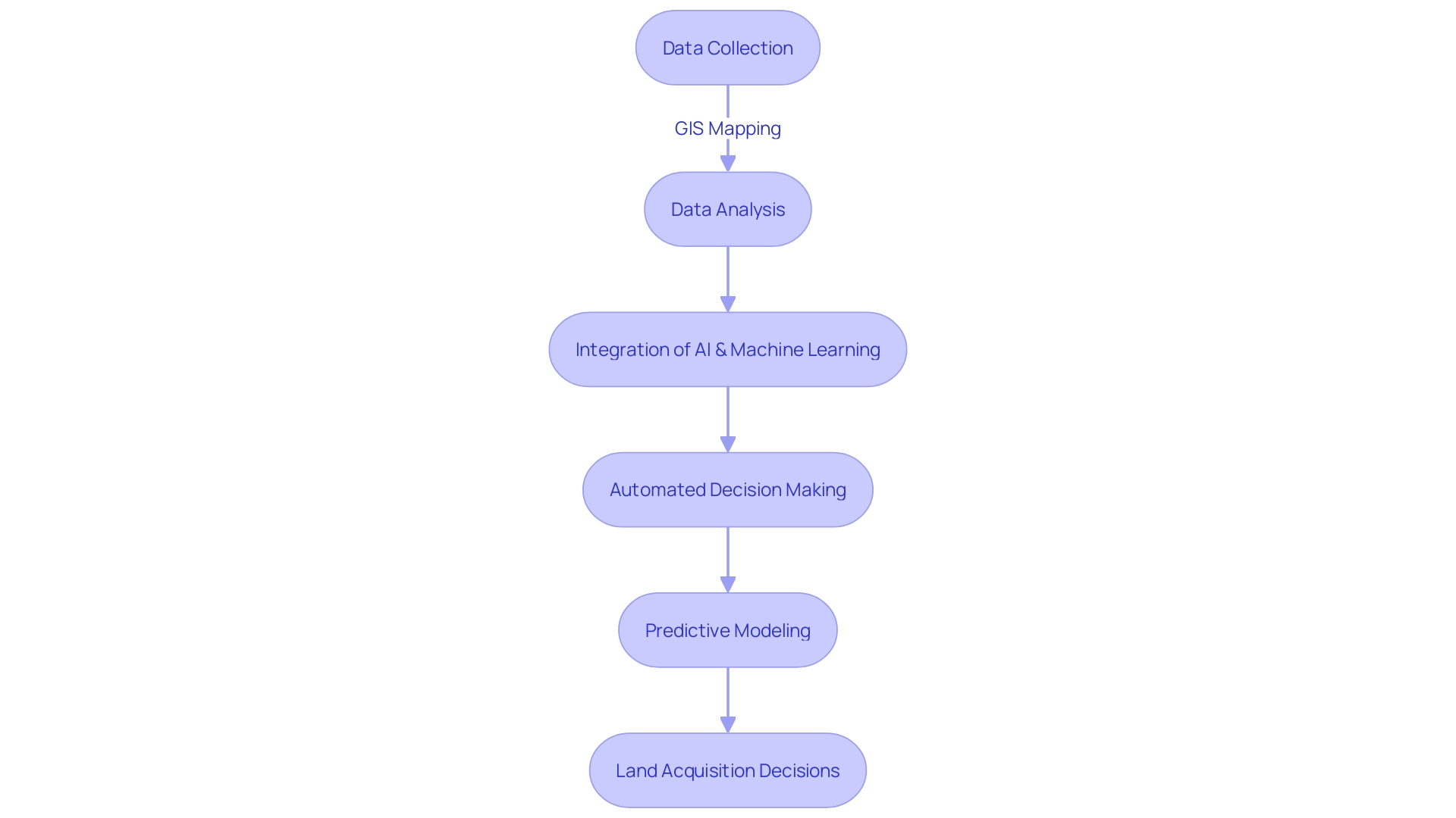
Geographic Information System (GIS) mapping stands as a cornerstone of land acquisition, and its continued evolution is poised to bring about transformative changes. The integration of GIS with artificial intelligence (AI) and machine learning is a game-changer, enabling advanced automation in analysis, decision-making, and predictive modeling. Mobile GIS applications are also on the rise, empowering field personnel with real-time data collection and mapping capabilities directly from smartphones and tablets. Simultaneously, remote sensing methods are progressing, with drones and cutting-edge satellite systems providing unparalleled precision and timeliness in imagery.
The significance of these advancements cannot be overstated. As noted by the Geospatial Commission's partnership with The Alan Turing Institute, Ai's application in land use decision-making illuminates the profound opportunities and trade-offs inherent in land use changes. Moreover, according to a Landscape Assessment by Columbia University, the University at Albany, and Esri, Ai's role in accelerating climate and nature solutions is crucial, underscoring the urgency of harnessing these technologies for a sustainable future.
Reflecting on the historical journey of surveying—from the rudimentary tools of ancient civilizations to the sophisticated equipment of today—the trajectory of progress has been steep. The precision and efficiency afforded by modern surveying techniques are foundational to numerous industries, from construction to resource management. As Bayanat's transition from a mapping and surveying firm to an AI-powered geospatial analytics company illustrates, the scope of what can be achieved today was once unimaginable.
Geospatial analytics is thus not only a tool for visualizing information but a strategic asset across industries. From telecoms employing GIS for network optimization, as highlighted in recent industry reports, to the role of real estate software in managing property transactions and accounts, the applications are diverse and impactful. As urban centers continue to expand, GIS development is crucial for agencies like the U.S. Geological Survey and the Federal Emergency Management Agency, which rely on accurate, up-to-date geospatial data to inform decisions and respond to emergencies.
In sum, the fusion of GIS mapping with cutting-edge technologies is catalyzing a new era in land acquisition, characterized by enhanced precision, efficiency, and strategic foresight.

Conclusion
In conclusion, Geographic Information Systems (GIS) have transformed land acquisition by providing a dynamic visual platform for analyzing and selecting land parcels. This technology enables stakeholders to make well-informed decisions by gaining insights into topography, infrastructure adjacency, and environmental attributes. GIS fosters enhanced communication and cooperation among various parties, optimizing project management and minimizing misunderstandings.
Advancements in spatial data science and AI have enriched GIS capabilities, facilitating nuanced interpretations of data and scenario testing for complex land use decisions. The integration of GIS in smart city planning and sustainable development enhances inclusivity and addresses societal challenges.
GIS mapping combines various data collection methods, such as aerial imagery, satellite imagery, LiDAR scanning, and field surveys, to comprehensively analyze land features. It offers valuable insights for site selection, environmental analysis, negotiation, valuation, due diligence, conflict resolution, and project management.
Implementing GIS mapping requires navigating legal and regulatory frameworks governing land use and prioritizing data governance and security. Proactive measures and robust protocols safeguard the rights and interests of all parties involved.
Challenges exist in procuring and assimilating up-to-date, precise data, as well as in navigating the complexity of GIS software and expertise requirements. Efforts must be made to ensure equitable access to technology and analytical skills, addressing the "data divide" for a more democratic data ecosystem.
The future of GIS mapping lies in its integration with AI and machine learning, enabling automation in data analysis, decision-making, and predictive modeling. Mobile GIS applications and remote sensing technologies offer real-time data collection and unprecedented detail in imagery.
In summary, GIS remains a cornerstone of modern land acquisition strategy, providing an indispensable tool for visualizing, analyzing, and collaborating towards optimal land use. The fusion of GIS mapping with advanced technologies propels us into a new era of enhanced precision and strategic foresight in land acquisition.


