Introduction
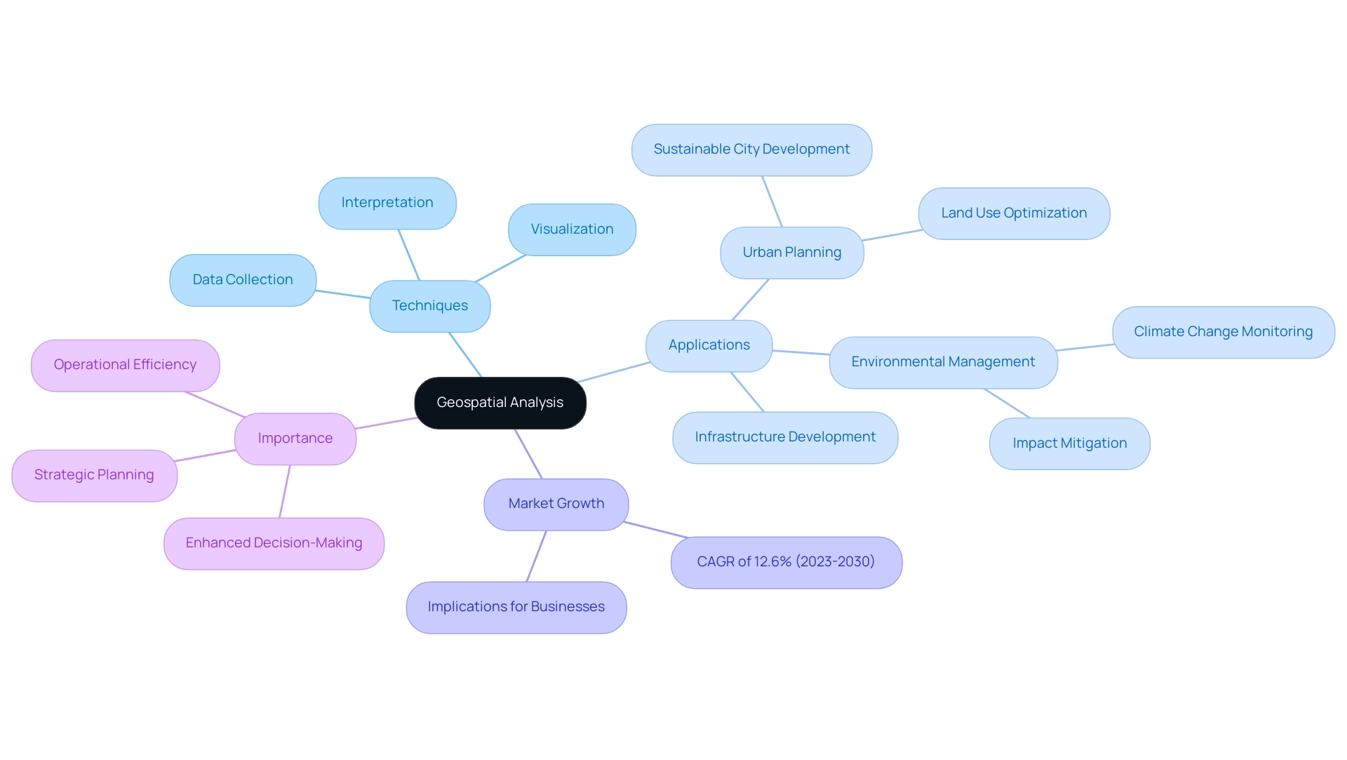
Geospatial analysis stands at the forefront of modern decision-making, offering a sophisticated framework for understanding spatial relationships within various contexts. By harnessing techniques that encompass data collection, visualization, and interpretation, this analytical approach proves indispensable across multiple sectors, including urban planning, environmental management, and infrastructure development. As the geospatial analytics market continues to expand, projected to grow at a Compound Annual Growth Rate (CAGR) of 12.6% from 2023 to 2030, organizations are increasingly recognizing the value of integrating these insights into their strategic planning.
The ability to effectively utilize geospatial data not only enhances operational efficiency but also informs critical decisions related to resource allocation and project planning, ensuring that stakeholders are well-equipped to navigate the complexities of today's dynamic landscape.
Understanding Geospatial Analysis: Definition and Importance
Geospatial examination encompasses a range of techniques used to study spatial and geographic data, including the collection, visualization, and interpretation of information related to the earth's surface. This sophisticated analytical approach is crucial across numerous fields such as urban planning, environmental management, and infrastructure development. By utilizing spatial examination, organizations acquire the capability to comprehend spatial connections, which consequently guides important choices regarding resource distribution, location selection, and project development.
Significantly, the spatial analytics market is expected to expand at an impressive Compound Annual Growth Rate (CAGR) of 12.6% from 2023 to 2030, highlighting the growing dependence on these technologies across multiple business fields. In 2024, the significance of employing spatial data metrics will be crucial as organizations strive to navigate intricate market dynamics. Jess Cook, Head of Content & Comms Island, highlights the significance of geographical assessment by stating, 'This type of evaluation is crucial in improving decision-making processes, allowing businesses to visualize information within a geographic context and thereby promote strategic planning and operational efficiency.' This emphasizes how incorporating statistical insights can improve the decision-making framework.
Practical uses of spatial examination are extensive. For instance, in urban planning, it aids in the development of sustainable cities by optimizing land use and infrastructure placement. Recent progress in spatial examination methods, such as enhanced machine learning algorithms and real-time information integration, are further enhancing these applications in 2024. Similarly, in environmental management, it helps monitor and mitigate the impacts of climate change. A significant case study on geographic expansion strategies illustrates how businesses can evaluate market potential in new areas through demographic and economic examination. This informed approach enables the development of phased expansion plans that match market demand and competition.
The capacity of spatial examination to offer insights that conventional data evaluation methods frequently miss renders it an essential tool for stakeholders aiming to improve their strategic planning and operational efficiency. As advancements in geospatial technologies continue to evolve, their application will undoubtedly expand, offering even greater precision and utility in decision-making processes.
Applications and Benefits of Geospatial Analysis in Various Fields
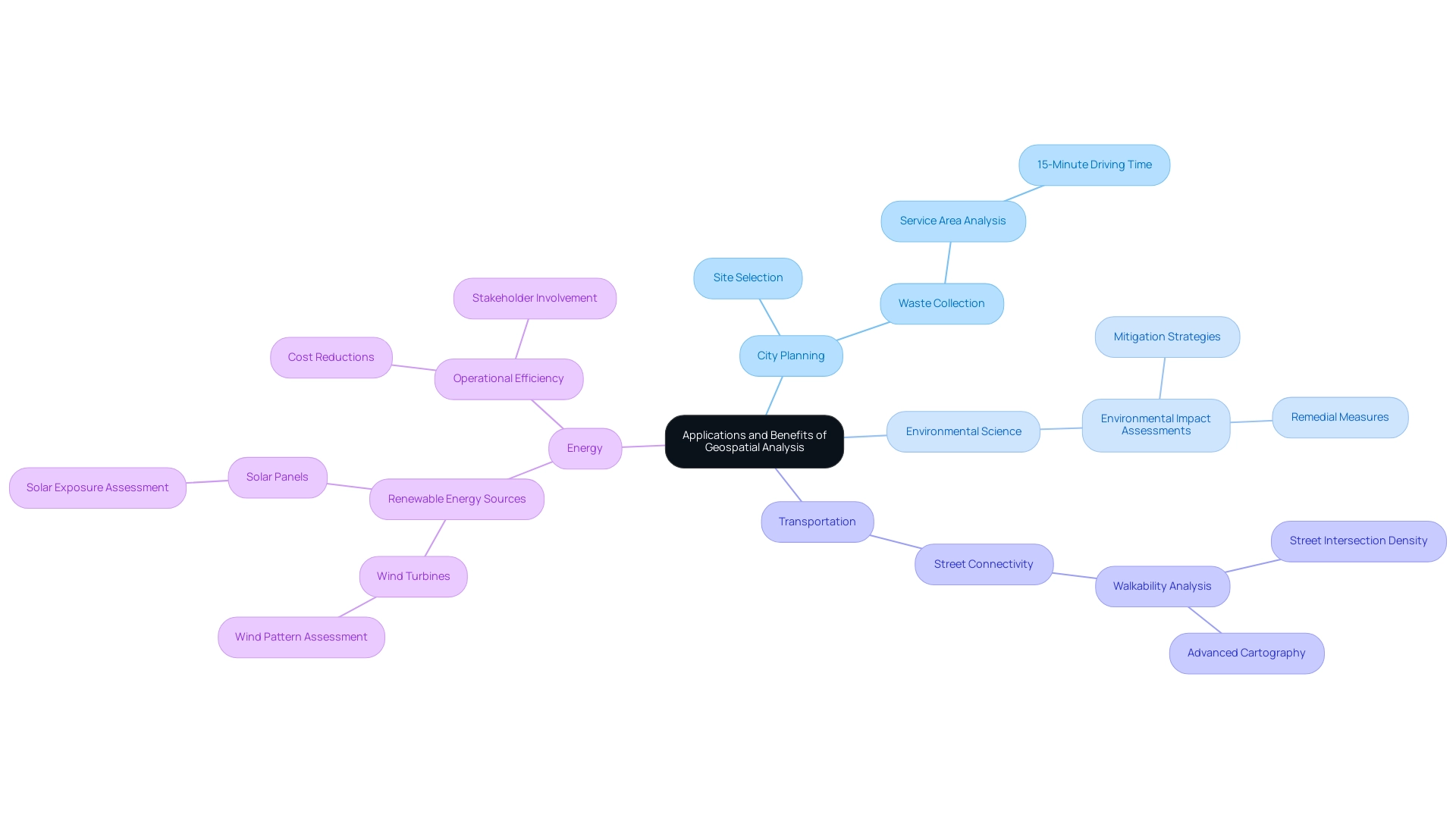
Geospatial examination is an essential instrument employed in multiple fields, such as city planning, environmental science, transportation, and energy. In the field of city planning, it facilitates site selection for new developments by evaluating factors such as population density, land use, and transportation access. For example, service area evaluation for waste collection facilities can identify the most efficient locations within a 15-minute driving time, ensuring that resources are allocated effectively. Meli Wesley Kiptoo highlights the importance of GIS, stating, 'GIS is therefore essential in the sustenance and development of metropolitan areas which promote industrial as well as economic growth.'
In environmental science, geospatial analysis is utilized to carry out environmental impact assessments for proposed city projects. These assessments help evaluate and mitigate the environmental impacts of development, leading to the implementation of recommended remedial measures. The use of open data and open-source tools such as QGIS enables data-driven strategies to enhance city planning and development. For example, analyzing street connectivity for walkability through the computation of street intersection density and visualization with advanced cartography not only enhances urban mobility but also promotes healthier lifestyles.
The energy industry gains greatly from spatial evaluation by enhancing the positioning of renewable energy sources, like wind turbines and solar panels. By assessing geographical factors such as wind patterns and solar exposure, spatial evaluation aids in pinpointing the most appropriate sites for these energy sources, maximizing their efficiency and output. This optimization results in cost reductions and better decision-making, showcasing the tangible advantages of spatial study in improving operational efficiency. Moreover, the capacity to visualize intricate information promotes improved stakeholder involvement and project results, emphasizing the crucial role of geospatial examination in advancing sustainable and informed growth across various fields.
Types of Data Used in Geospatial Analysis
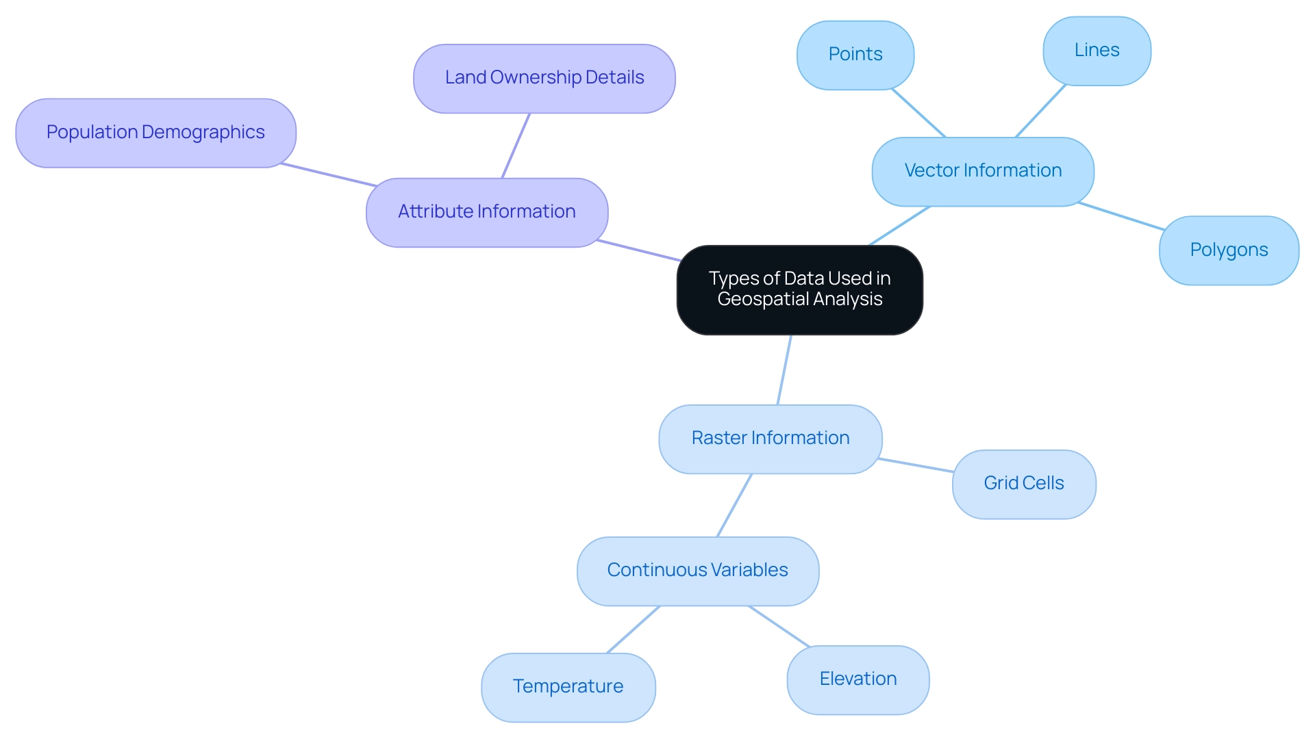
Geospatial examination depends on a variety of information types, including:
- Vector information
- Represents geographic features as points, lines, and polygons
- Allows for precise mapping of features such as roads, rivers, and property boundaries
- Raster information
- Comprises grid cells that signify continuous variables, such as elevation or temperature
- Frequently utilized for environmental evaluation
- Attribute information
- Provides additional insights about geographic features, such as population demographics or land ownership details
The blend of these information types allows thorough evaluation and visualization, promoting informed decision-making in projects.
Challenges and Best Practices in Geospatial Analysis
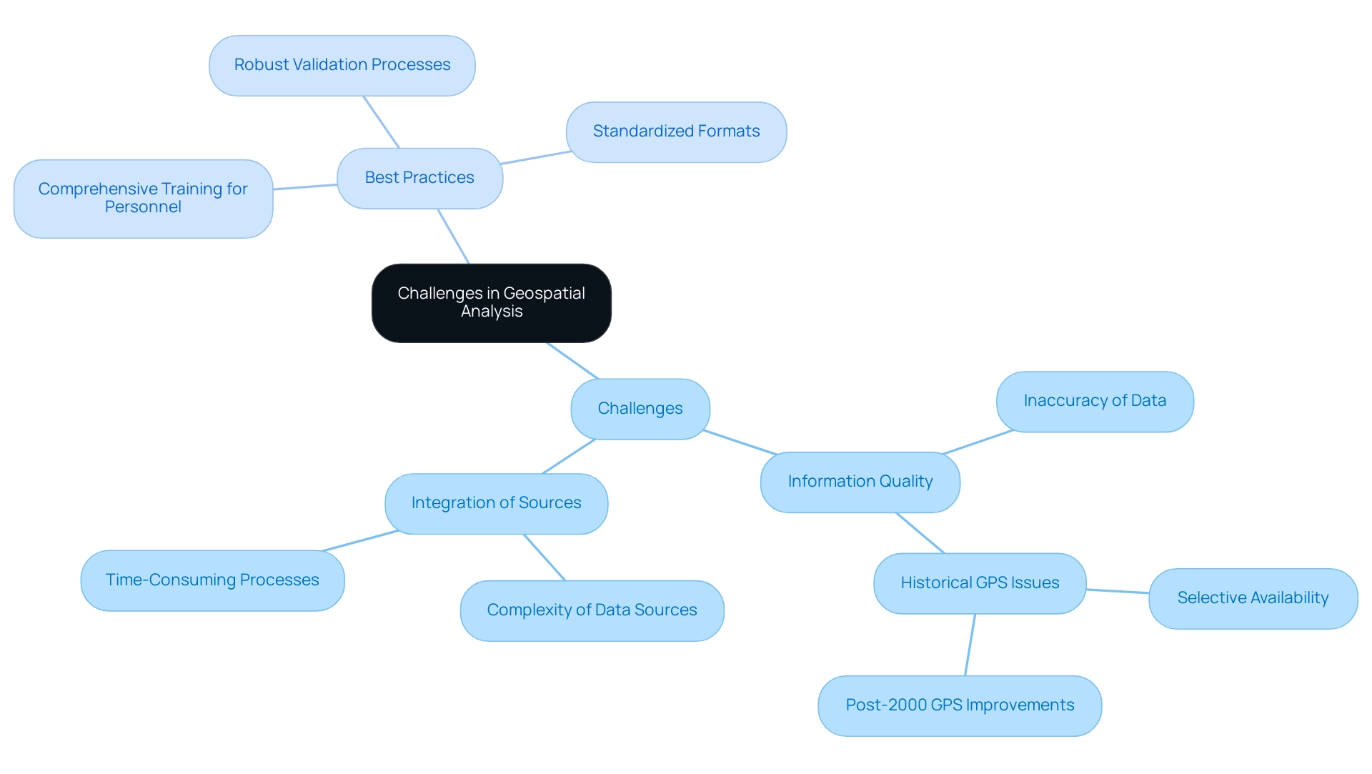
Geospatial analysis encounters various challenges, especially regarding information quality and the integration of diverse sources. Ensuring the accuracy and consistency of information is paramount, as studies show that up to 30% of it can be inaccurate, leading to erroneous conclusions. For instance, prior to 2000, GPS signals were intentionally degraded for civilian use through Selective Availability, which introduced errors in consumer-level GPS measurements. The discontinuation of Selective Availability significantly enhanced GPS precision for civilian applications, illustrating the critical importance of information quality.
Integrating information from various sources, such as satellite imagery and survey results, presents additional complexity and requires substantial time. Recent advancements, including no-code machine learning operations platforms like Striveworks, now allow organizations to perform advanced geospatial assessments without requiring extensive GIS or scientific expertise. To navigate these challenges, best practices include:
- Implementing robust validation processes
- Adopting standardized formats
- Investing in comprehensive training for personnel
Brett Foreman, Senior Product Manager at Capella Space, highlights the significance of these practices, pointing out that consistent and precise information is crucial for effective evaluation. Moreover, as stated by industry expert Jane Smith, "The integration of various information sources is crucial; without it, organizations risk making decisions based on incomplete details." Encouraging cooperation among stakeholders and implementing a structured method for information management can greatly improve the efficiency of spatial examination efforts. By following these best practices, organizations can overcome inherent challenges and attain more dependable and actionable insights from their geographic information.
Software Tools for Effective Geospatial Analysis
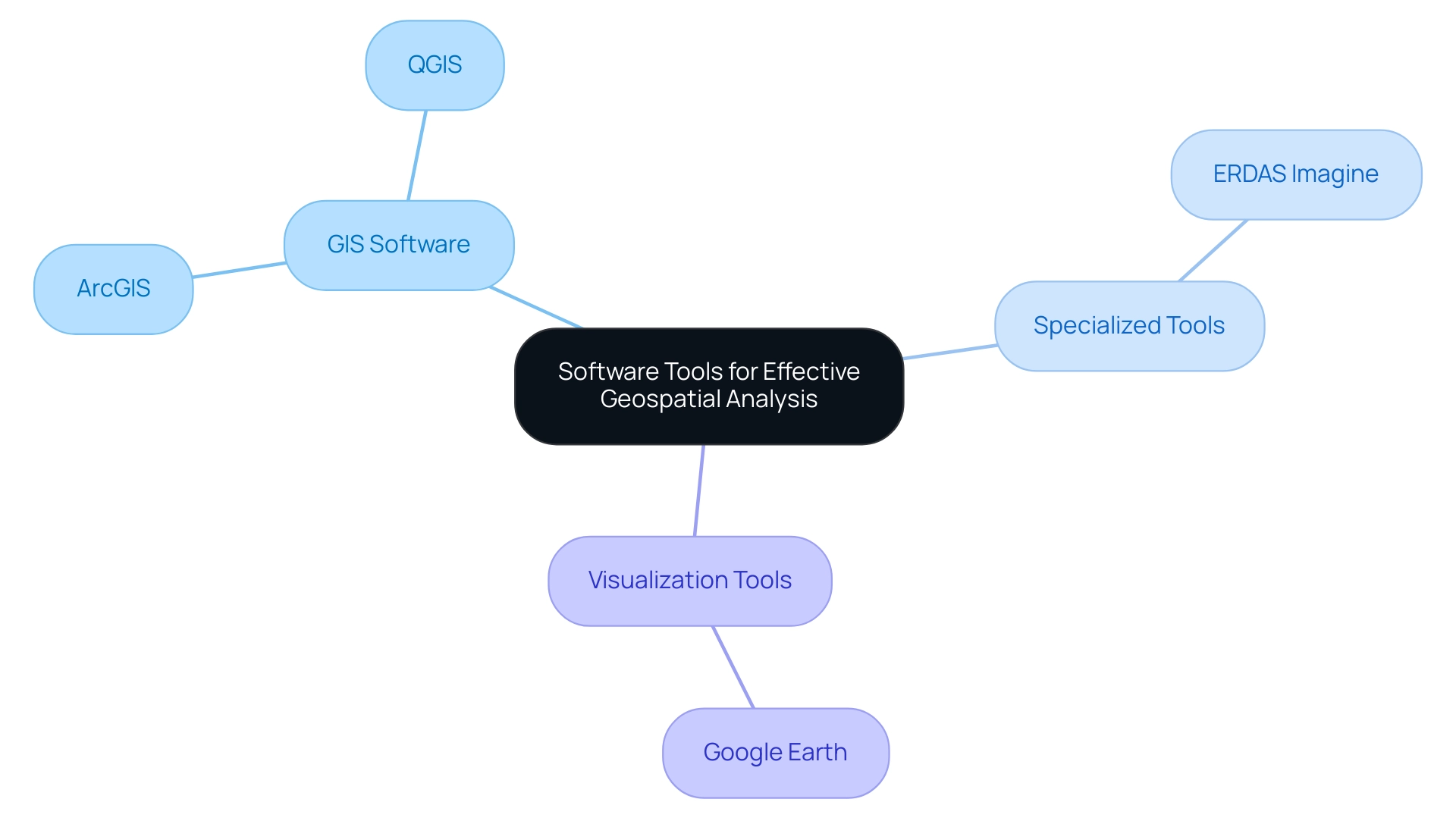
Various software applications are frequently utilized for spatial examination, including:
- Geographic Information Systems (GIS) software like ArcGIS and QGIS
- Specialized tools such as ERDAS Imagine for remote sensing
- Google Earth for visualization
These tools allow users to analyze spatial information, create detailed maps, and visualize complex datasets. Additionally, AI-powered title research software has emerged as a valuable resource for enhancing accuracy and efficiency in land services. By leveraging these tools, organizations can streamline their geospatial analysis processes, improve data visualization, and ultimately make more informed decisions in their projects.
Conclusion
Geospatial analysis emerges as a pivotal element in modern decision-making across various sectors. By employing techniques that encompass data collection, visualization, and interpretation, organizations can gain a nuanced understanding of spatial relationships, which is critical for effective resource allocation and project planning. The projected growth of the geospatial analytics market at a CAGR of 12.6% from 2023 to 2030 underscores the increasing reliance on these analytical methodologies in navigating the complexities of contemporary challenges.
The applications of geospatial analysis are extensive, ranging from urban planning and environmental management to energy optimization and transportation. Each sector benefits uniquely from the ability to evaluate geographic data, leading to informed decisions that promote sustainability and operational efficiency. The integration of diverse data types, including vector, raster, and attribute data, enhances the capability to conduct comprehensive analyses, while the use of advanced software tools further streamlines these processes.
However, challenges such as data quality and integration remain significant hurdles. Addressing these issues through best practices—such as robust data validation, standardized formats, and comprehensive training—can significantly improve the reliability and accuracy of geospatial analysis outcomes. As organizations continue to embrace these practices, they will be better positioned to leverage geospatial insights, resulting in more strategic and informed decision-making.
In conclusion, the role of geospatial analysis is undeniably crucial in shaping effective strategies across various fields. As technological advancements continue to evolve, the potential applications and benefits of geospatial analysis will expand, offering organizations the tools necessary to thrive in an increasingly data-driven world. Embracing this analytical approach is not merely advantageous; it is essential for navigating the complexities of modern decision-making landscapes.


